These are some of the known maps produced by the U. S. Department of Agriculture for the Black Hills National Forest in South Dakota and Wyoming.
Black Hills National Forest Maps


1923(?)
Folded = 4" x 8"
Unfolded = 20" x 24"
No date.
(Mentions loss of timber due to fire in 1922)
----------------------------------------------------------
1927
Folded = 4" x 8"
The date is clearly shown in the legend.
----------------------------------------------------------

1934
Folded = 4" x 7.25"
Unfolded = 22" x 31"
The date is clearly shown in the legend.
----------------------------------------------------------

1940
Folded = 4" x 9"
Unfolded = 19" x 27"
The date is shown on the front cover and in the legend.
----------------------------------------------------------
1955
Folded = 4.25" x 7.25"
Unfolded = 22" x 17"
The date is clearly shown in the legend.
----------------------------------------------------------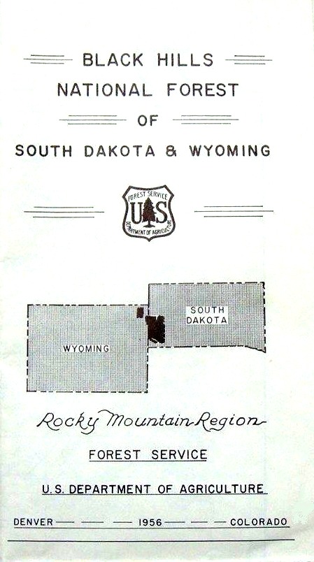
1956
Folded = 4.25" x 7.25"
Unfolded = 22" x 17"
The date in the legend is 1955.
This map appears to be an exact copy of the 1955 map except for the 1956 date on the bottom of the cover.
----------------------------------------------------------

1968?
Folded = 3.5" x 8"
Unfolded = 20.5" x 32"
There is no date shown anywhere on this map. In 1968, Highway 16 split to go around Rockerville.
I-90 was stopped at the Lawrence/Meade County line near Sturgis.
These two road features are the same on both the 1968 state highway map and this map.
This map does not have the same detail as the other Black Hills National Forest maps.
----------------------------------------------------------

1972
Folded = 5" x 8.75"
Unfolded = 26" x 44.5"
The date of 1972 is clearly shown in the legend.
----------------------------------------------------------

1976
Folded = 5" x 8.75"
Unfolded = 26" x 44.5"
The date of 1972 is clearly shown in the legend.
A small note at the bottom of the legend states "Partial Revision 1976".
----------------------------------------------------------

1980
Folded = 5" x 8.75"
Unfolded = 26" x 44.5"
The date of 1972 is clearly shown in the legend.
A note below the 1972 date says "Reprint of 1980".
A small note at the bottom of the legend states "Partial Revision 1980".
This map appears to be identical on the covers and inside of the 1976 map.
----------------------------------------------------------
1988
Folded = 4" x 8.75"
Unfolded = 27" x 47.5"
The date of 1988 is shown on the outside cover.
----------------------------------------------------------

1995
Folded = 4" x 8.75"
Unfolded = 27" x 51"
The date of 1995 is shown on the outside cover.
----------------------------------------------------------

2001
Folded = 4" x 8.75"
Unfolded = 27" x 51"
The date of 2001 is shown on the outside cover.
(Cover is identical to the 1995 map.)
----------------------------------------------------------
2014
Folded = 4" x 8.75"
Unfolded = 36" x 51"
The date of 2014 is shown on the outside cover.
Note: There were no updated maps issued between 2001 and 2014.
----------------------------------------------------------

2017
Folded = 4" x 9"
Unfolded = 36" x 51 1/2"
The date of 2017 is shown on the outside back cover.
----------------------------------------------------------

© Jerry Penry 2021