U. S. COAST & GEODETIC SURVEY "KOKO HEAD 3" Jerry Penry
1927
November 27, 2012
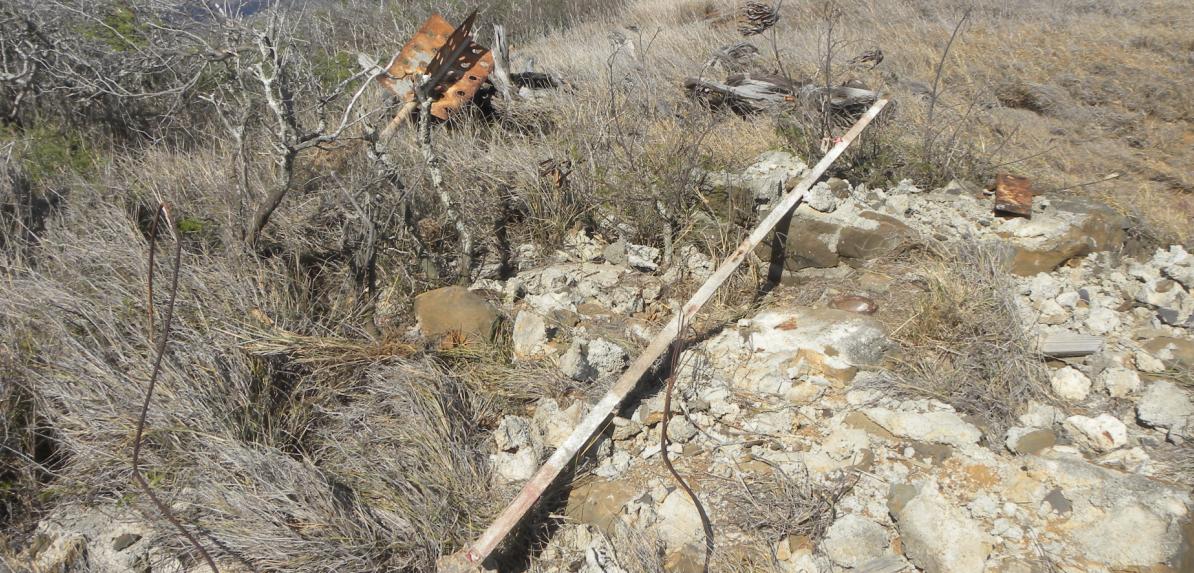
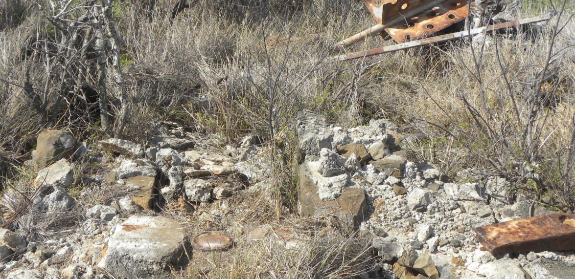
The location for "Koko Head 3" is on the southeast tip of Oahu, Hawaii, near Hanauma Bay which is popular for snorkeling in the coral reef. There have been several survey monuments on this hill over the years which have been destroyed. Koko head 3 was established by USC&GS in 1927 by placing a standar bronze disk in a 5" cast iron pipe filled with concrete. The "3" designation is to avoid confusion with other triangualtion stations which are now gone. A Hawaii Territory Survey structure was placed over the monument probably in the year 1929. During WWII, a concrete lookout bunker was established just southeast of the monument. Three reference marks were established by USC&GS, two of which were placed on the WWII bunker. Today only Reference Mark No. 2 remains. The stem for Reference Mark No. 3 was found on the WWII bunker. Reference Mark No. 1 was reported destroyed in the 1963 description. The "Type A" structure consisted of native stones cemented together to form the walls with a concrete pad on the rood holding the center signal pole in the center. This has all been destroyed. The signal pole with vanes was found lying in the grass west of the monument. The steel yoke for the bottom of the signal pole was found lying in the rubble of the stones. After removing broken stones that were formerly part of the structure walls, the monument was found in good condition. A paved trail that starts at the parking lot for the Hanauma Bay snorkeling area takes you right to the monument site.
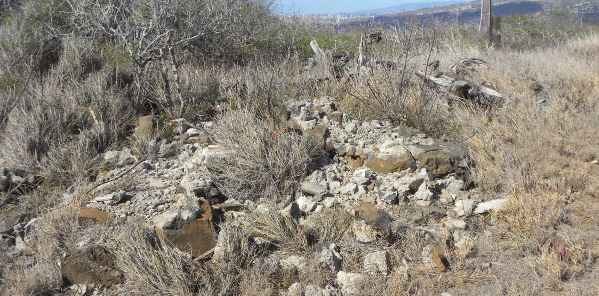
Remains of the old Hawaii Territory Survey "Type A" structure that was once over the monument.
The top of the old Hawaii Territory Survey signal pole in the weeds.
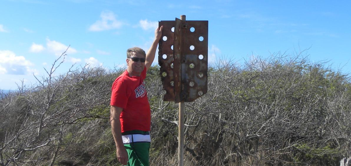
Jerry with the recovered signal pole with red/white blades.
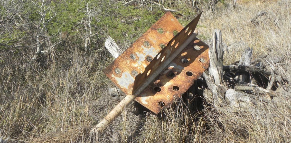
Another view of the signal pole that was once over the monument structure.
A long 2"x2" wooden pole painted alternating red/white was found on the ground nearby.
The recovered disk is visible. The signal pole is in the background.
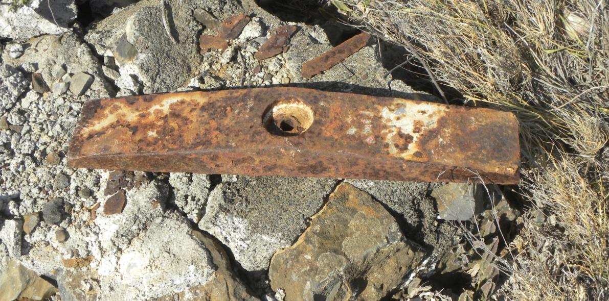
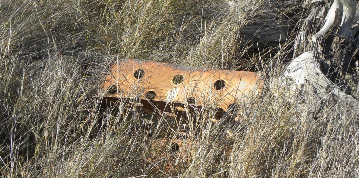
The steel yoke that the bottom of the signal pole rested in.
The bronze disk that was found under the rubble of the old structure.
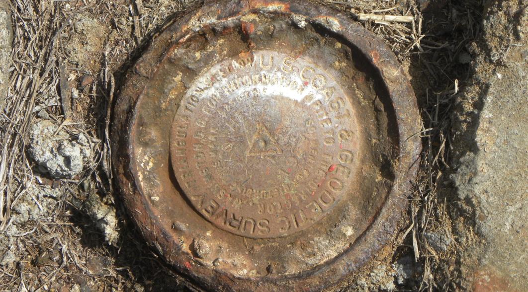
Close-up view of the USC&GS bronze disk "Koko Head 3".
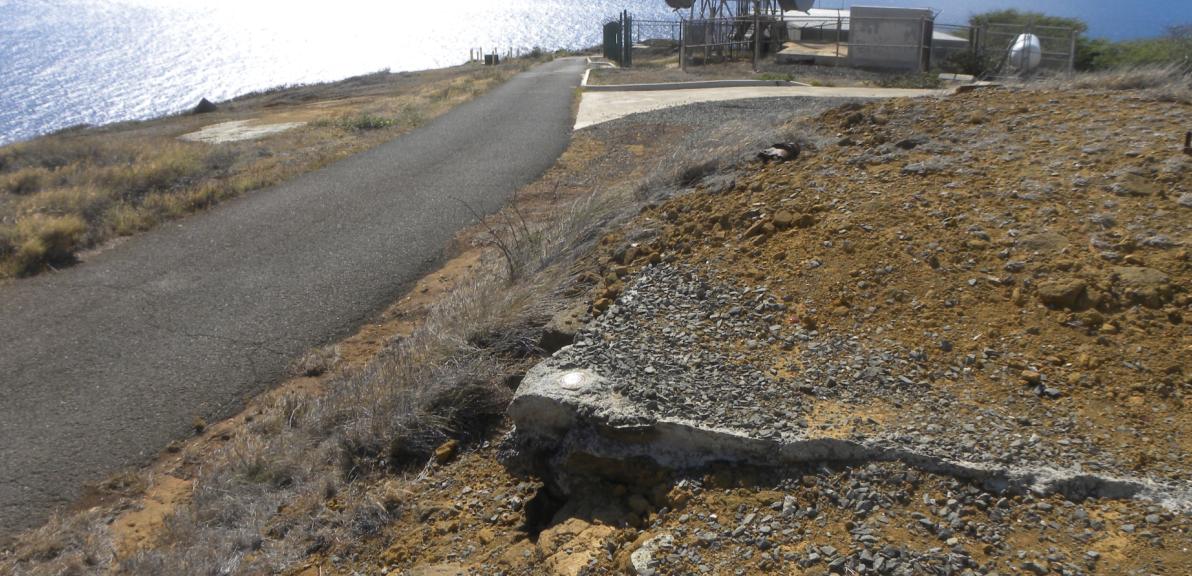
Reference Mark No. 2 on a corner of the old concrete WWII lookout bunker.
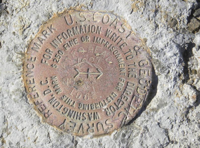
Close-up of Reference Mark No. 2.
The entrance to the WWII bunker. The remains of Reference Mark No. 3 is at the top right of the opening.
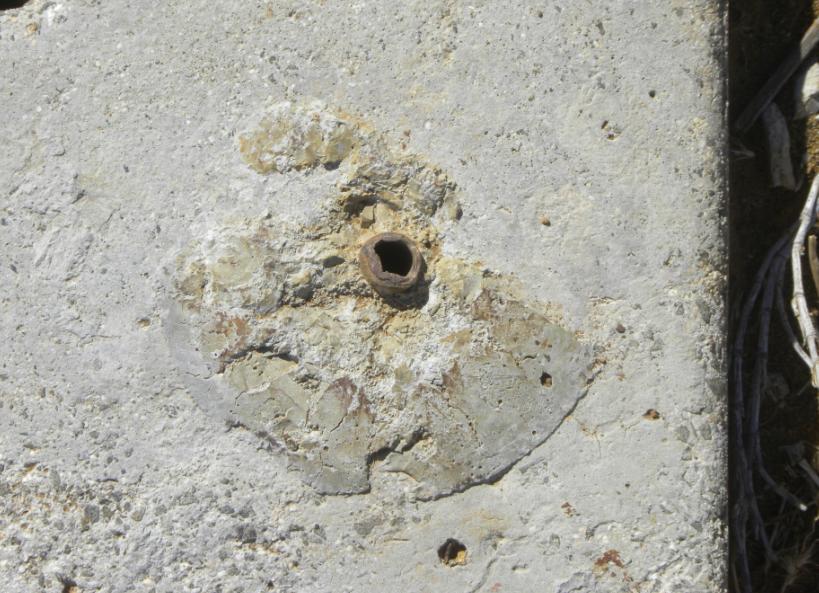
Closeup of where Reference Mark No. 3 was existed.
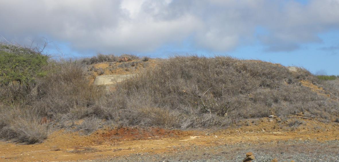
The top of the WWII bunker is barely visible. Dirt has been piled up around the openings.
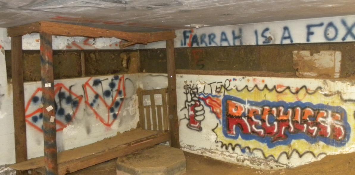
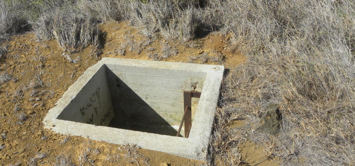
Inside the former concrete WWII lookout bunker.
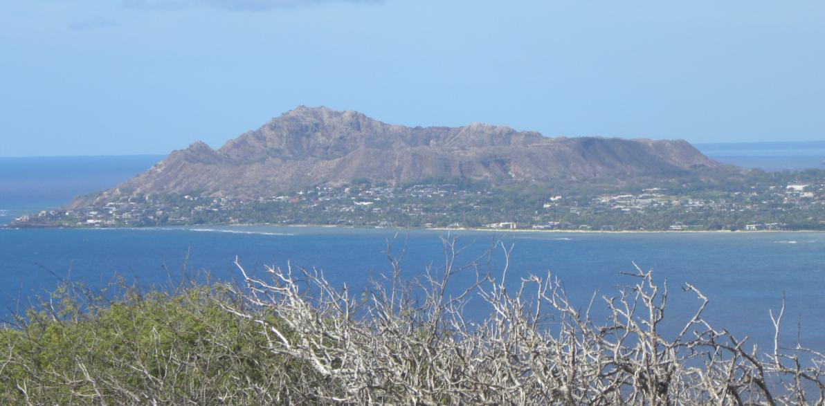
A nice view looking west toward the famous Diamond Head crater.
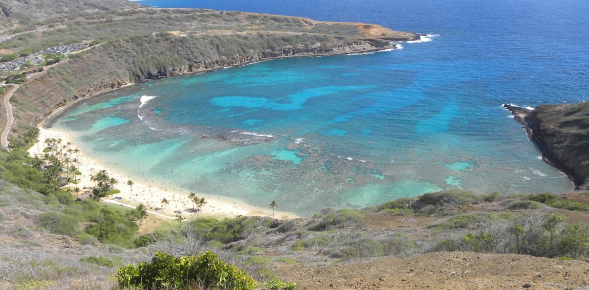
Hanauma Bay is located north of the monument site.
Other Hawaii Survey Markers


© Jerry Penry 2012