Missouri River Commission BAIRD Jerry Penry
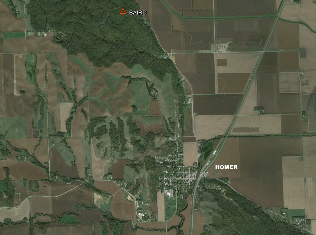
Triangulation station "Baird" is located on a high tree-covered bluff just northwest of the town of Homer, Nebraska. The original MORC description stated that the location was 1/2 mile southeast of Colonel Baird's house which is most likely how the station obtained its name. The house was probably next to a spring nearby known as Baird's Spring which is along the foot of the bluffs. Today the station is poor for GPS use due to the many trees that surround the area, but one can imagine the spectacular view that this location once offered. There is evidence of use of this marker by the U. S. Army Corps of Engineers by finding three COE reference disks in concrete in addition to the two reference marks placed by USC&GS in 1948.
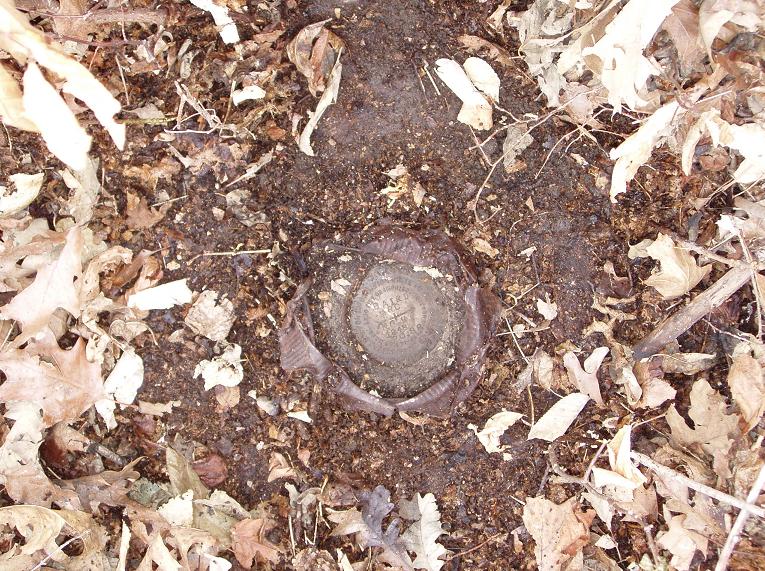
The iron pipe holding the triangulation station disk matches the diameter of an original 1890 MORC pipe. We dug down on one side of the pipe, being careful not to disturb the location of the pipe, and were able to probe and confirm that the original MORC flat stone is still in place. Whether the disk in pipe is directly lined over the drill hole in the original stone cannot be determined without a complete excavation. It was deemed not wise to move the pipe since the brass disk marks the precise position of station "Baird" regardless if it is exactly over the drill hole.
Triangulation Station
1890
March 21, 2008
The monument marking the Missouri River Commission (MORC) triangulation station known as "Baird" is an example where the United States Coast & Geodetic Survey either found the original cast iron MORC cap missing on the pipe or they replaced it with their own brass disk by filling the pipe with concrete. The C&GS brass disk was set in 1948. What is not clear is whether C&GS first dug down to the stone to verify that the pipe was centered over the drill hole in the MORC stone.

Station "Baird" is now a C&GS brass disk in concrete in the original MORC pipe.
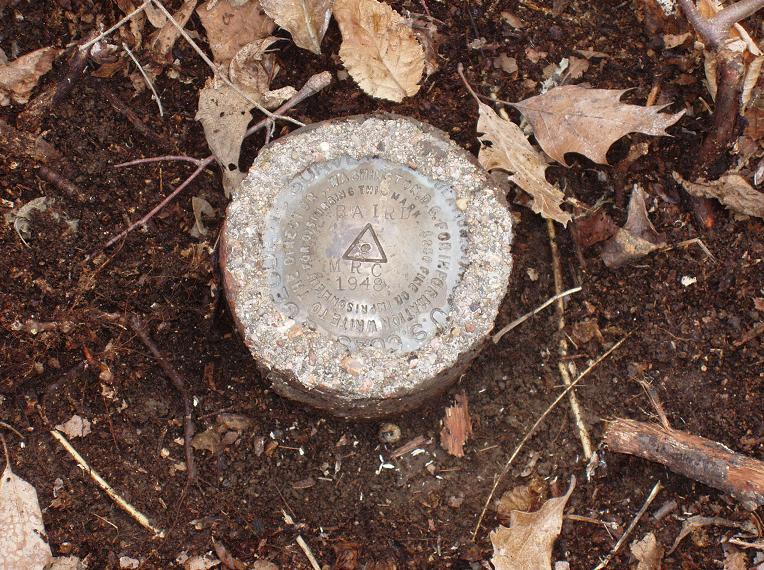
Closeup of the USC&GS brass disk set in 1948.

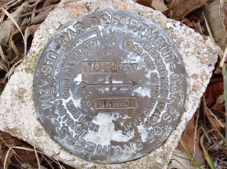
Reference Mark No. 1 set by USC&GS in 1948.
Reference Mark No. 2 set by USC&GS in 1948.

Corps of Engineers reference mark.
Corps of Engineers reference mark.

Corps of Engineers reference mark.
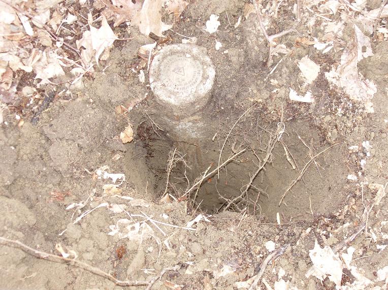
Excavation next to the pipe to confirm the original 1890 MORC stone was still present.

A long wooden pole in the immediate area that likely once held a signal flag.

A wooden board found nailed to a post. It appears to have been once painted and the faint outline of the letters were penciled to reveal the wording.
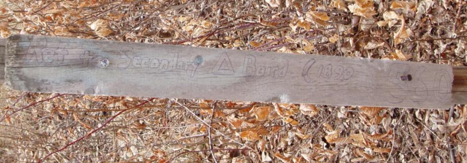
"Ref to Secondary [triangle] Baird (1890) 560"

© Jerry Penry 2008
