Missouri River Commission BLACKBIRD Jerry Penry
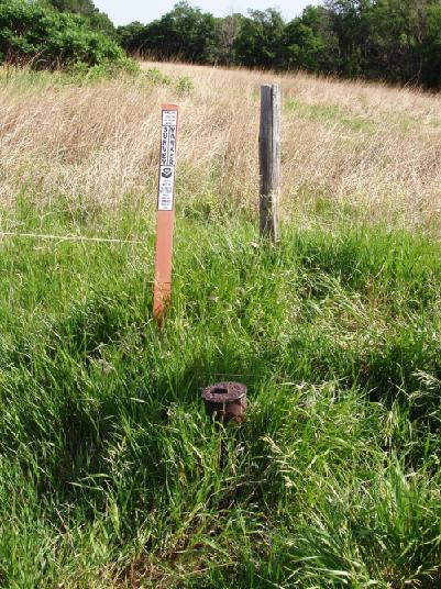
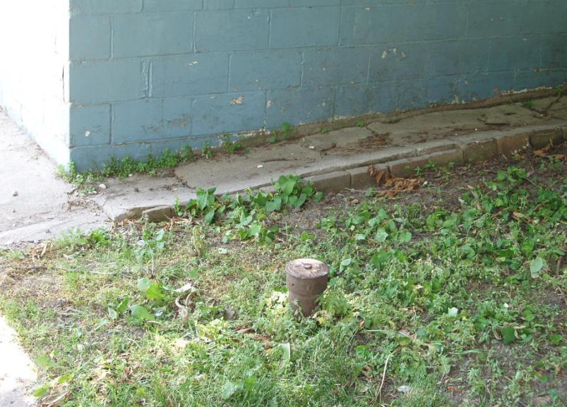
The monument marking the Missouri River Commission (MORC) point known as "Blackbird" is one of the few remaining triangulation stations left in the State of Nebraska from the original survey of 1889-1890 having both the upper and lower monuments intact. Less than 40 of these markers had been established in Nebraska and nearly all have succumbed to the fate of theft, vandalism, or construction. A few other monuments exist in their historical locations where the United States Coast & Geodetic Survey in the 1940's had placed a brass disk cemented into a pipe marking the location of the original MORC cap.
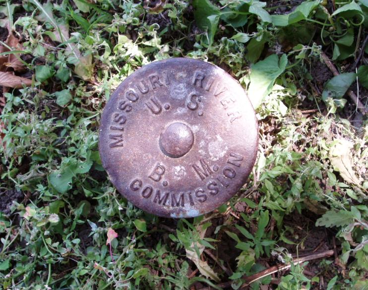
The MORC provided the first large scale accurate survey of the Missouri River area utilizing the finest equipment and methods of that era. The monuments were well ahead of their time consisting of a 4 1/2" diameter iron pipe with a 6" cast iron cap bolted to the top. Below this pipe was a second monument consisting of an 18" square limestone block 4" thick with a drill hole in the center. The utilization of the lower monument has proven to be well worth the effort as found at station Blackbird.
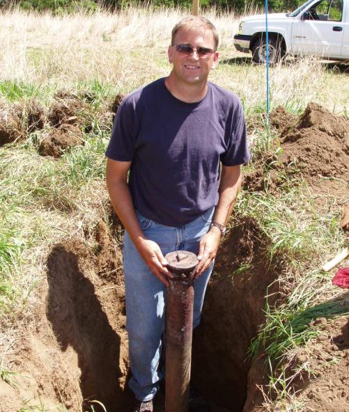
Nebraska surveyors Gene Thomsen and Jerry Penry have pursued the monuments of the MORC for several years, finding several original bench marks and one lower triangulation station stone. Ryan Lorenzen, a Bureau of Land Management surveyor working on the Winnebago and Omaha Indian Reservations, contacted them about the existence of a monument still having the MORC cap intact on the pipe. The pipe had been obviously disturbed from its location since it was leaning, so it was decided to conduct a remonumentation of this point knowing that the lower monument should still be there undisturbed. (After excavation the monument was found to be about a foot above the lower stone vertically, and also moved to the north horizontally).
One major concern was the location of the Blackbird station which was not only located on the Omaha Indian Reservation, but very close to a sacred burial ground. Before any excavation could be started, Ryan began pursuing permission in late January of 2006 to dig around the location of the monument. After working through the proper channels, permission was secured in mid May of 2006.
Participating in the recovery were surveyors Gene Thomsen (Nebraska Department of Roads); Jerry Penry (Lancaster County, Nebraska); Jim Richardson (Nebraska NGS advisor); Ryan Lorenzen and Shane Mast (Nebraska BLM); John Lee and Charlie Doman (BLM - Cheyenne, WY).
****************************************************************
Lewis & Clark
[Clark]
[Floyd]
[Ordway]
[Gass]
Triangulation Station
1890
June 7, 2006
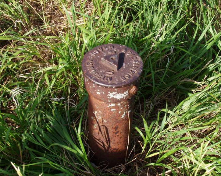
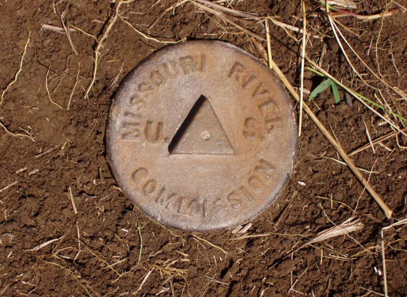
The 6" diameter cap attached to a 4 1/2" diameter pipe.
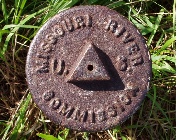
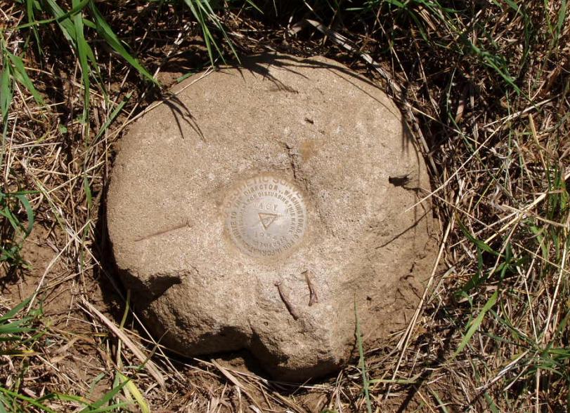
Details of the cap showing the markings of a Missouri River Commission triangulation station.
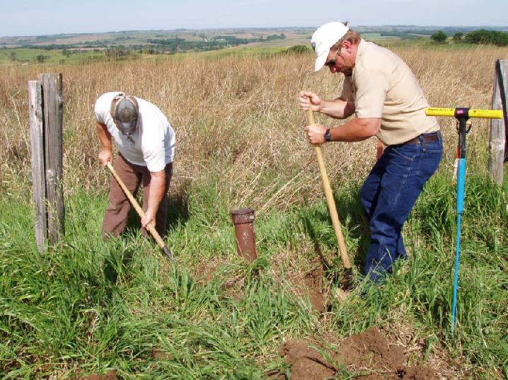
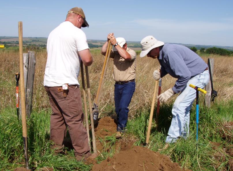
BLM surveyors Shane Mast (left), and Ryan Lorenzen begin the digging.
BLM surveyors John Lee (left), and Charlie Doman (center) join in the digging.
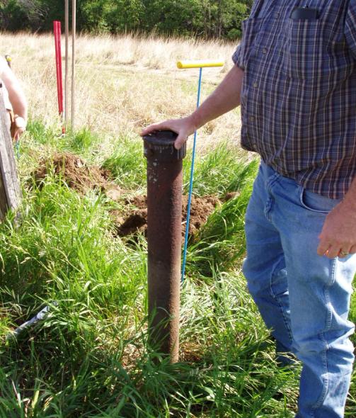
Nebraska surveyor Gene Thomsen showing the upper monument, a 37" long pipe with cap.
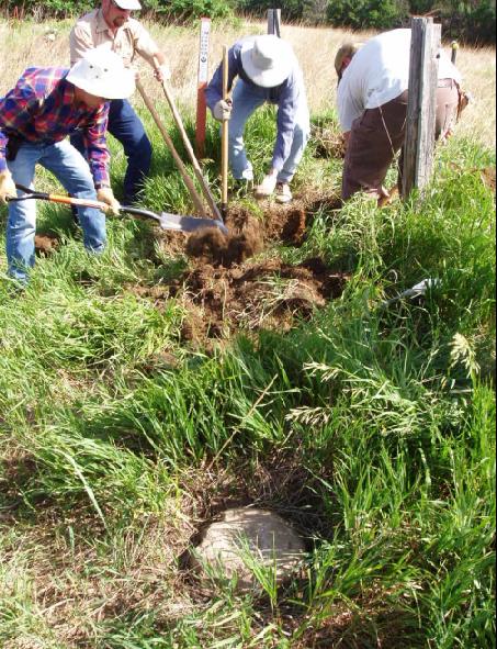
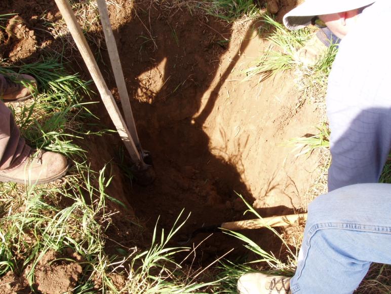
The digging resumes for the lower monument stone.
Anticipation grows as we near the top of the lower stone monument.
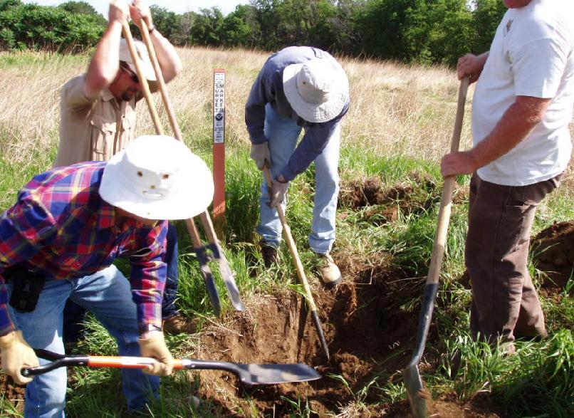
With the hole 3' deep caution in digging ensures the stone won't get damaged.
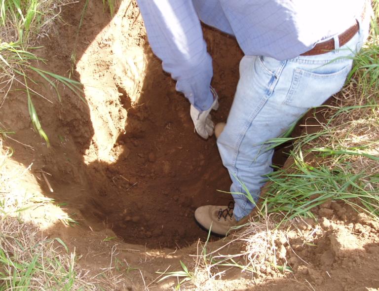
Charlie Doman is on top of the stone just before it becomes fully visible.
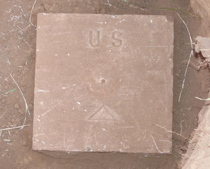
A view of the lower stone monument after dirt is cleared away.
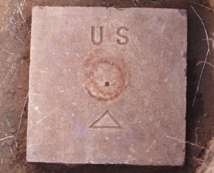
The stone after cleaning shows several rust rings where the pipe was once located.
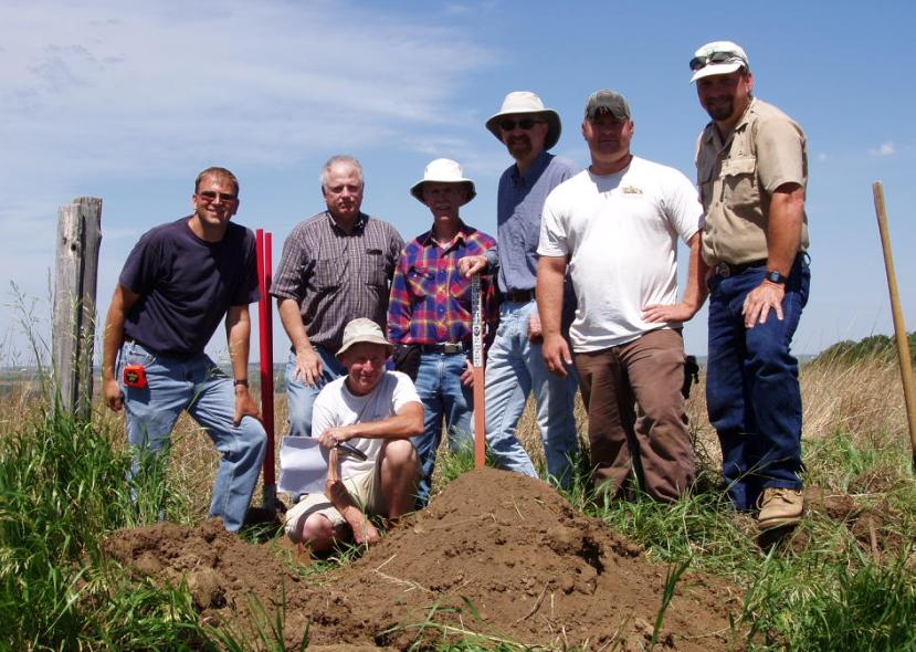
The Remonumentation Crew
Jerry Penry, Gene Thomsen, Jim Richardson (kneeling), John Lee, Charlie Doman, Shane Mast, and Ryan Lorenzen.
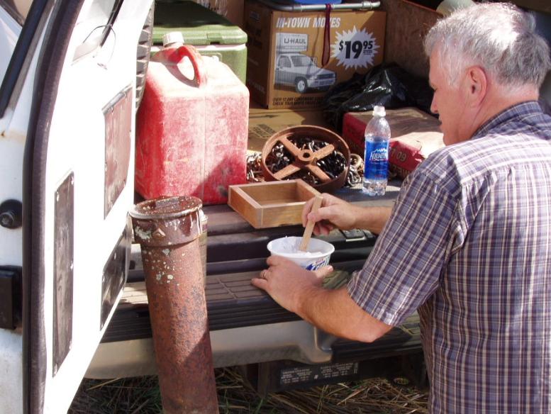
Gene Thomsen prepares plaster for making molds of the rare cap.
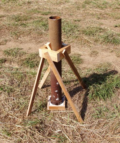
The support apparatus made by Gene to hold the pipe in place since the cap could not be removed.
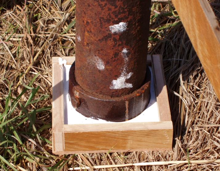
Close-up of the cap in a frame of plaster.
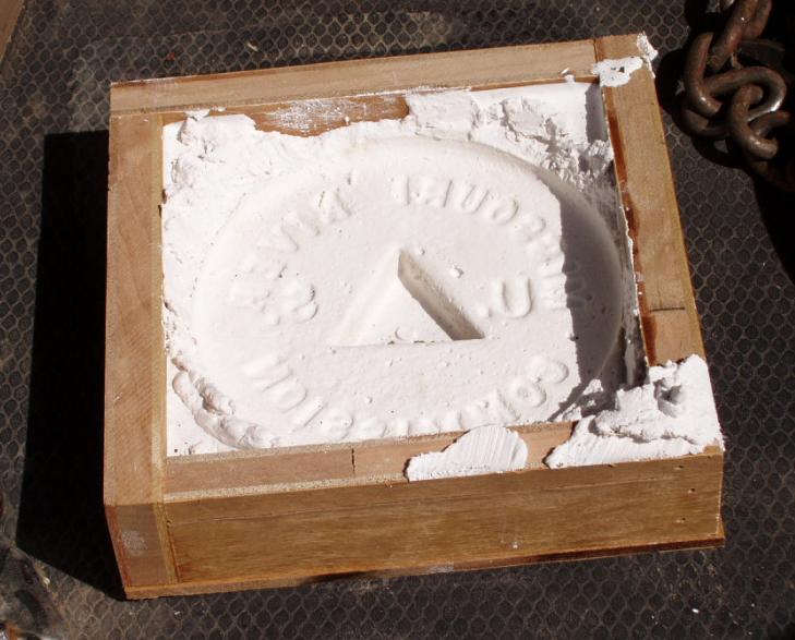
The finished mold of the cap features.
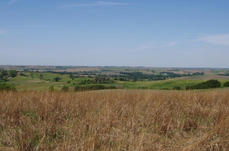
An outstanding view of the Nebraska countryside looking west from station "Blackbird".
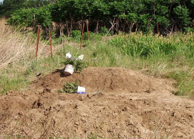
Nearby graves indicate the need to be sensitive of the area where the marker is located.
Jerry standing with the two-piece upper and lower monuments.
A nearby USC&GS triangulation station "Macy" was placed close to the MORC marker in 1934.
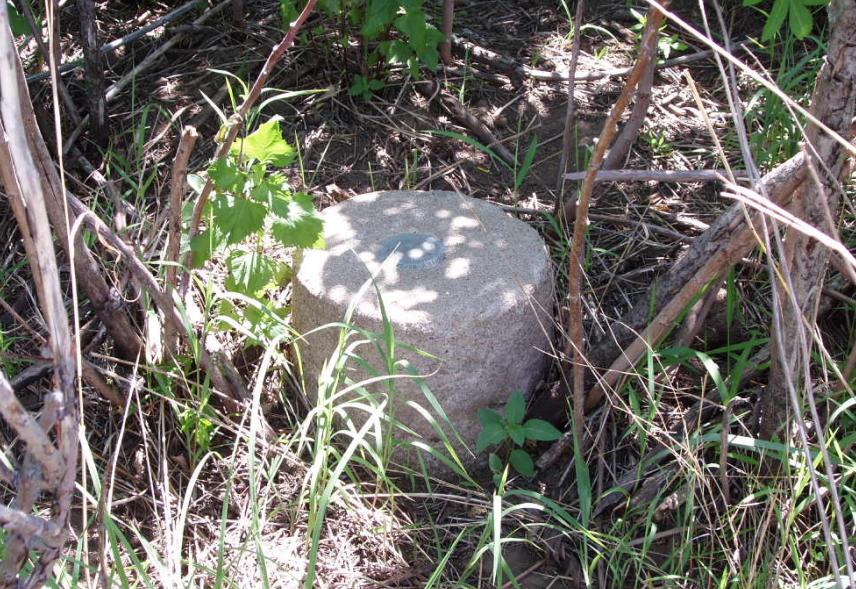
Macy Reference Mark No. 2 was found in good condition in sumac brush.
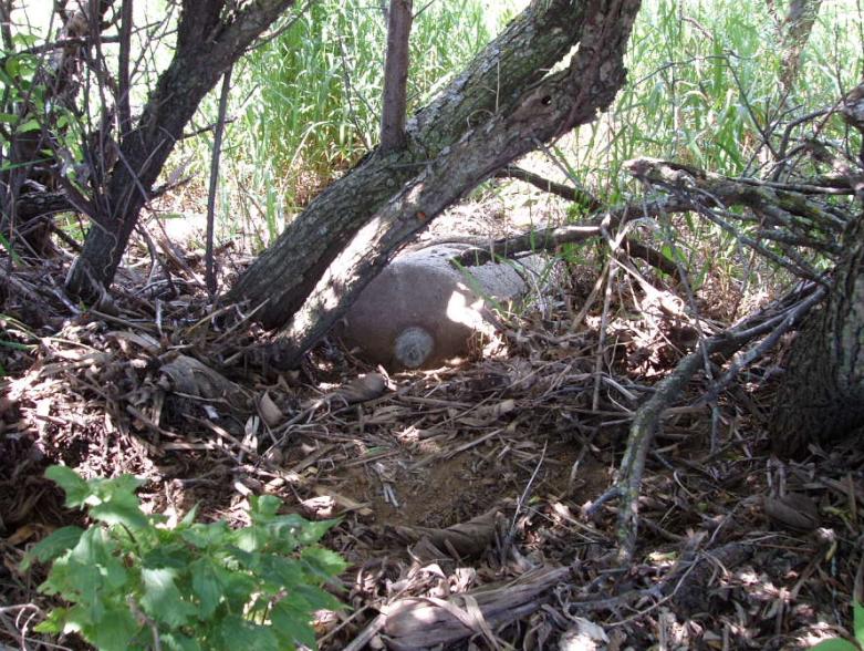
An initial search for Reference Mark No. 1 failed to find anything in the tall grass.
Looking in nearby plum brush found the monument removed from its position.
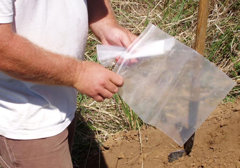
Shane places a note signed by all participants along with business cards into a plastic bag.
This was placed inside the bottom of the pipe above the stone.
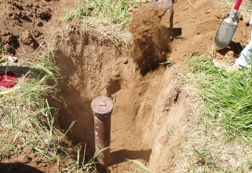
Time for backfill.

Tamping ensures the pipe will hold its position over the drill hole in stone.
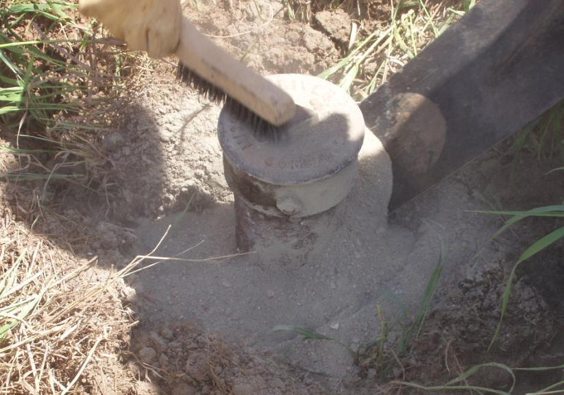
Added stability measures are concrete placed around the top for stability.
The finsihed monument now flush with the ground.
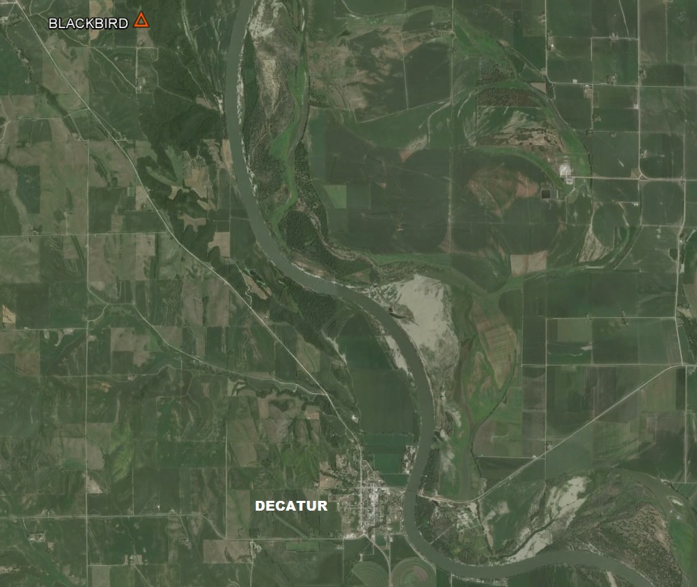
An added bonus was finding MORC benchmark 135/1 in the nearby town of Decatur.
Close-up of the MORC benchmark cap.

View of the Decatur toll bridge over the Missouri River just east of Decatur on Highway 175.
Related links to Chief Blackbird & Blackbird Hill.
Blackbird Hill
The Legend of Blackbird Hill
Aug. 11th Saturday 1804
We landed at the foot of the hill on which Black Bird I, the late King of the Mahar who Died 4 years ago, & 400 of his nation with the Smallpox was buried, and went up and fixed a white flag bound with Blue, white & red on the Grave, which was about 12 foot Base & circular, on the top of a Pinnacle about 300 foot above the water of the river. From the top of this hill may be Seen the bends or meandering of the river for 60 or 70 miles round & all the County around the base of this high land is a Soft sandstone Bluff of about 140 or 150 foot. Above the Bluff on this Creek the Mahars had the Smallpox & 400 of them Died 4 years ago. A mound of earth about 12 feet Diameter at the base & 6 feet high is raised over him turfed, and a pole 8 feet high in the Center. On this pole we fixed a white flag bound with red, Blue & white. This hill about 300 feet above the water forming a (Cliff) Bluff between that & the Water of Various height, from 40 to 150 feet in height. . . Having passed a Creek in a Deep bend to the L.S. Called by the Mahars Wau can di Peeche (Great Spirit is bad). On this Creek & Hills near it about 400 of the Mahar Died with the smallpox.
[Blackbird (wazhi-'gabe) was noted for his friendship with white traders and his strong rule over his own people. Under his leadership the Omahas rose to prominence on the eastern plains. Reports of his war deeds are mixed, but he seems to have had great authority because of his sorcery, especially in the deaths of the enemies who were likely killed by his use of poisons obtained from traders. Legend has it that he was buried seated on the back of his horse, on the hilltop where he used to watch for the coming of his friends the traders].
Saturday August 11th 1804
Proceeded on, passed a high Bluff where the King of the Mahars Died about 4 years ago. The Hill on which he is buried is about 300 feet High. The nation Goes 2 or 3 times a year to Cry over him. Capt. Lewis and Clark went up on the Hill to See the Grave; they hoisted a flag on his Grave as a present [honor] for him which will please the Indians.
Saturday 11th
This Blackbird was a great king among his people. They carry him provisions at certain times &c. Capt. Lewis & Clark went up to the grave & carried a white flag & put up on the pole which Stood over the grave, which was a round heap, (9 miles by land from below their Nation).
Saturday 11th. His name was Blackbird, king of the Mahars; an absolute monarch while living, and the Indians suppose can exercise the power of one though dead.

© Jerry Penry 2006
