Missouri River Commission BRICKKILN Jerry Penry
In 1889, the Missouri River Commission established one of their triangulation stations on a prominent hill 2.0 miles south of the red-colored hill in Section 14, T99N, R71W of the 5th P.M. The lower monument consisted of the typical 4-inch thick 18-inch square limestone buried in the ground with a capped iron pipe for the surface monument. It is likely that the surface monument was taken by curio seekers soon after it was established.
In 1934, the U. S. Coast & Geodetic Survey came to this same hill but could not find the 1889 triangulation station. In the same general vicinity, USC&GS placed their own monument, a bronze disk in a 12-inch round mass of concrete for the surface monument, with a similar monument buried below. This new triangulation station was designated "Brickkiln 2", to distinguish it from the original monument placed 45 years earlier. Two reference marks were placed nearby and an azimuth mark on another hill approximately 3200 feet to the southeast.
Even though USC&GS did not find the physical monument for the 1889 Missouri River Commission monument, the agency had always maintained a geodetic position determined through a Least Squares Adjustment by incorporating the early Missouri River Commission monuments into their system regardless of whether they were found and occupied. By determining the azimuth and distance between the 1934 position and the 1889 position, I calculated the 1889 monument to be located 17.78' northwest of the 1934 monument.
On December 24, 2012, I went to the location and confirmed the existence of the lower stone 2.5 feet deep by probing at the calculated distance. I returned on July 19, 2013, and, as the sun set below the horizon, excavated the stone monument. The next morning, after an intense thunderstorm produced an inch of rain, the recovery continued. Angles were turned to the drill hole in the stone while occupying the 1934 bronze disk and backsighting the 1934 azimuth mark. I placed an iron pipe over the drill hole in the stone and tightly backfilled. A 6-inch square wooden box, 18 inches in length, was placed around the pipe and filled with concrete. A new brass disk, stamped "Brickkiln 1889-2013" was placed in the concrete and checked by angle and distance to assure that it was directly over the drill hole in the stone. The distance between the 1934 bronze disk and the drill hole in the 1889 stone was found to be 17.65'.
Triangulation Station
1889
July 20, 2013
This triangulation station is located in south central South Dakota along the south (or west) side of the Missouri River approximately 18.5 miles west of the town of Platte. The river at this location makes a slight bend in an east direction, but generally flows southeast. The name, Brickkiln, is derived from a nearby natural landmark located along the right bank of the Missouri River approximately 875 yards south of the water's edge. The landmark is locally known as "Red Rock" since an eroded upper portion of this barren hill is dark red in color and stands out from the surrounding countryside. It is probable that early settlers referred to this hill as "Brickkiln" since it resembled a brick chimney or smokestack.
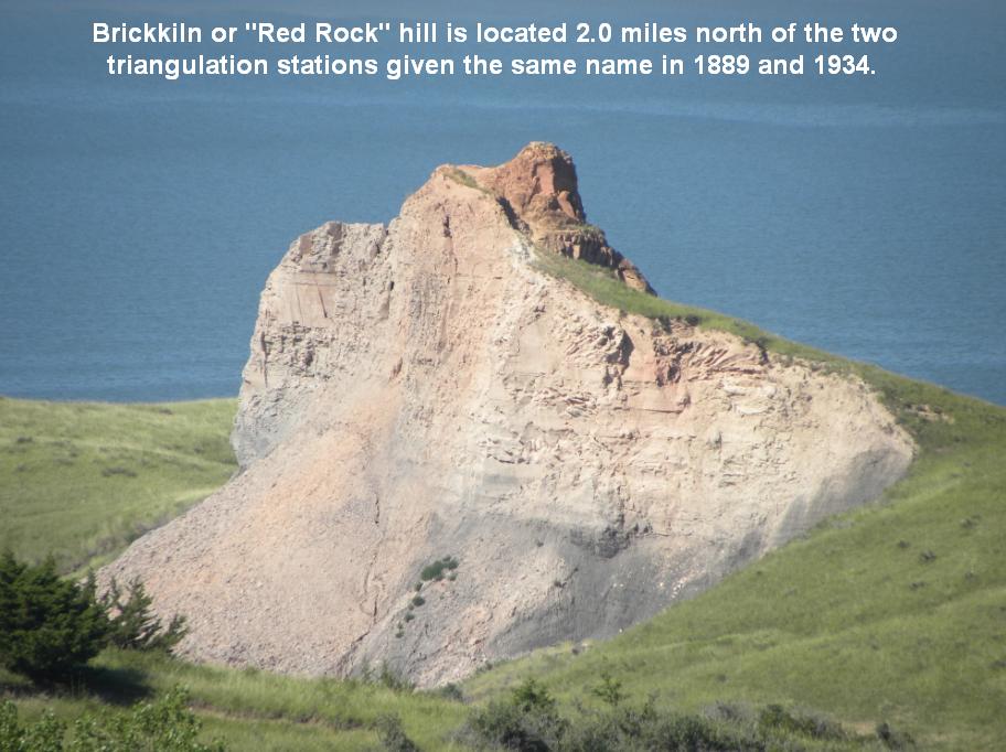
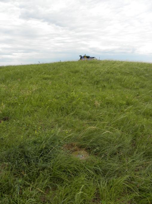
This land formation, for which the survey marker gets its name, is located 2.0 miles to the north of the hill where the monument is located.
Locally known as "Red Rock", the land formation was known as "Brickkiln" when the Missouri River Commission placed the monument in this area in 1889.

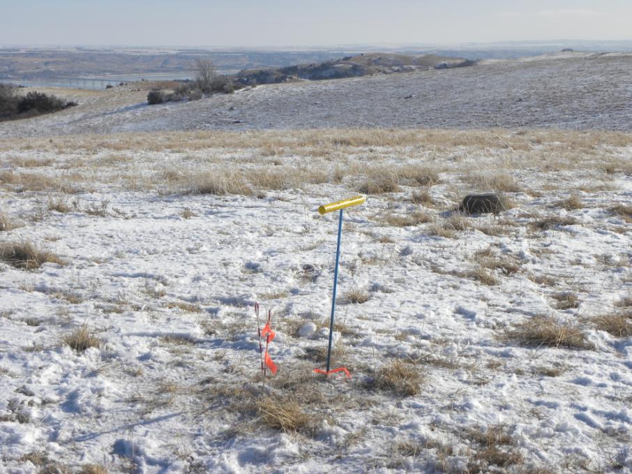
Probing confirmed the location of the 1889 monument on December 24, 2012.

The 1934 monument from which the measurement was made to the 1889 monument.

Beginning the recovery on July 19, 2013.

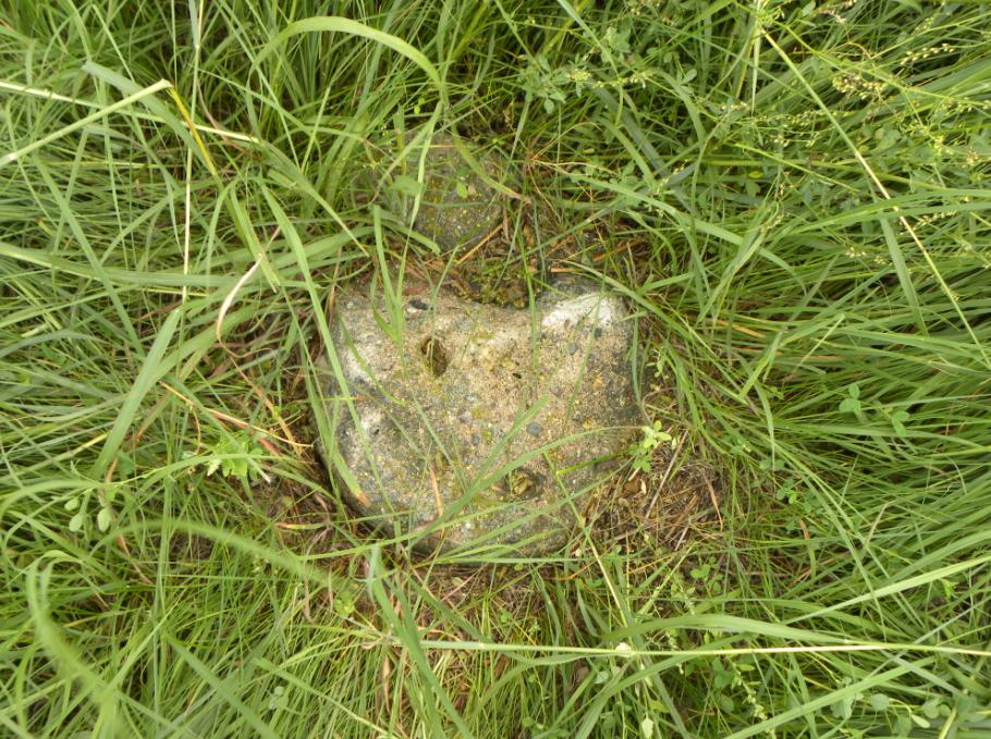
Digging for the lower 1889 stone.

First glimpse of the buried stone placed 124 years earlier.

Sunset as the digging continues.

The stone is uncovered in darkness. The camera flash reveals the entire stone.

A time delayed photo captures the remaining light and shows the moon.
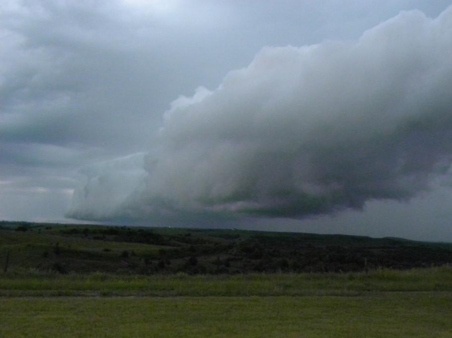
An intense thunderstorm passes on the morning of July 20, 2013, leaving an inch of rain.
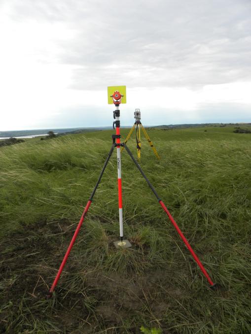
Setup over the 1934 marker with the prism pole on the 1889 stone.
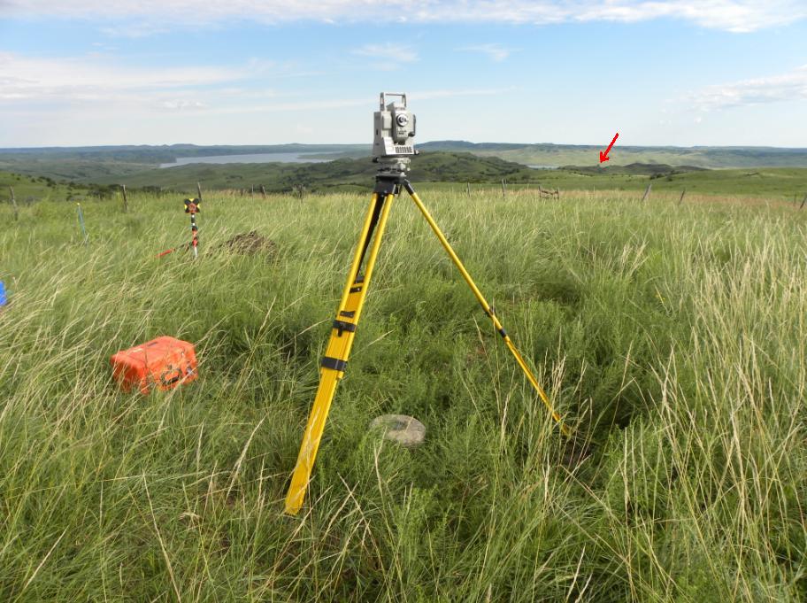
The arrow at right points to the "Red Rock" (Brickkiln) hill 2.0 miles away.

View looking over the stone toward the 1934 monument.

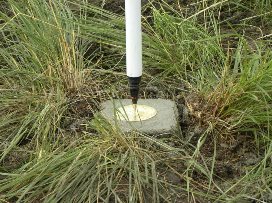
The prism pole point in the drill hole of the stone.

Jerry turns angles to tie in the 1889 stone from the 1934 bronze disk in concrete.

Another view looking nearly due north.

String lines help center the iron pipe over the drill hole.

A wooden box placed around the pipe will be filled with concrete.

Cattle to the east bed down after their morning grazing.

As seen through the zoom lens, Red Rock (Brickkiln) is 2.0 miles to the north.

The box has been filled with concrete. Sod is added around the monument.
The new brass disk in placed in the concrete and is being checked for position.
View of the new brass disk set for the upper monument over the original "Brickkiln" stone.

Closeup of the finished monument to mark the original location for the 1889 triangulation station.
Looking west toward the triangulation station over Reference Mark No. 1.

Reference Mark No. 1.

Closeup of Reference Mark No. 1.
The remains of Reference Mark No. 2 which had been hit and knocked out.

The backsight set up over the Azimuth Mark.

Brickkiln 2 - 1934 Azimuth Mark.
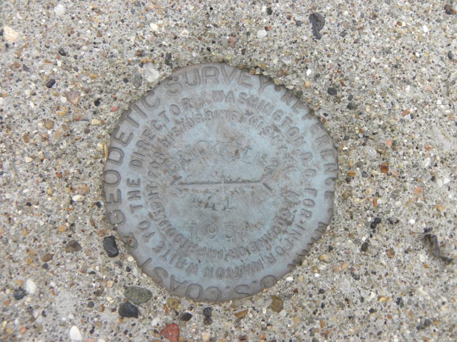
Closeup of Brickkiln 2 Azimuth Mark.
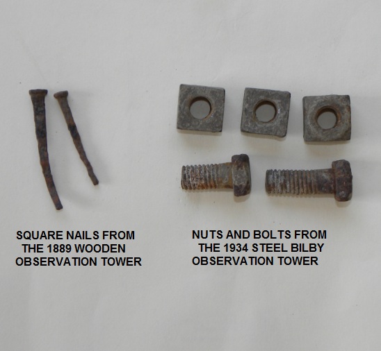
Square nails from 1889 along with iron bolts and nuts from 1934 that were used to build the observation towers.
Nebraska Surveying

© Jerry Penry 2013
