Missouri River Commission FORT THOMPSON October 25, 2019
The triangulation station monument marking the Missouri River Commission's (MORC) point known as "Fort Thompson" is one of over 90 strategic surveying points placed in South Dakota along the Missouri River during 1889-90 for mapping purposes. These triangulation stations have largely disappeared over the years in part due to their interesting design. The early surveyors spent a large sum of time, money, and effort to map the Missouri River from its mouth at Three Forks, Montana, to the confluence with the Mississippi River at St. Louis. This project was one of the most accurate surveying and mapping operations performed anywhere in the United States. Forward thinking individuals who were in charge of the project thankfully had the foresight to know that placing a lower buried and hidden monument would preserve their work if the surface monument later became moved or stolen.
When Ryan Lorenzen and Dustin Fiebelkorn first discovered the capped iron pipe in late August of 2019, they were thrilled that it still existed. However, the calculated position indicated it should be approximately 22 feet to the west. A probe was sunk into the ground and hit something which indicated it very well could be the buried lower stone. Plans were then made to return at a later date to excavate and prove our assumption the capped pipe had been moved.
The images that follow show our remonumentation project to restore the capped pipe back to its original location over the buried stone. Precise static GPS work found that the capped pipe had been moved 22.240 feet to the east. The position of the monument, as restored, was found to be only 1.038 feet from our calculated position. This is a great testimony to the expert work that was performed by the surveyors 130 years ago.
Also on the same hilltop as the 1889 Missouri River Commission monument is another triangulation station placed by a different agency and named "Soldier". This marker is a bronze disk with a triangle in the center set into a square concrete pad that was placed in 1948 by the U. S. Coast & Geodetic Survey (USC&GS). The report for this monument does not make mention of the Missouri River Commission's capped pipe which should have been visible. In other locations, USC&GS has used the existing MORC monument by removing the cast iron cap, filling the pipe with concrete and placing their disk in the center. The lack of using or mentioning the MORC capped pipe in 1948 indicates it was either not present or the USC&GS surveyors correctly thought its position was suspect. The USC&GS station "Soldier" is located 24.254 feet northeast of the remonumented MORC capped pipe over the stone.
Triangulation Station
1889
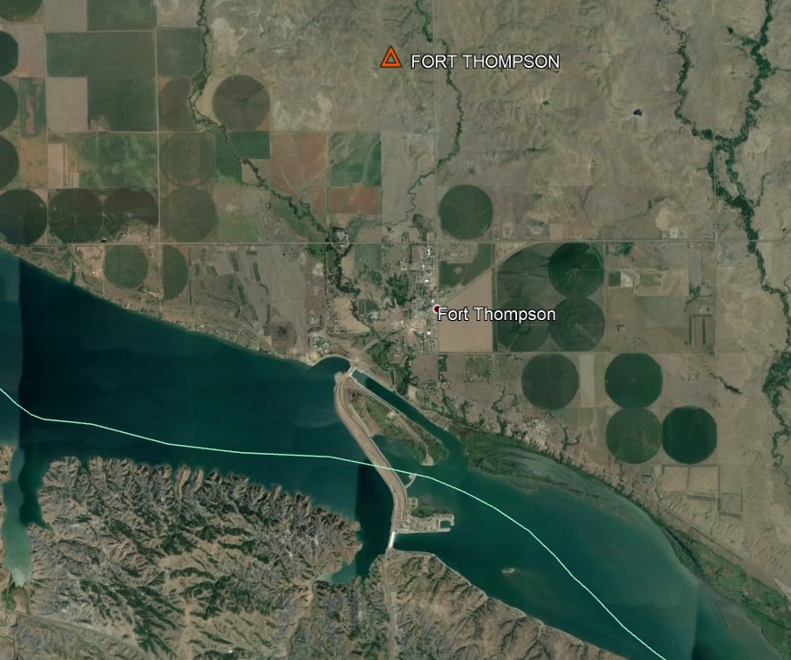
The location of the "Fort Thompson" triangulation station is about 1.8 miles north of Fort Thompson.

The leaning capped iron pipe that was found to have been moved and out of position.

Embossing on the top of the 5 1/2" diameter cast iron cap that is affixed to the 4 1/2" diameter pipe with a long bolt.
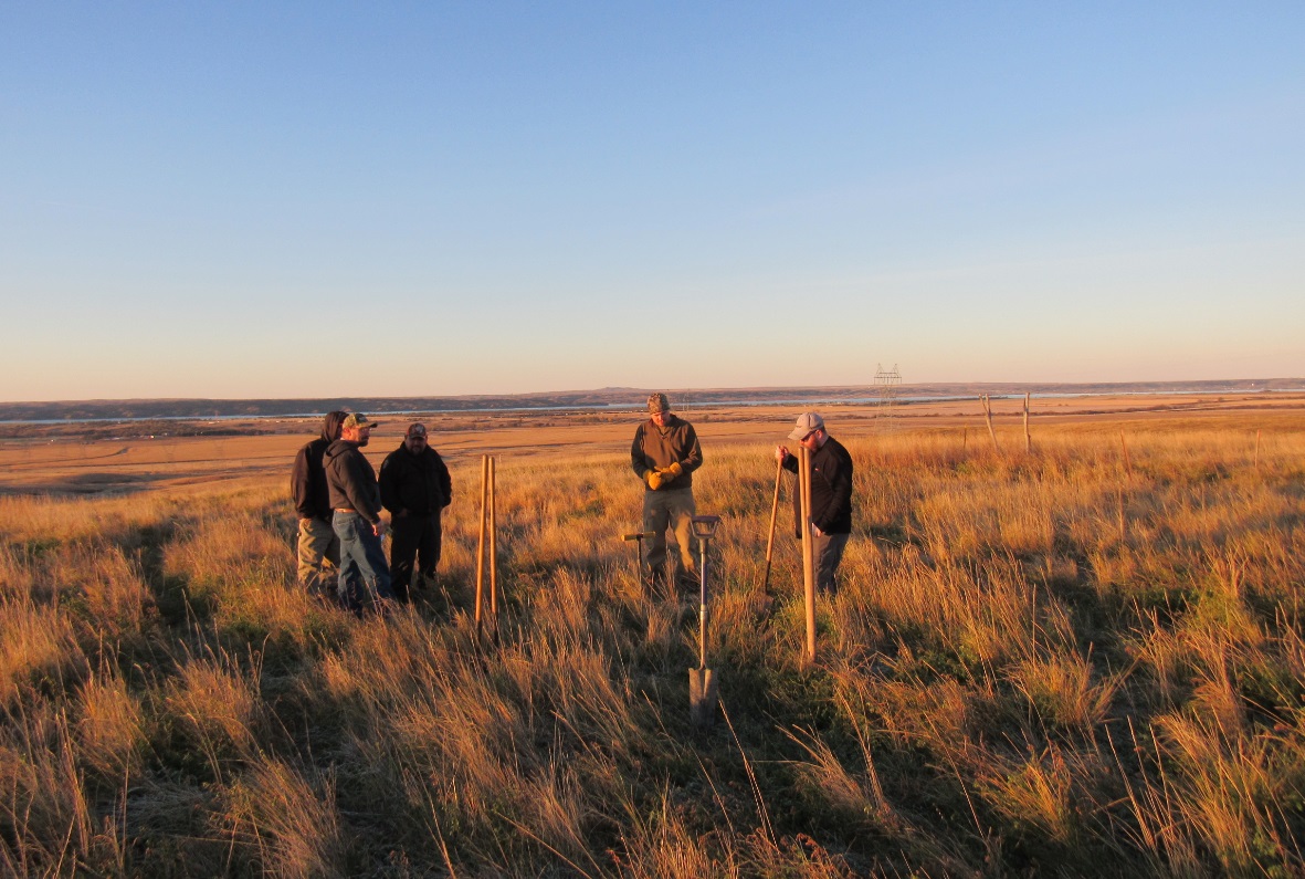
The early morning search begins for the buried stone that was set for the lower monument.

Digging in earnest to see what the probe struck below the surface.

The relationship to where the capped pipe was initially found well away from our calculated position.

The first glimpse of the buried stone that proved we had calculated and found the correct location.

The buried lower monument consists of an engraved flat limestone that is 18" square.

The lower stone inside the excavated hole. The first light of day upon it in 130 years.

Taking a GPS reading on the drill hole in the stone which marks the exact location.

The capped pipe now out of its incorrect location and ready to be reset over the stone.

Now correctly back over its original location above the drill hole, the capped pipe and stone are reunited.

Checking the position of the cap to make sure it is directly over the drill hole in the lower stone.

Setting a concrete base around the capped pipe to hopefully ensure that it does not get moved again.
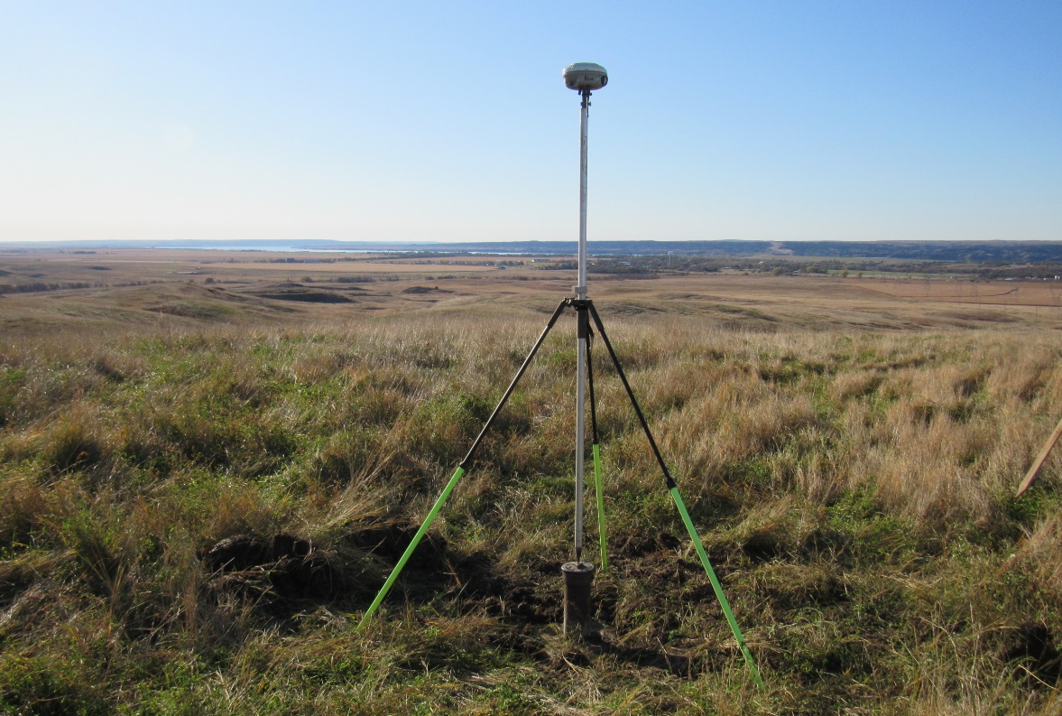
Obtaining a 4-hour static GPS session over the monument to obtain and record its precise location.

The recovery crew consisting of Ryan Lorenzen, Jerry Penry, Dustin Fiebelkorn, and Jerrod Looft.

A bronze disk in concrete marks USC&GS triangulation station "Soldier" that was placed in 1948.

The broinze disk that marks triangulation station "Soldier".

Reference Marks No. 1 and No. 2 that were placed for triangulation station "Soldier" in 1948.

© Jerry Penry 2019
