Missouri River Commission NEMAHA Jerry Penry
Triangulation Station
1890
January 21, 2013
This Missouri River Commission triangulation station is located approximately 4.5 miles southeast of Rulo, Nebraska, and 1.5 miles north of the Nebraska/Kansas state line. In 1945, the U. S. Coast & Geodetic Survey stated that they had replaced the original Missouri River Commission pipe with their own bronze disk in concrete. There was no mention if the iron pipe still had the Missouri River Commission's cap affixed to it. There should have been the Missouri River Commission's lower stone below the pipe, but USC&GS made no mention of finding this. The report in 1945 stated that the underground mark is also a bronze disk set in concrete. This leads to the question of whether the iron pipe found by USC&GS in 1945 was found in its correct location. In 2013, Gene Thomsen, along with Jerry and Jenny Penry found the USC&GS bronze disk along with the two reference marks. Probing all around the disk did not indicate that the stone was there. This might be a case where the original Missouri River Commission's iron pipe was moved and USC&GS had assumed that it was in its correct location in 1945 when they remonumented the location. The correct name for this station today is "Nemaha Reset" as designated by USC&GS. Further investigation needs to be made to determine where the lower Missouri River Commission stone is located.


Gene Thomsen at the site of the 1945 USC&GS triangulation station.

Closeup of the bronze disk in concrete placed in 1945.
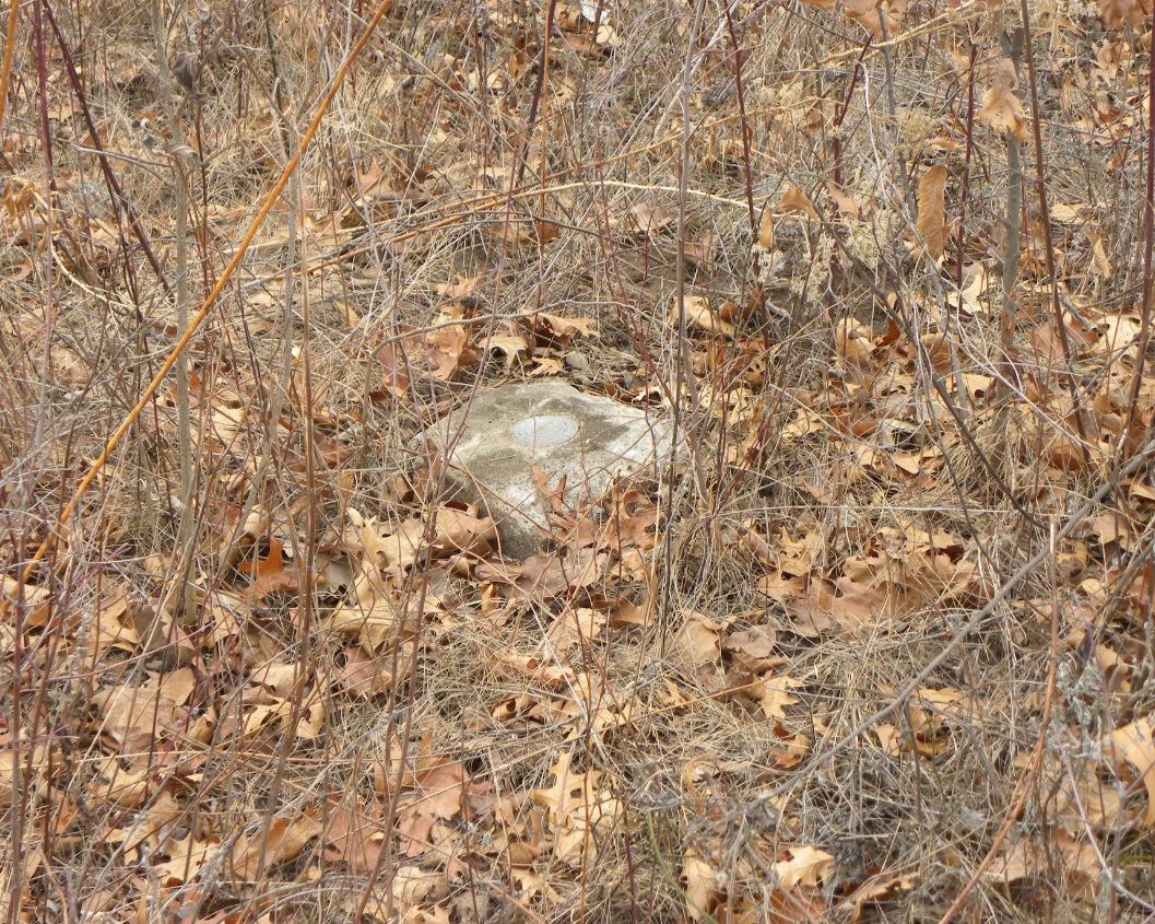
Reference Mark No.1.
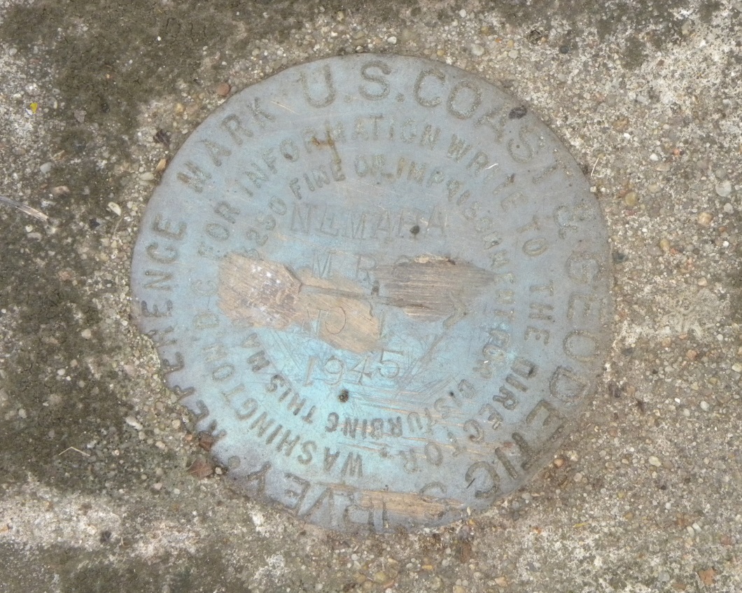
The bronze disk for Reference Mark No. 1.
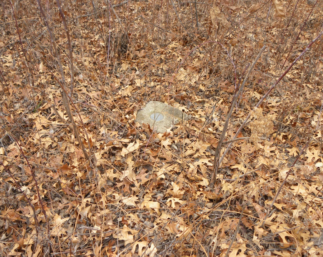
Reference Mark No. 2.
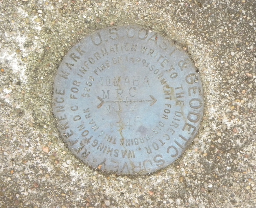
The bronze disk for Reference Mark No. 2.

© Jerry Penry 2013
