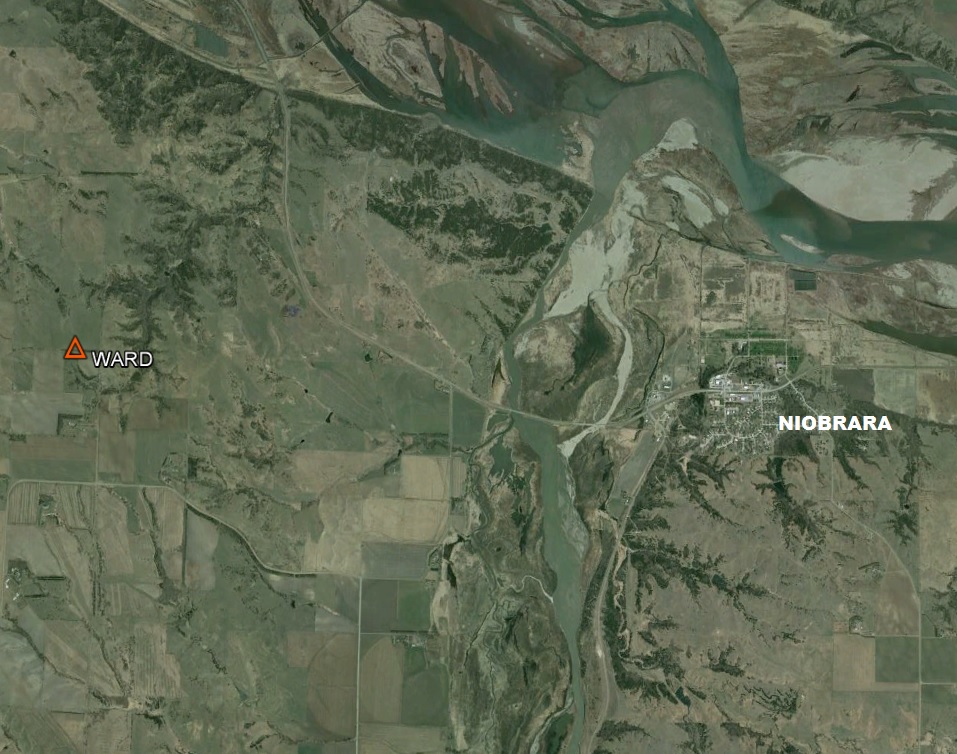
Missouri River Commission WARD Jerry Penry
Station "Ward" has an unusual history that was long held in mystery until October 17, 2008. The finding of this triangulation station's lower monument of 1889 and the position for the surface monument as it existed in 1948 was solved.
FULL STORY
Triangulation Station
1889
October 17, 2008
The oldest and rarest geodetic monuments in Nebraska are those of the Missouri River Commission that were placed during the years 1889-1890. Prior to the search for station "Ward", there had been only one confirmed iron pipe with cap still in existence for a triangulation station. There had been 39 of the triangulation monuments placed on the Nebraska side of the Missouri River. Each was double monumented with a capped iron pipe at the surface over a lower marked stone.
(Click Here)
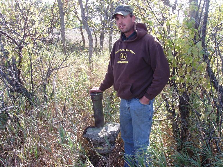
Excitement was made with the discovery of the 1889 pipe by the landowner's son.
The search for the 1948 reference marks begin, but everything has changed.
The rare 1889 Missouri River Commission pipe with cap (not where it belongs).
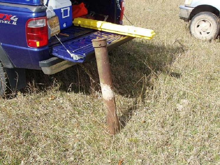
The 1889 pipe with the concrete removed.
The discovery of the first reference mark finally gave us the break we needed.
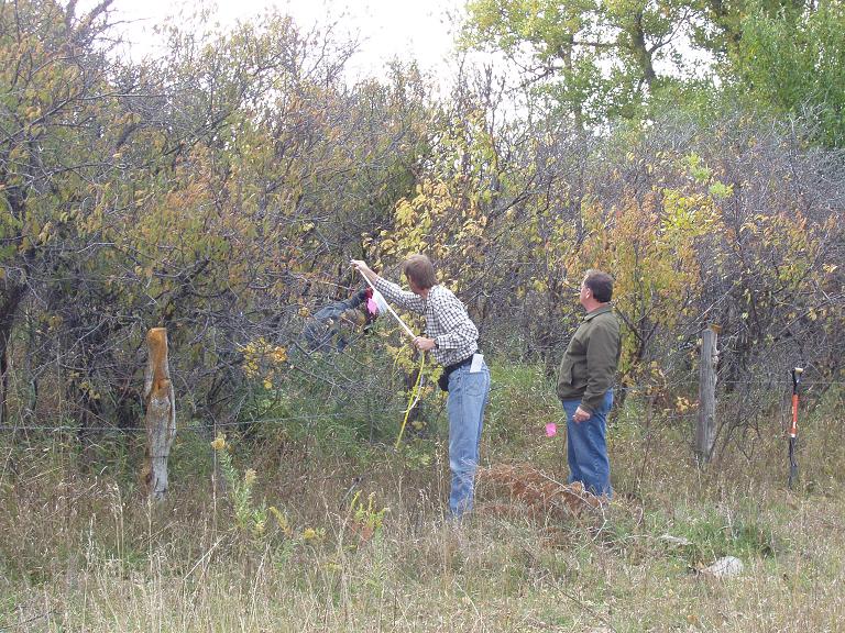
Erik feeds the tape across the fence to measure.
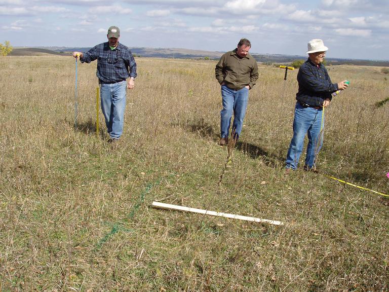
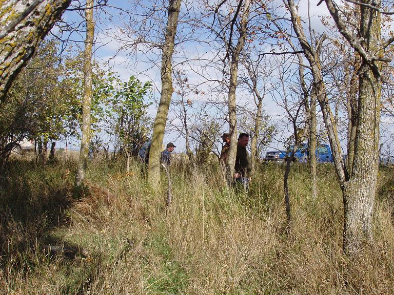
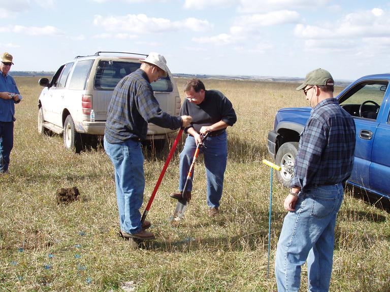
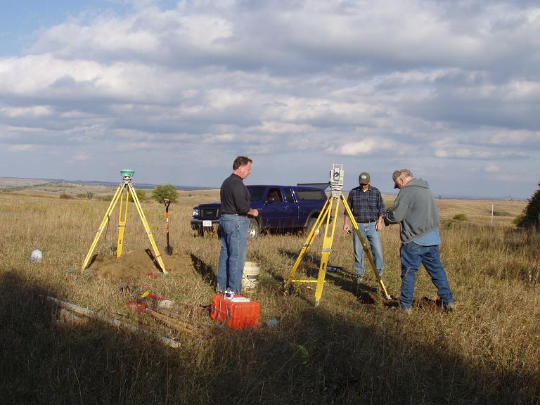
Kurt, Dave and Rex begin searching for the 1889 Missouri River Commission stone.
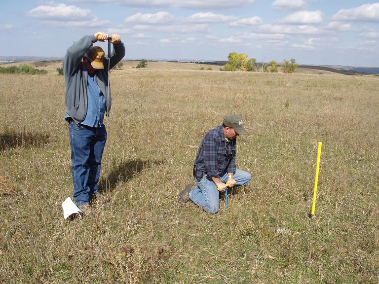
Gene and Kurt make many holes in the hard ground trying to find the stone.

In the distance is Ponca Hill where station "Ward" connected with station "Ponca" in 1889.

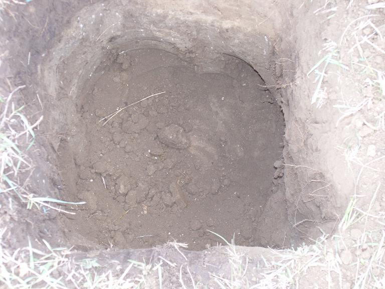
Digging the first hole where the distances from the reference marks said the 1948 position should be,
and where we thought the stone might be located.

Reference Mark No. 1 that was set in 1948.
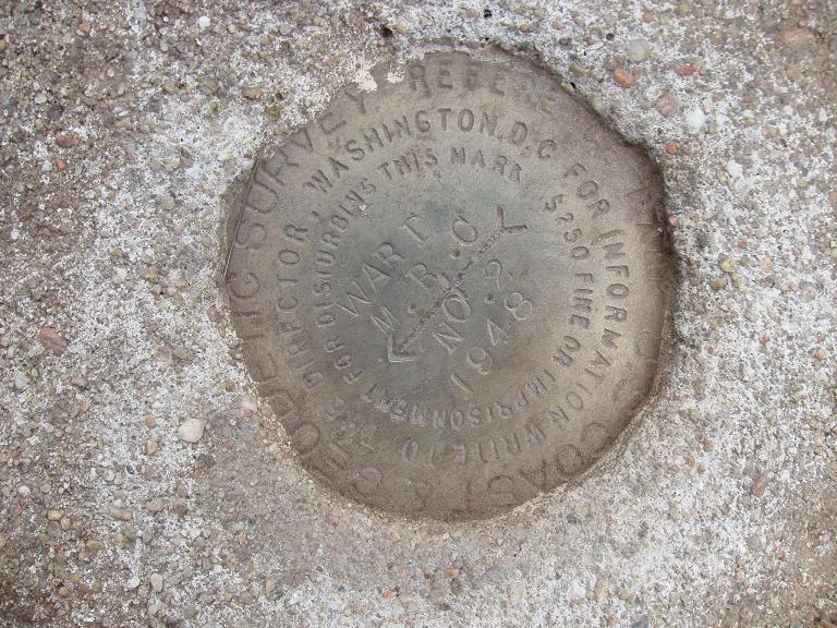
Reference Mark No. 2 that was set in 1948.
Deeper probing to a 36" depth struck the 1889 stone, so Rex and Dave get after it!
The first sign of the original lower monument established by the Missouri River Commission in 1889.

We theorize that the stone was probably cracked at the time it was placed.

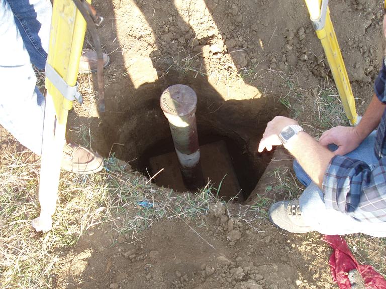
The 56" long pipe is in place for "WARD RESET" at the 1948 location.
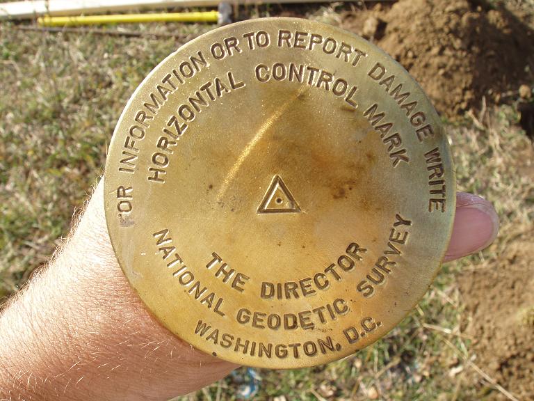
The new brass disk for "WARD RESET" before stamping.

Jerry stamping the disk for the 1948 location.

Concrete placed around "WARD RESET".
Collecting GPS data on the drill hole of the 1889 Missouri River Commission stone and getting EDM distances
with the total station to the reference ties to properly set "WARD RESET".

Dave and Kurt continue operations at the site.
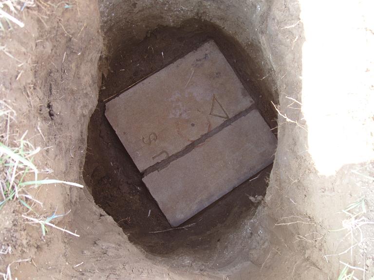
The cleaned stone showing the cracked stone.
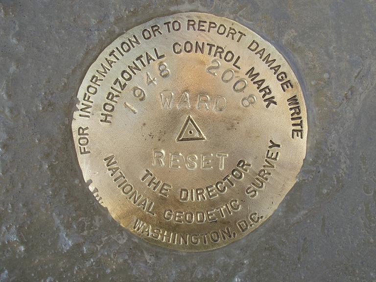
The new brass disk for the 1948 location.
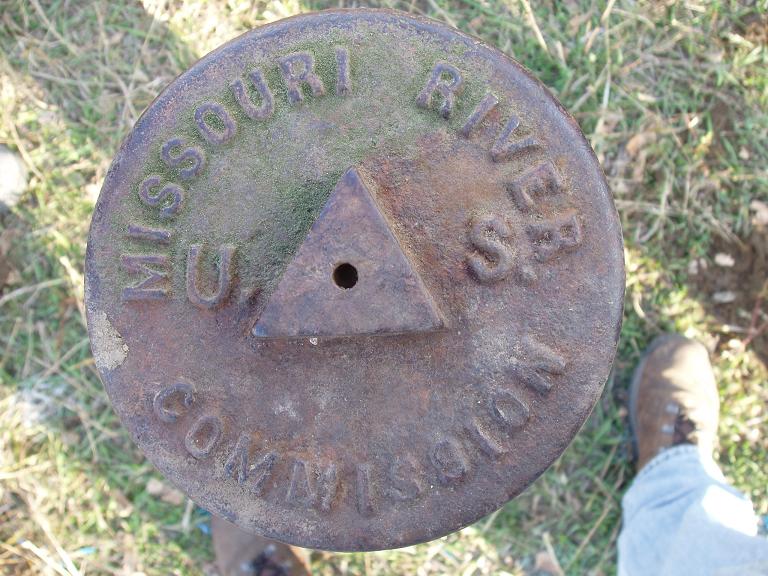
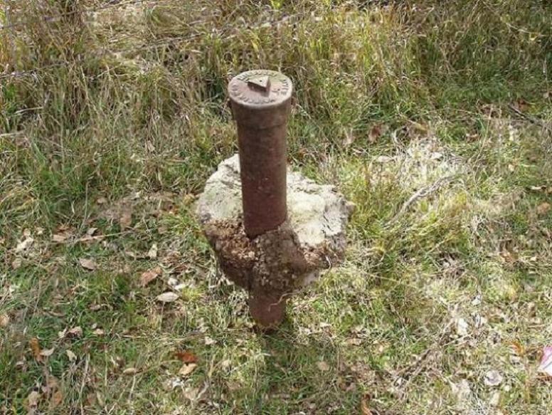
The 1889 Missouri River Commission cap. Only the second one found so far in Nebraska to be still in existence.

The 1889 Missouri River Commission pipe and cap is placed over the drill hole.

Dave and Kurt make the final adjustments before backfilling around the pipe.
The 1889 pipe and 1889 stone are once again reunited.

One last look at the historical monument.

Both "Ward" stations of 1889 and 1948 which are 11.23' apart.
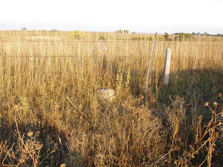
The azimuth mark set in 1948 is no longer visible due to trees.
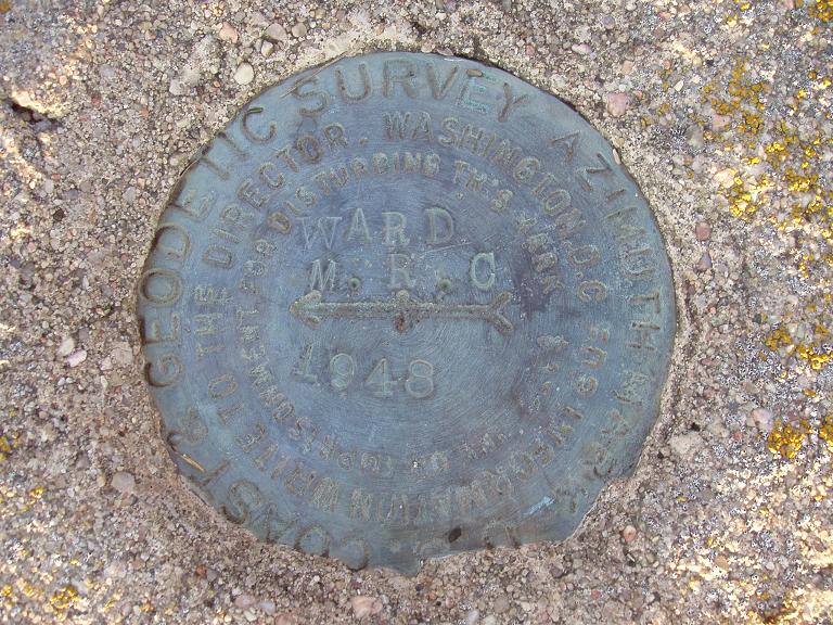
Closeup view of the "Ward" azimuth disk of 1948.

The landowner's son-in-law came to look with his son. Ironically the dad's first name is "Ward".

© Jerry Penry 2008
