USGS
Bench Mark
"DW 5190"ca. 1898
Jerry Penry
September 26, 2015
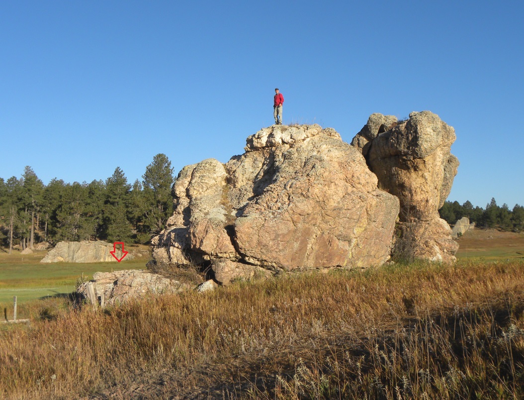
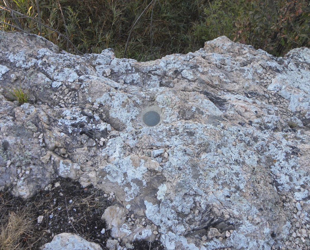
The location of this bench mark is in a large boulder approx. 6 miles south of Custer near a former railroad station known as Mayo. The rock is described as being 100' x 30' and 25' tall and noticeably stands alone from other rocks or stone outcroppings. The Burlington Railroad built their line just to the west side of the rock which is immoveable. The original USGS monument was a copper bolt in a drill hole. This monument was found to be missing in 1934 when USC&GS established their line of bench marks along the railroad. According to the datasheet, C&GS found a drill hole in the stone which they reported as supposedly being the location of the USGS monument. A flat bronze disk was then cemented into the drill hole and was stamped "J 178 1934". The monument was recovered by Kurt Luebke, Dave Ingram and Jerry Penry.
The original USGS quad showing the bench mark near the railroad station known as "Mayo".
The original USGS description for DW 5190.
Kurt Luebke on the rock with the arrow pointing to the location of the bench mark.
The former railroad grade next to the rock which is now the Mickelson Trail.
The arrow points to the location of the bench mark.
The USC&GS bronze disk designated "J 178".
Close up of the bronze disk cemented into the drill hole where the original USGS copper bolt was once located.
Other Deadwood Datum Bench Marks
© Jerry Penry 2015