USGS
Bench Mark
"DW 6060"ca. 1898
Jerry Penry
September 4, 2010
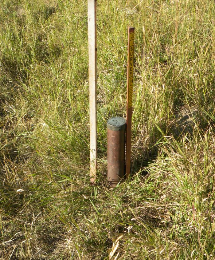
The location of this bench mark is approximately 6 miles west and 4 miles north of Custer, South Dakota. Despite the changes that have occurred in the area, the bench mark survived and is currently marked by a National Forest survey marker sign. Recovered by Kurt Luebke, Jenny Stukel and Jerry Penry.

Bench Mark "DW 6060" along the west side of Road 285.
Bench Mark "DW 6060".
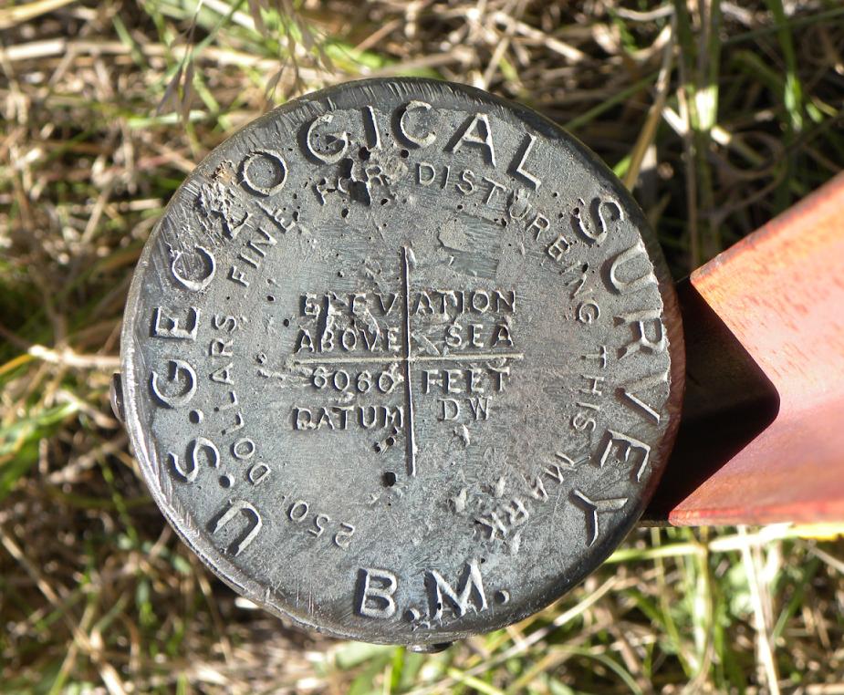
The top of the cap.

The original description. The road going west to Bear Springs no longer exists today. None of the bearing trees could be found.

The original USGS quad sheep showing the location of "DW 6060".

Cyurrent Black Hills national Forest map showing the location of bench mark "DW 6060".
Other Deadwood Datum Bench Marks
© Jerry Penry 2010

