USGS
Bench Mark
"DW 6443"ca. 1898
Jerry Penry
September 4, 2010
Bench Mark "DW 6443" was established in the Black Hills by the U. S. Geological Survey sometime around the year 1898. It was referenced to the Deadwood Datum which depended upon a bench mark at Deadwood, South Dakota. The location is along the north side of Road 292 near the SE Corner of Section 33, T2S, R3E of the Black Hills Meridian. It is approximately 8 miles west and 4 miles north of the town of Custer, South Dakota. Recovered by Kurt Luebke, Jenny Stukel and Jerry Penry.

The original description for Bench Mark "DW 6443" describing the distance to the SE Corner of Section 33, T2S, R3E.

The USGS Bench Mark "DW 6443" (left) and the USDA capped alumuinum pipe marking the SE Corner of Section 33.
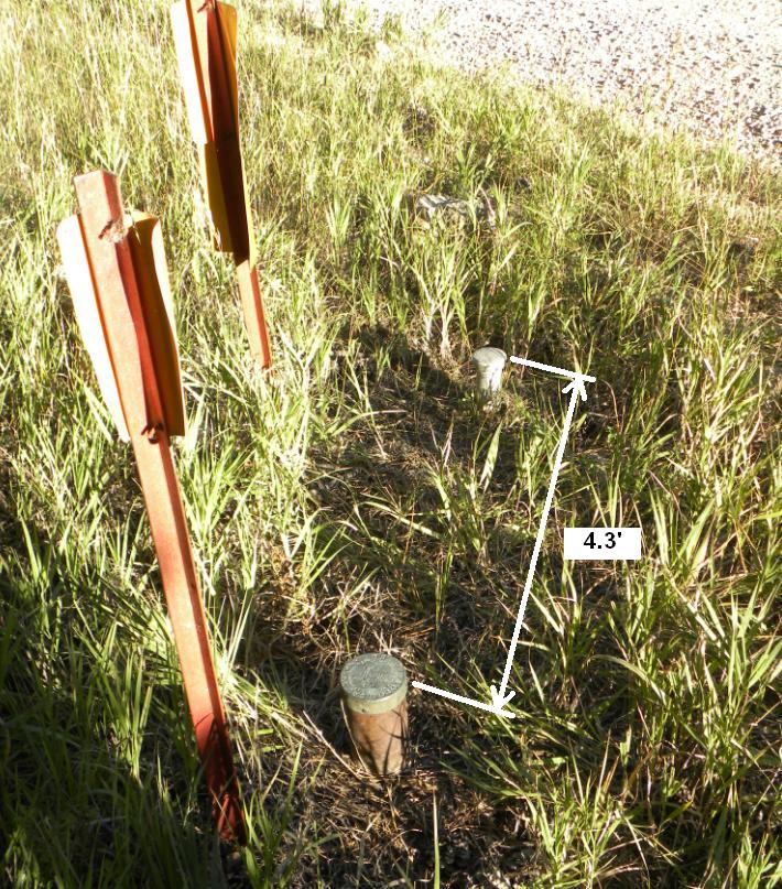
The distance between the two monuments was found to be 4.3'.

Looking northwest over the section corner and bench mark behind it.

United States Department of Agriculture aluminum cap marking the location of the SE Corner of Section 33.

Top of USGS Bench Mark "DW 6443".

Original USGS quad sheet showing the location of "DW 6443".

Current Black Hills National Forest map. The road should be drawn on the south side of the section corner.
Other Deadwood Datum Bench Marks
© Jerry Penry 2010

