USGS / USC&GS
Triangulation Stations
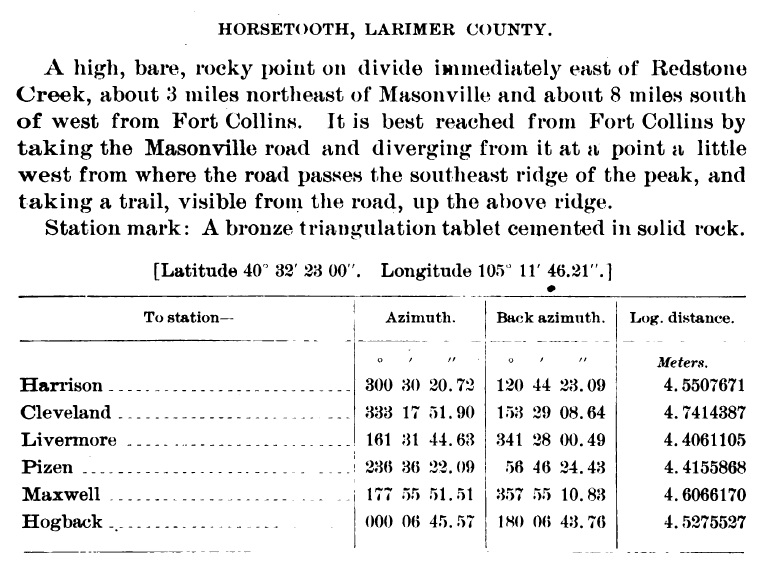
"HORSETOOTH"1902 & 1912
Jerry Penry
September 13, 2015
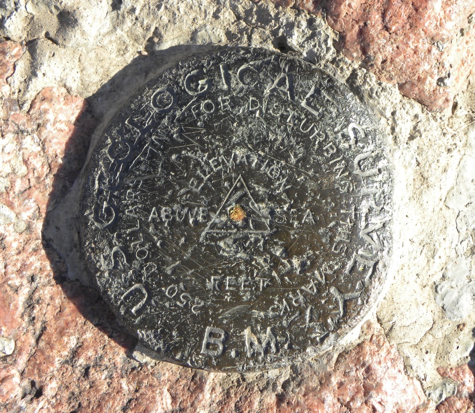
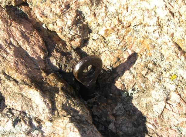
This triangulation station named "Horsetooth", was originally established by R. H. Chapman of the U. S. Geological Survey in the fall of 1902. In 1912, it was accepted and used by surveyors of the U. S. Coast & Geodetic Survey as a station for their 104th Meridian Survey. The monument is an early bronze USGS triangulation tablet which is marked by a triangle in the center. The initials "B.M." are on the lower edge since some stations were also used for bench marks. When USC&GS occupied the marker in 1912, they established a reference mark to the north. In 1935, USC&GS established a second reference mark to the south. This second mark was missing in 1939, so a replacement reference mark was established during that year. Several iron eye bolts, embedded into the rock surrounding the triangulation station, were used as guy anchors to secure the tower or sight when placed over the point.The location of the marker is on the southern end of Horsetooth Mountain in the foothills of the Front Range west of the city of Fort Collins, Colorado. The mountain is distinguishable by the large rock formation on its summit known as Horsetooth Rock which early explorers thought looked like a horse tooth.
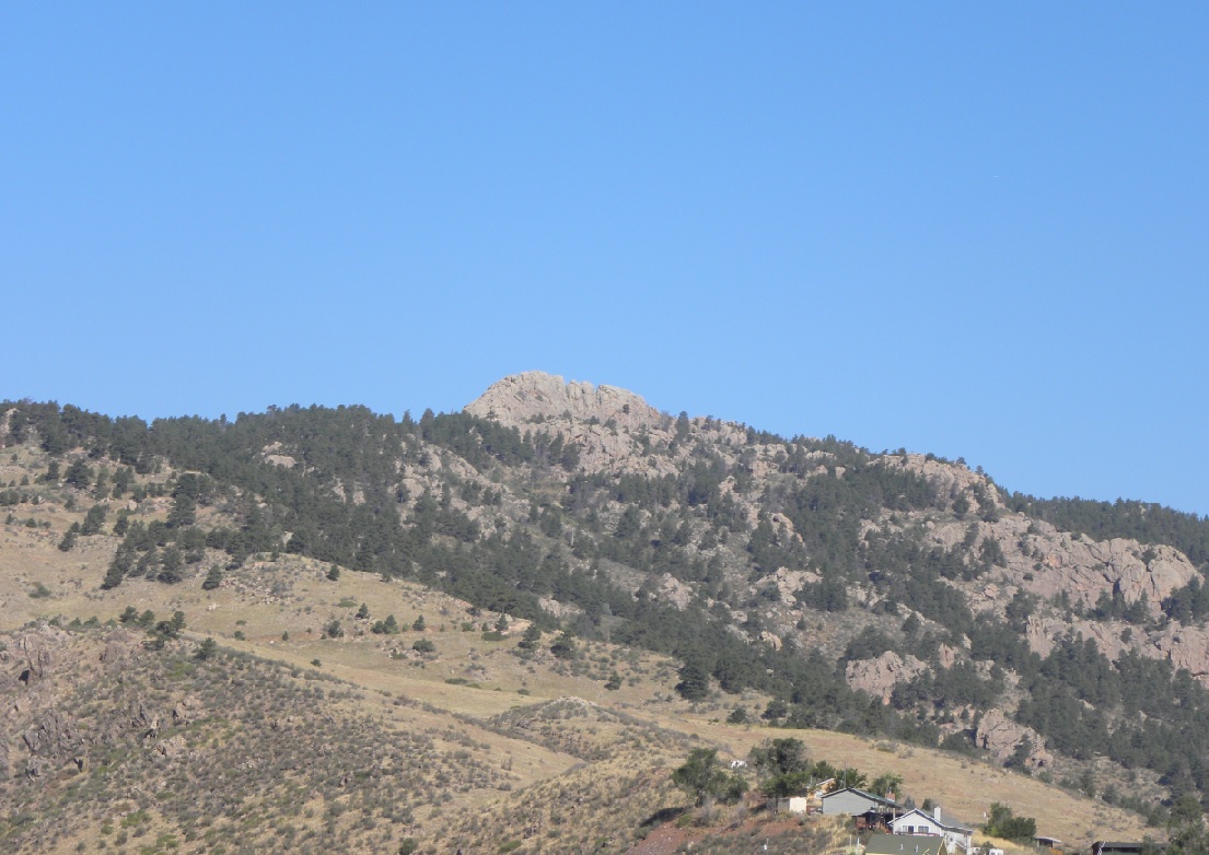
Horsetooth Mountain as viewed from the east.
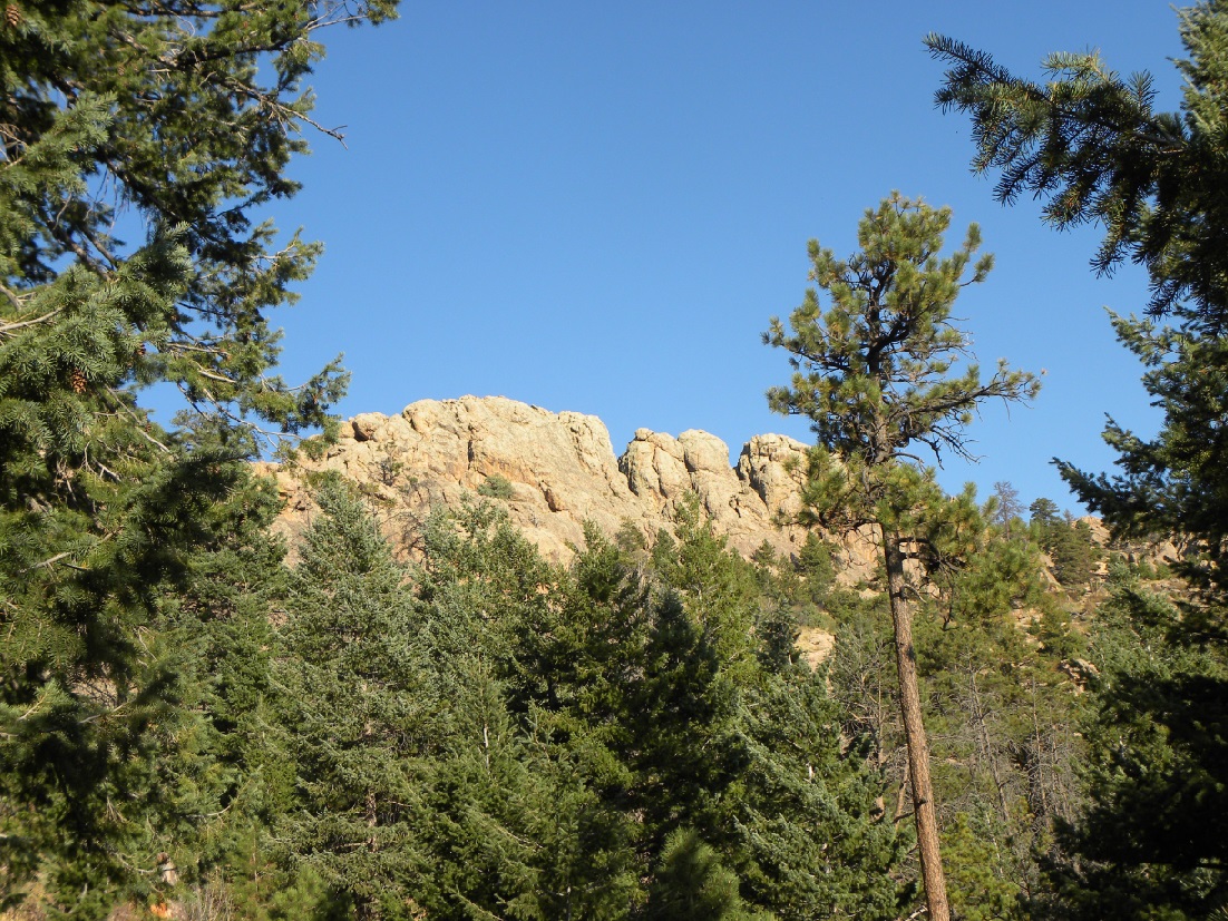
View of the summit from the hiking trail.
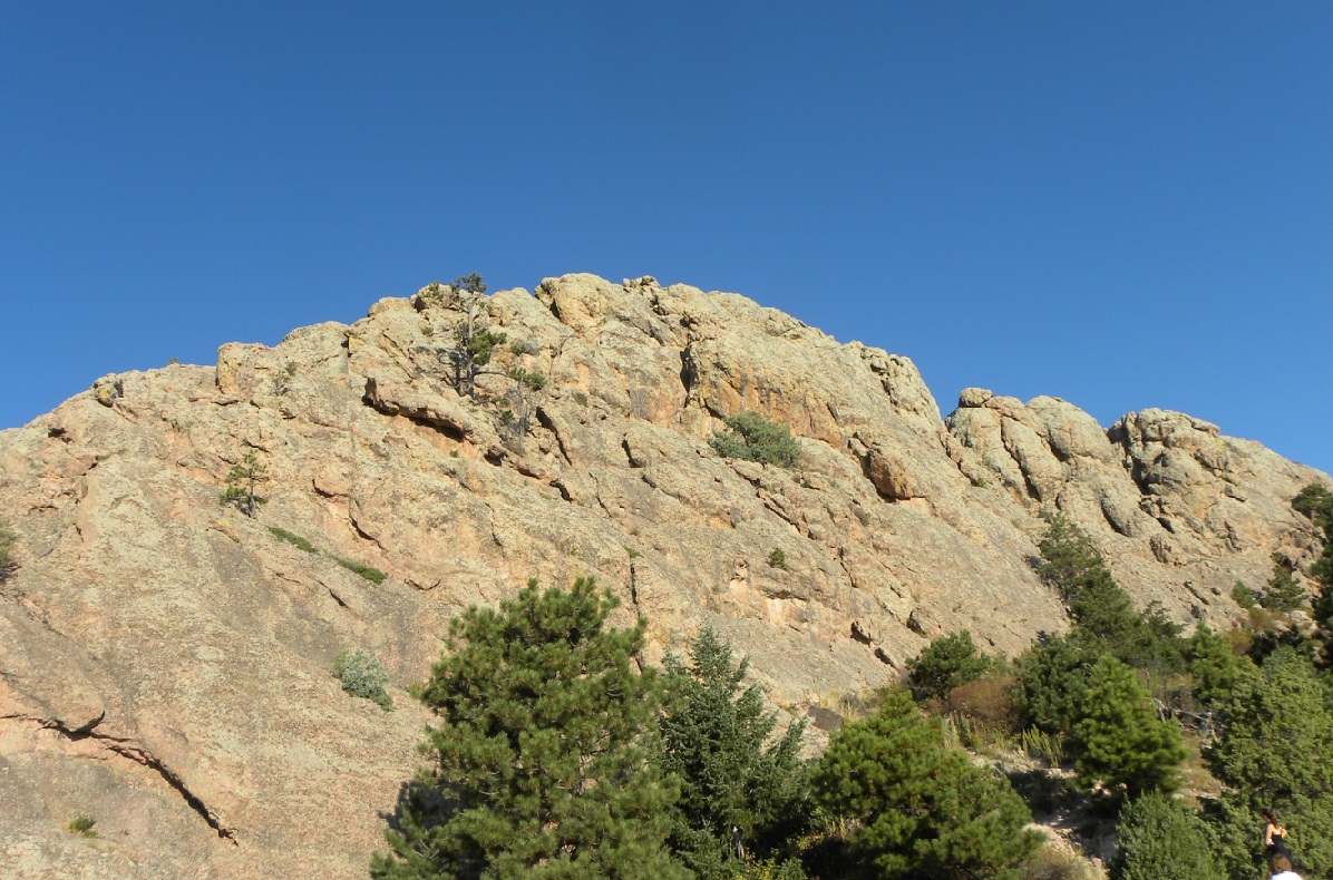
The final climb to reach the summit requires some thought in the route.
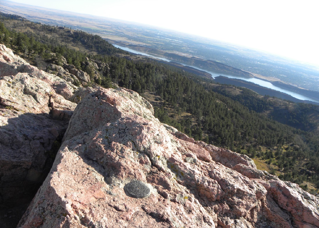
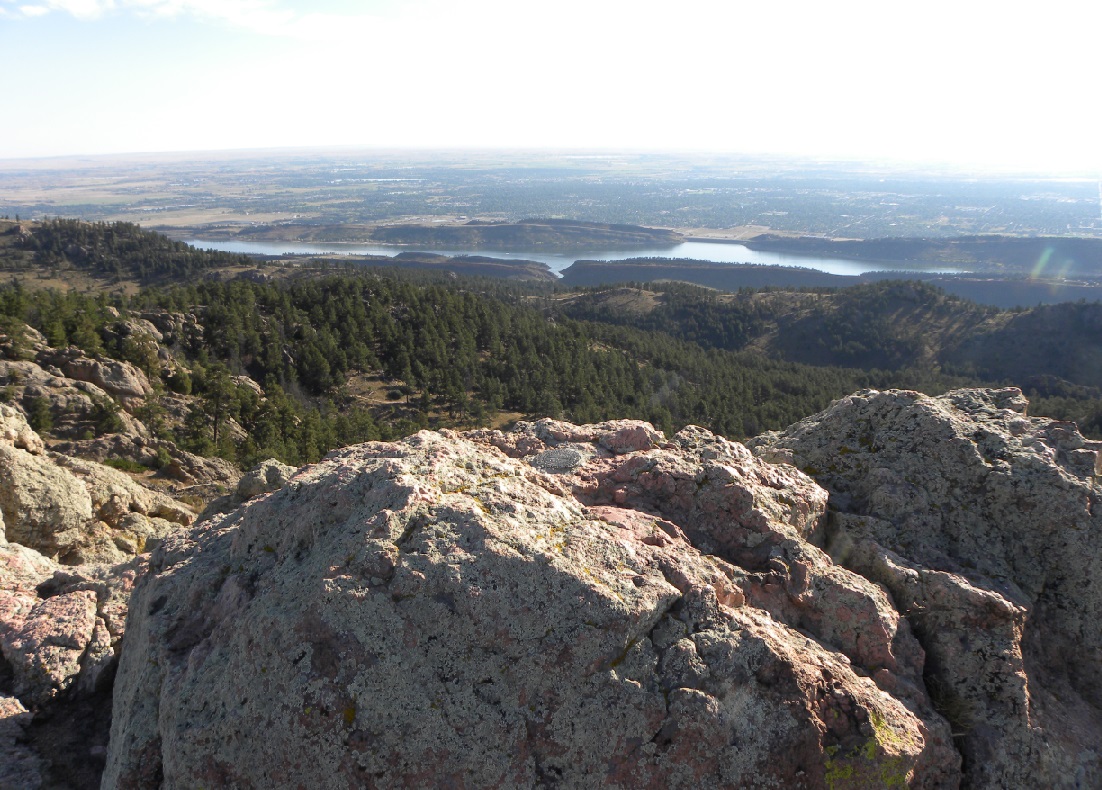
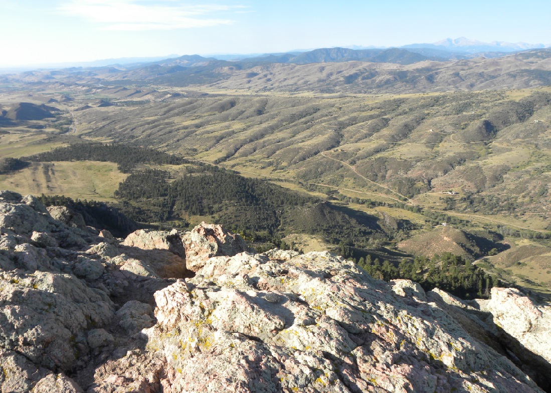
Looking to the northeast over the marker toward Horsetooth Lake and Fort Collins.
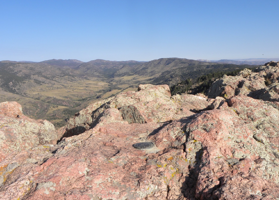
Looking to the north.
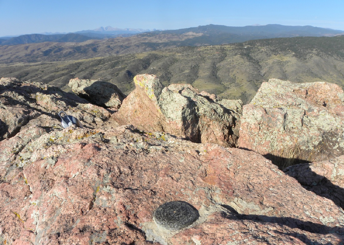
Looking south with Long's Peak in the distance.
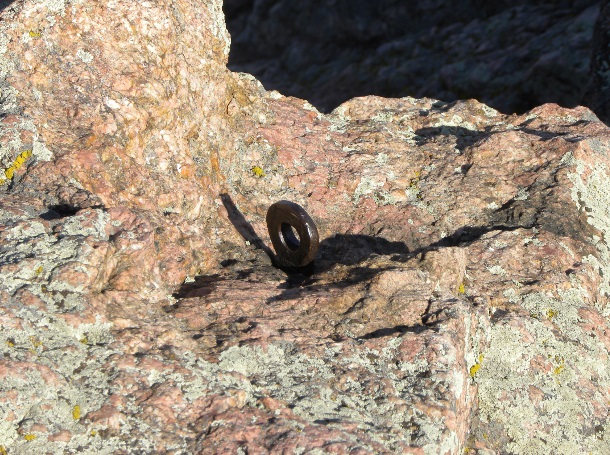
The 1902 USGS bronze triangulation disk.
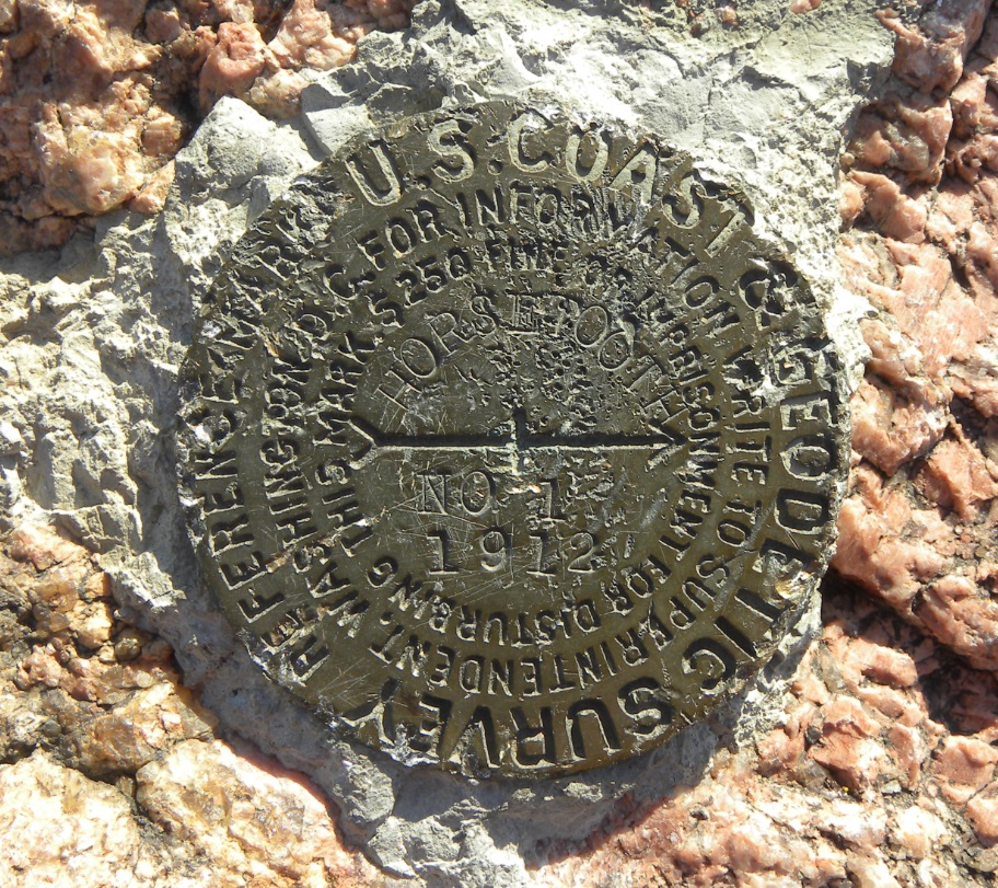
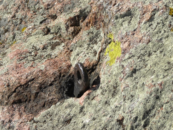
Reference Mark No. 1 established in 1912.
Closeup of Reference Mark No. 1.
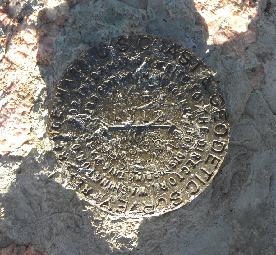
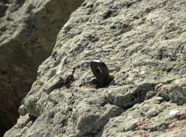
Reference Mark No. 2, originally established in 1935 and replaced in 1939.
Closeup of Reference Mark No. 2.
Several of the eye bolts once used to secure a sight over the point.
View from the east showing the formation that resembles a "horsetooth".
Dave Tharp found this Azimuth Mark near Horsetooth Reservoir in April 2019.
It is across Shoreline Drive from the Spring Canyon Water District building.
The original text from USGS Bulletin No. 216 dated 1903.
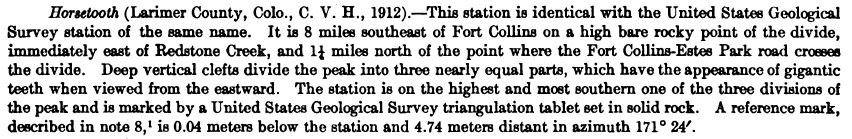
USGS Bulletin No. 644 dated 1916.
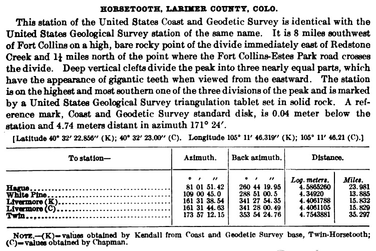
USC&GS Special Publication No. 19 dated 1914.
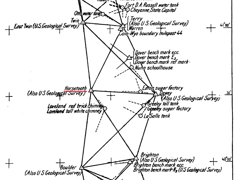
Map from USC&GS Special Publication No. 19 showing the location of the marker in their network.
Back to USGS Monuments

© Jerry Penry 2015