USC&GS 1898 Jerry Penry
Nebraska surveyors Gene Thomsen and Jerry Penry recovered the first United States Coast & Geodetic Survey triangulation station established in Nebraska. "Blue Hill" was set in 1898 during the important 98th Meridian Survey as it progressed northward into Nebraska. This marker was described as being an 8" square marble post. In 1934 a C&GS recovery team found "Blue Hill" lying on its side; however, the clay crock marking the underground marker was found undisturbed. At that time it was decided to move the stone marker approximately 43' west to the fence line where it was reset and redesignated as Benchmark "G-4". A brass disk set into a mass of concrete was placed over the crock at the original "Blue Hill" location in 1935.
Jerry had earlier been to the site in July and talked to the landowner who said the exact locations of the markers had been lost many years ago. The land owner also said he remembered his dad telling him he about seeing the geodetic crews set up upon their towers over one of the points, so he had a keen interest in seeing the marks.
The site location is 2 1/2 miles south and 3 1/2 miles west of the town of Blue Hill in south central Nebraska.
Triangulation Station
"BLUE HILL"
November 5, 2005
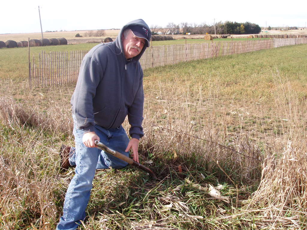
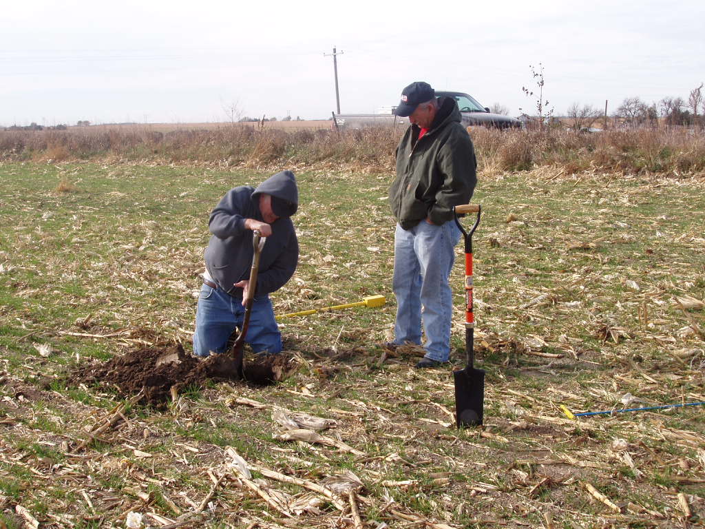
Gene begins to dig for "G-4" (formerly "Blue Hill") after probing indicated hitting something solid.
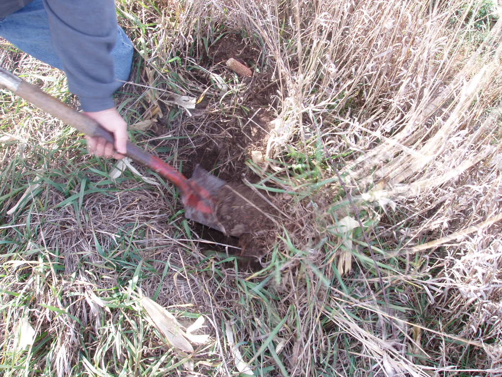
The first sign of "G-4" comes into view for the first time in many years.
Although dirty, it was exactly what we had hoped to find!
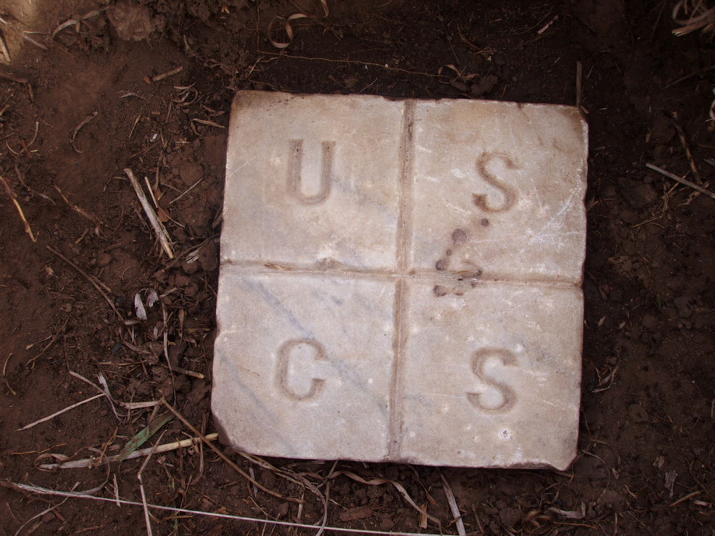
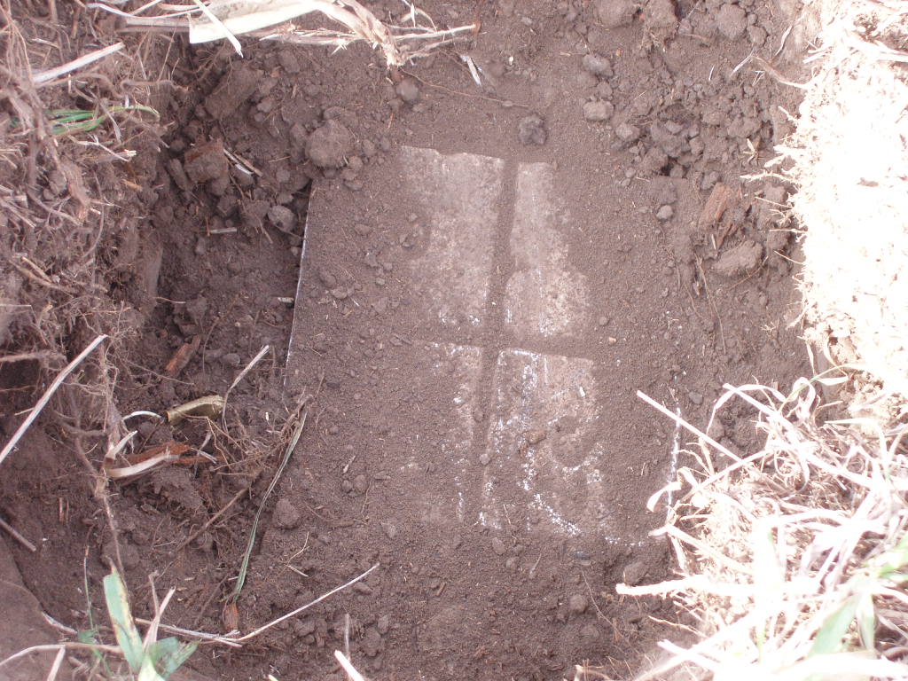
The marble stone set 107 years ago cleaned up very nice.
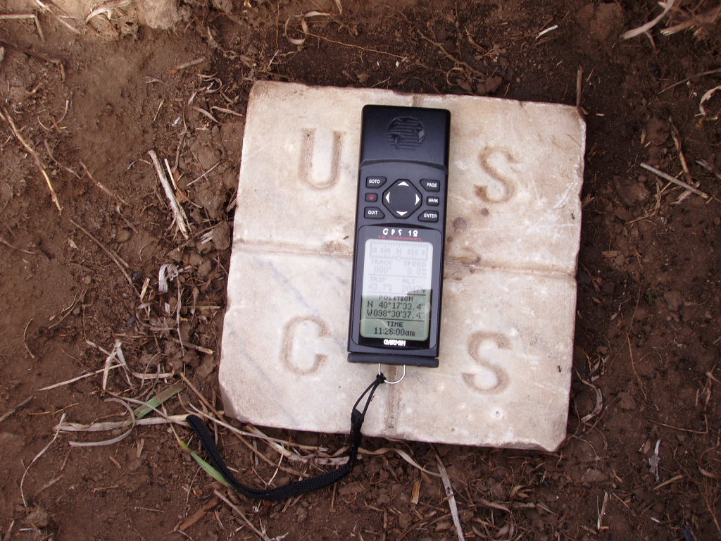
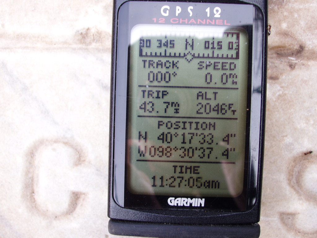
A GPS position will help for a future recovery.
Gene and the landowner begin to dig for "Blue Hill" after determining its location from Benchmark "G-4". There was no ferrous material with the marker, so the metal locator didn't help, but the probe found it!
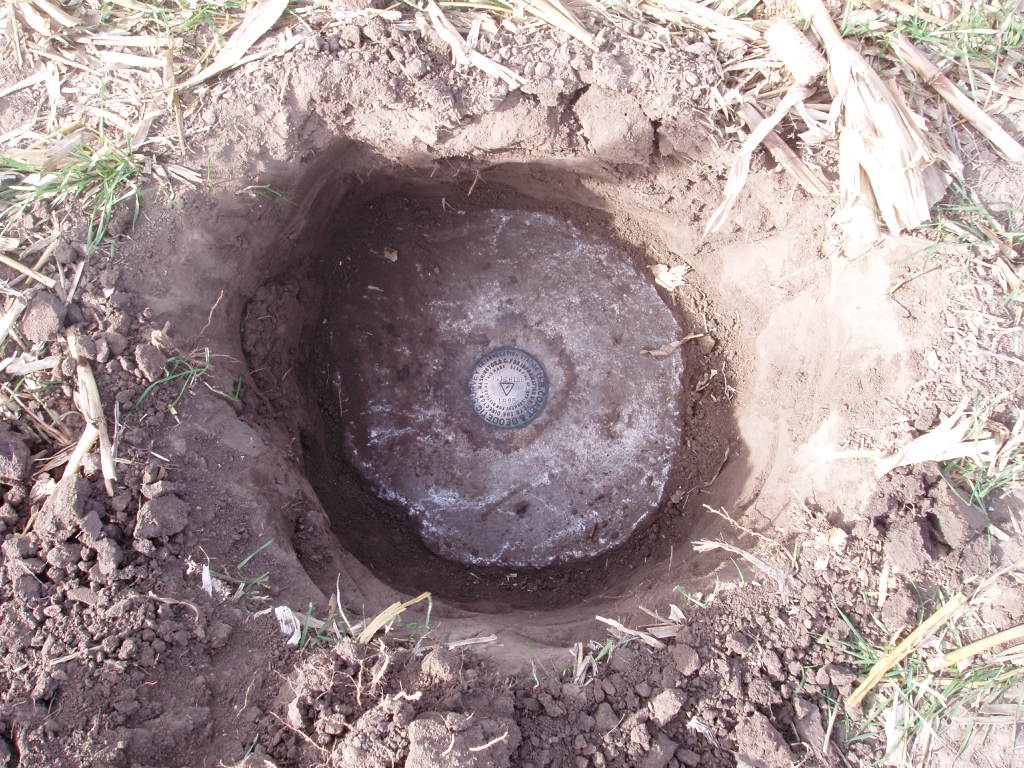
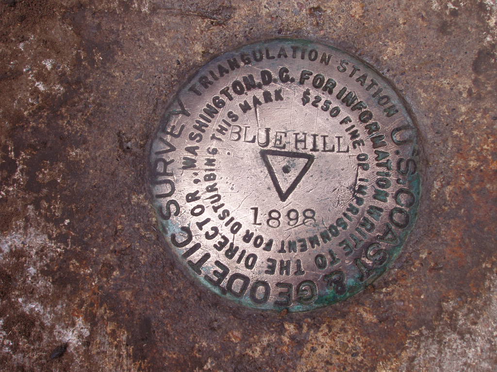
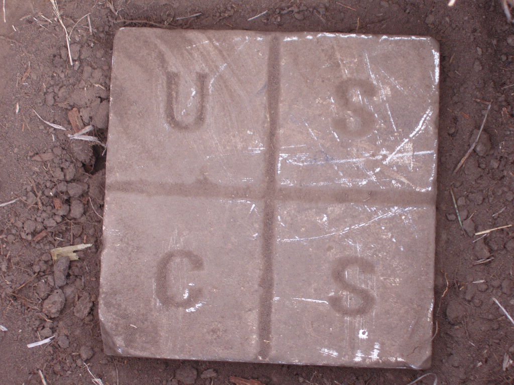
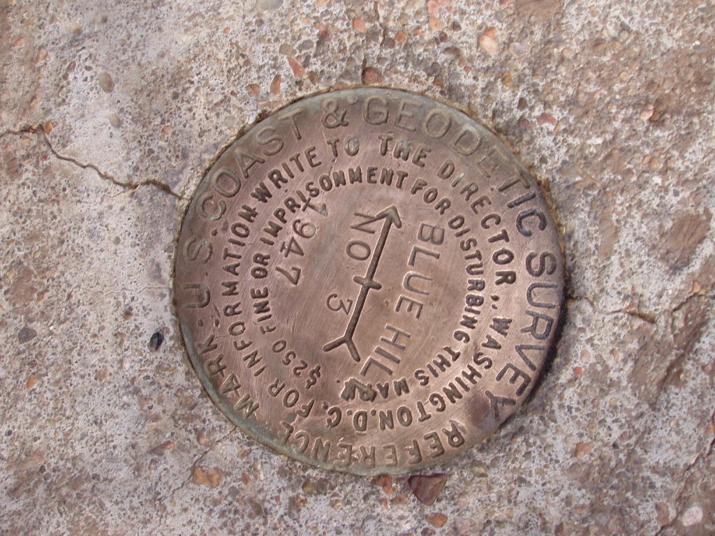
Closeup of "Blue Hill". The stamping of "1898" indicates the original year this station was established with the marble post. This brass disk was actually placed in 1935.
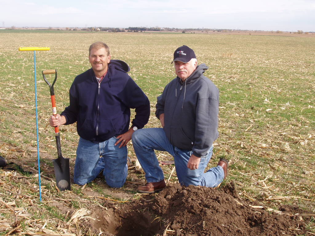
Jerry (left) and Gene pose after recovering "Blue Hill".
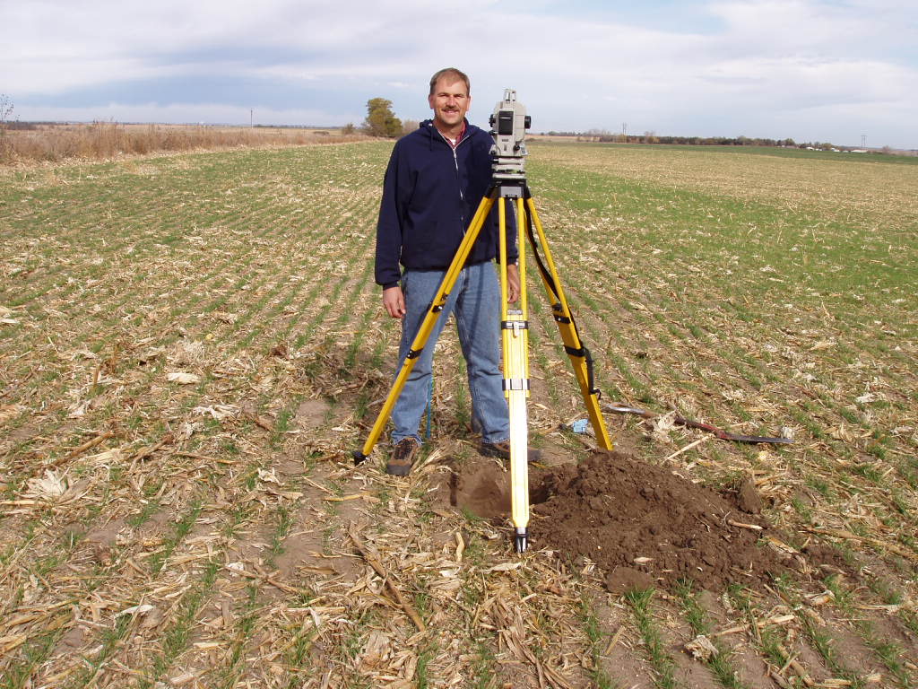
Jerry sets up over "Blue Hill" with his SET-3 total station to begin referencing the marker's location.
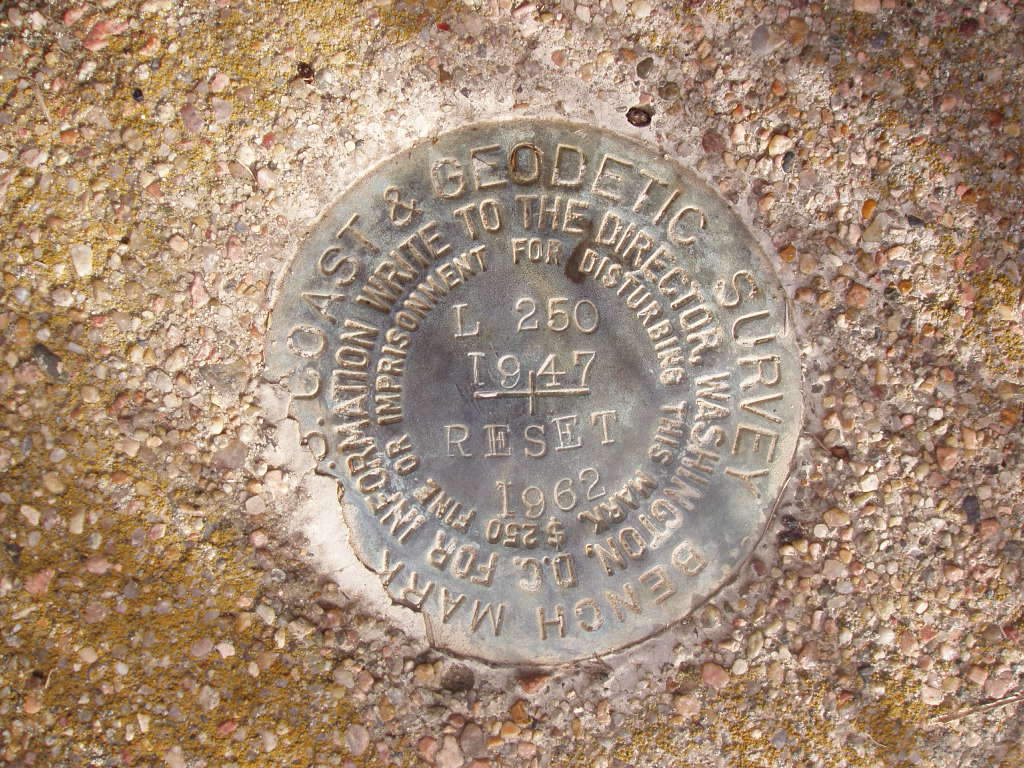
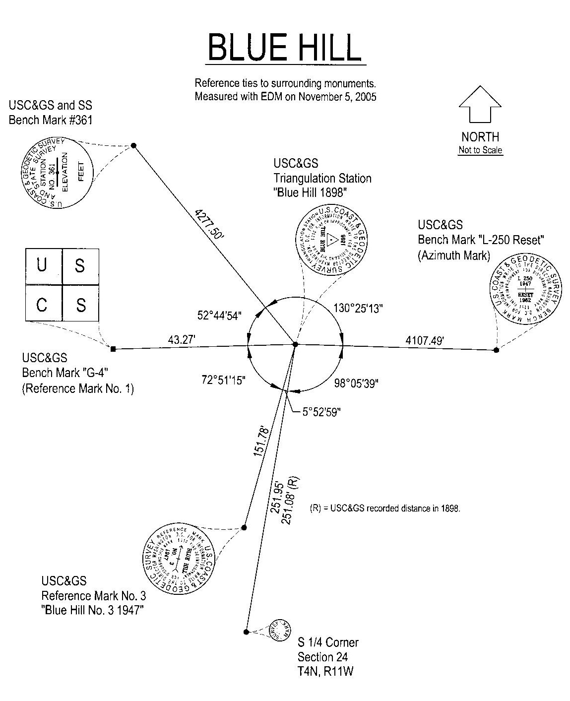
USC&GS benchmark "L-250" was used as the azimuth mark for the reference ties. It is located over 4,107' to the east of the triangulation station.
Reference Mark No. 3 was recovered about 12" deep, cleaned up and used as a reference tie.
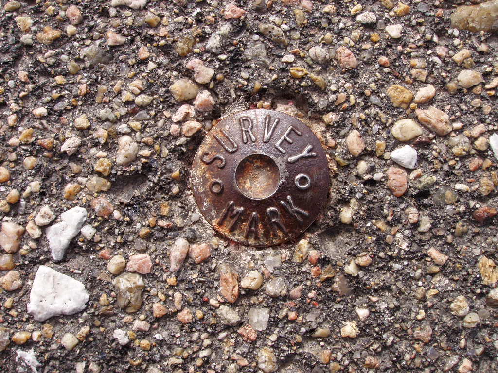
A 1" diameter "Survey Mark" was found for the S 1/4 Corner of Sec. 24, T4N, R11W of the 6th PM, in the nearby U.S. Highway #281 and tied into "Blue Hill".
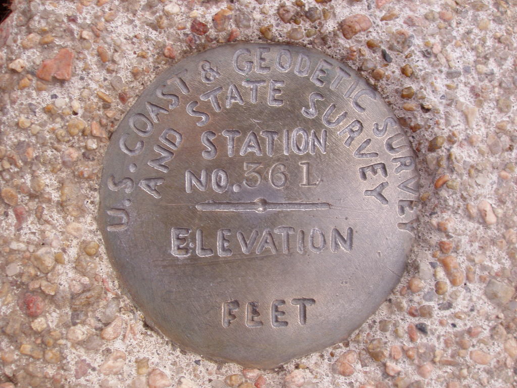
A rare USC&GS & SS survey disk No. 361 was found to the northwest at just over 4277' and used as a tie. These type of marks were set only during the Depression in a Civil Works Administration project.
--------------------------------------------------------------------
Back to 98th Meridian Survey Monuments


© Jerry Penry 2008