USC&GS
Triangulation Station
"CARTER"1898
Jerry Penry
October 20, 2007
Triangulation station CARTER is a point in south-central Nebraska on the famed 98th Meridian Survey that stretched between Mexico and Canada. In the spring of 1898 this station was established to help the geometry of the main network. The actual sighting location was a cottonwood tree, but a jug was placed at the base of the trunk to mark the tree's location. After the completion of the 98th Meridian Survey, both the tree and the jug fell into obscurity except for a brief moment in 1950 when surveyors from the Coast & Geodetic Survey made an effort to find it, but decided it could not be found without establishing another nearby point to triangulate to it. It was deemed not worth the effort to find the station.In the fall of 2007, seven Nebraska surveyors set out to determine if any traces of the jug might still remain after the passing of 109 years.
FULL STORY
(Click Here)
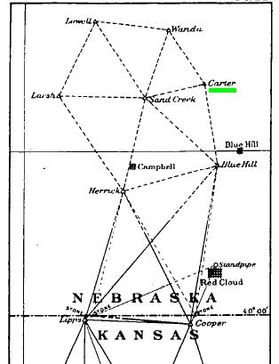
Early reconnaissance showed that the location for station "Carter" might be a primary station.
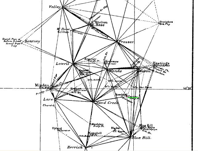
The progress of the 98th Meridian Survey to June 30, 1898.
Four primary stations connected to secondary station "Carter".
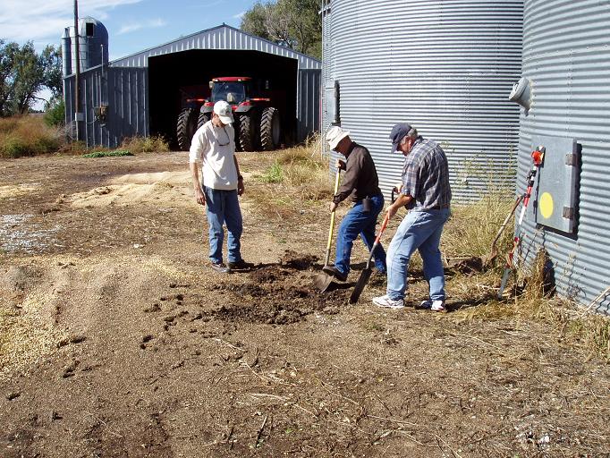
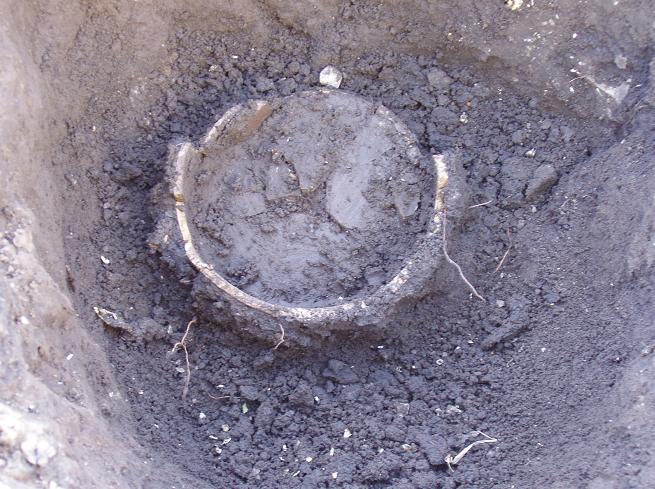
Digging begins at the location staked out from the calculations.
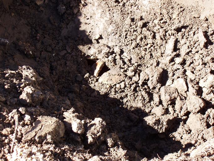
The discovery of pottery fragments gets everyone excited.
More fragments confirm we have found the jug.
The spout from the top of the jug.
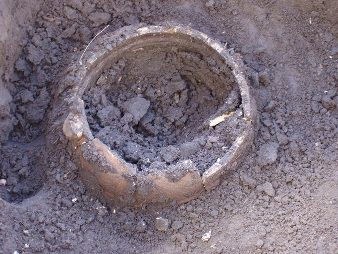
The walls of the jug are exposed.
The bottom of the jug is the last to be removed.
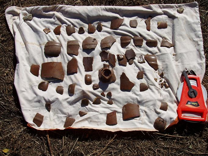
Recovered pieces were carefully cleaned and placed on a piece of cloth.
Nebraska licensed land surveyors.
Rex Heiden, Gene Thomsen, Jerry Penry, and Lyle Davis.
The pieces were first arranged to determine the sequence for reconstruction.
The old jug begins to take shape.
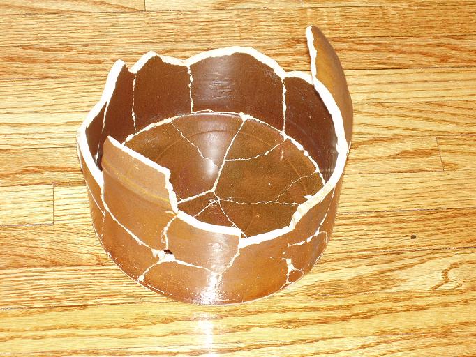
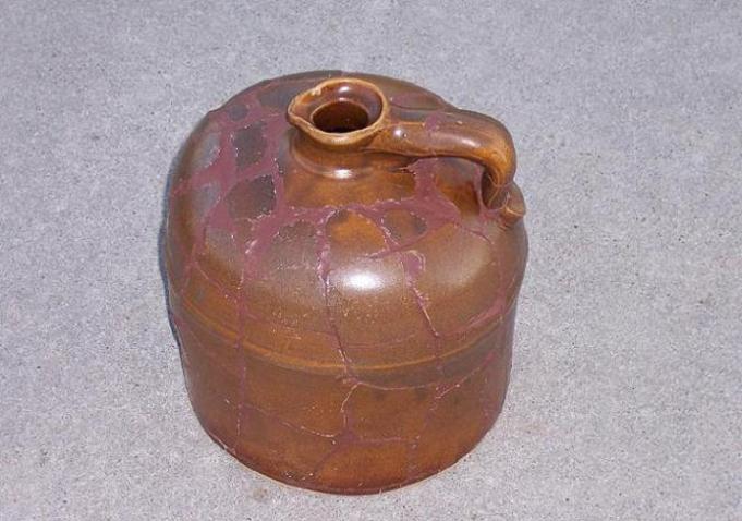
The finished jug.
Back to 98th Meridian Survey Monuments

© Jerry Penry 2008