USC&GS
Triangulation Station
"COUNCIL HILL"1900
Jerry Penry
April 25, 2009
Triangulation station COUNCIL HILL is a point in north-central Nebraska on the famed 98th Meridian Survey that stretched between Mexico and Canada. In the summer of 1900 this secondary triangulation station was established five miles north of Brunswick to help the geometry of the main network which was located further west. It connected with primary stations Hall, Sparta, Walnut, and Old. An interesting aspect of station Council Hill is the fact that USC&GS never described what type of monument they had set at this location, nor did they provide a description of the general area where the station was set like they typically did for the other stations. At the main triangulation stations 8-inch square marble posts were used. At other secondary stations the records indicate that pine stubs, jugs, and bottles were used. Council Hill was a complete mystery, but we did have the historic geodetic position, so it could be recovered. The hill itself is historically known to have been a meeting area for the Native Americans since a full view can be seen in all directions from the top of the hill.
The "Council Hill" station is shown on the C&GS map located in the 1901 Annual Report.
This is the last part of the network in northern Nebraska before going into South Dakota.With the assistance of David Doyle, chief geodetic surveyor for the National Geodetic Survey, a position was determined for station Council Hill that was projected forward from the original 1900 latitude/longitude position to a NAD 83 (1995) position. Past results at other stations have proven that the original 98th Meridian Survey network was highly precise and that projecting the old positions forward mathematically works very well.
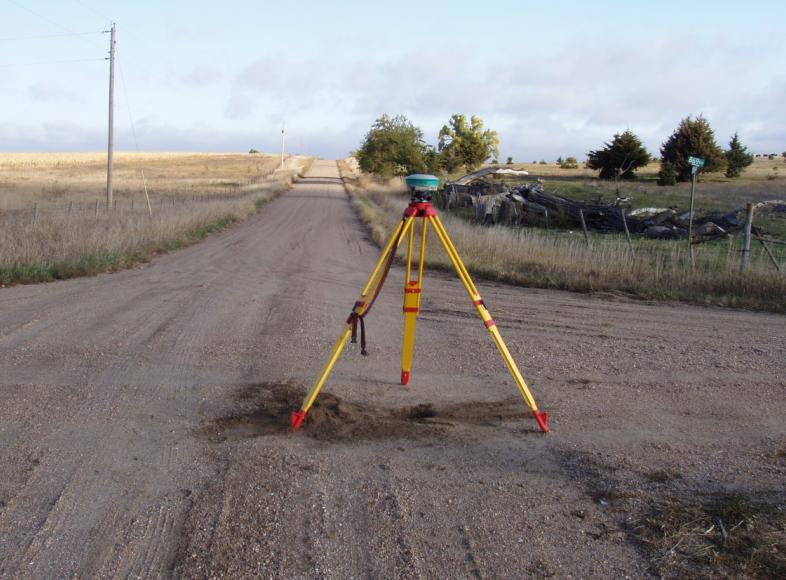
The field work to recover the Council Hill monument and see what might actually be there began on October 17, 2008, when Nebraska Deputy State Surveyor Gene Thomsen and David Hoffart (owner of Transit Works in Lincoln, Nebraska) met with me at the site. We were en route to recover other monuments further to the north near the Missouri River during that fall day. We set two Sokkia 2700IS receivers on two points in the vicinity of the lost monument. One monument was a section corner since it was available and the other was a rebar that we set approximately 1028' feet to the north. One-hour GPS sessions were made and later processed through OPUS to obtain the solutions. Computations were then made to determine the position of station Council Hill in relation to the two OPUS positions. By setting a total station upon one point and backsighting the other, an angle could be later turned and a distance measured to the calculated position of Council Hill during a return trip on a later date.
-------------------------
October 17, 2008
The field work to begin finding the old monument started in October 2008 by establishing two GPS positions on nearby points that would be visible from the Council Hill station. This receiver is on a section corner monument that we used only because it was available. It had no prior position on it.
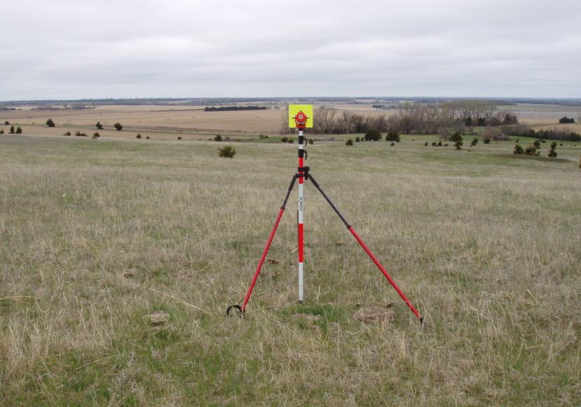
The other GPS receiver was placed upon a random point that we set approximately 1028' to the north of the receiver that was on the section corner. This point would be used as a backsight.-------------------------------------
April 25, 2009
The total station is set upon the section corner and the angle has been turned to the calculated position of station Council Hill. The landowner, who had been previously contacted, stopped by (his pickup) to watch us do our surveying. He had no knowledge that any survey marker had ever been placed on the hill. Gene and Dave are on top of Council Hill with the prism staking out the monument with the same name as I direct them where to move.
At the calculated monument position looking back toward the position where the total station had been set up.
Ready to start the search!
We gently eased the probes down into the sand and struck something solid just off of our calculated location.
Careful digging revealed something about 1' down. It turned out to be a cow tooth(?).
More bone fragments would be also found as we excavated further.
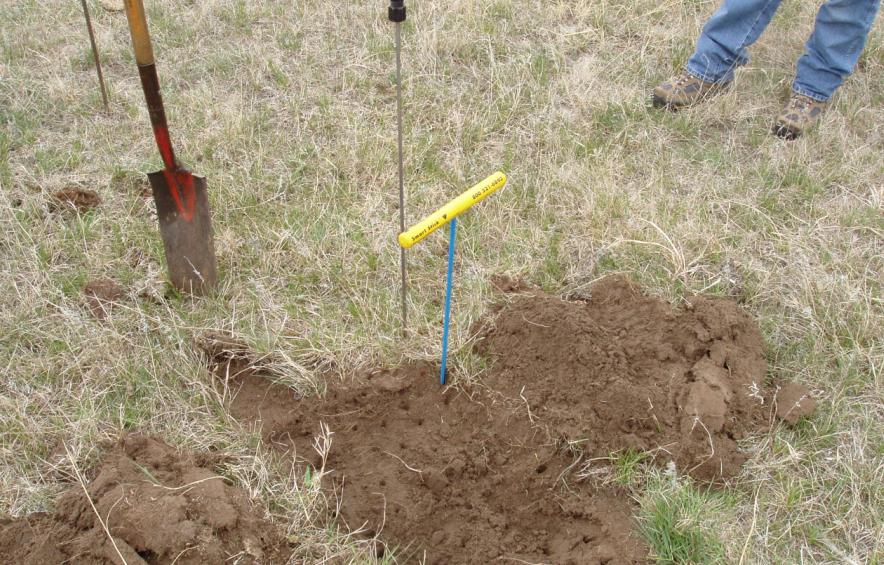
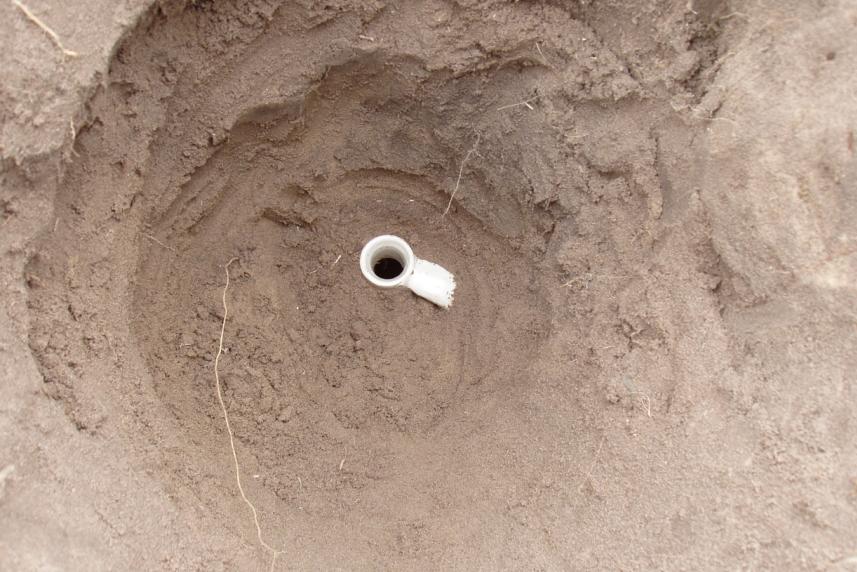
This is the first sign that we had found something of importance! At first I thought it might be the opening to an old crock bottle. The land owner was very impressed that we could determine this location so closely.
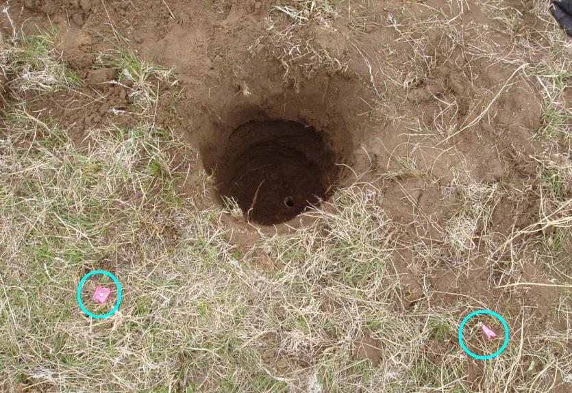
Tie nails were set and the opening was carefully referenced.
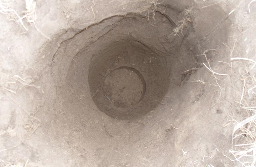
The reference tie nails are shown by the circles with the opening of the monument down in the hole.
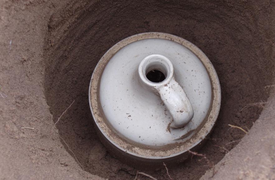
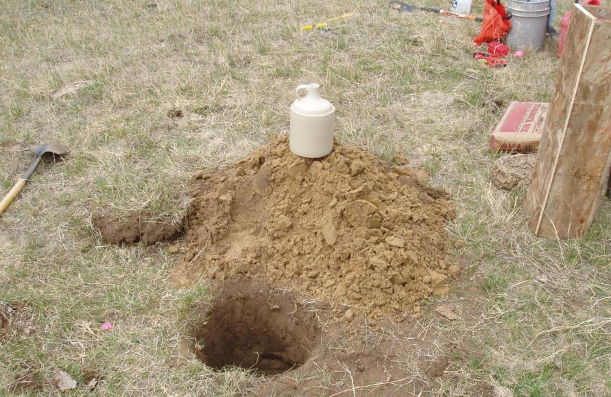
Further excavating reveals the handle of a jug, so we have now identified what was set for the monument.
The tape measure shows the top of the jug is at 2.0' deep.
The top of the old jug comes into view!
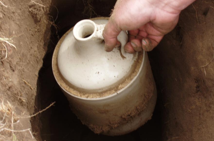
The sides of the jug are revealed.
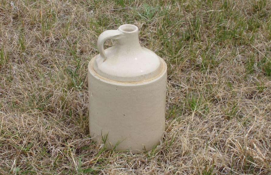
Out comes the jug after being buried for 109 years.
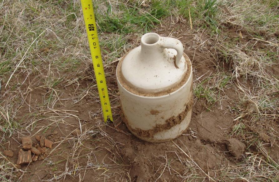
The jug is 7" in diameter and 12" tall.
The impression in the sand left by the bottom of the jug.
Gene Thomsen (left), Jerry Penry (with jug), and David Hoffart pose with their latest historical find.
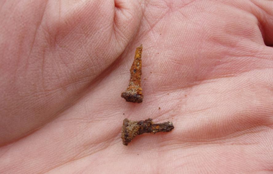
Two tacks were found with my White's coin metal detector. One was in the excavated sand (lower) which I theorize was set in the top of a pine hub that was at the surface monument and has since rotted away. The other was found inside the jug when we emptied out the small amount of sand inside. It came from the cork that was once in the top of the jug, but likewise had rotted away. The early reports at other stations indicated that tacks in corks were used. These are important finds since they are still in existence after well over a century.
The old jug with the tack found inside that once marked the exact location.
Lowering the depth of the hole prior to reinserting the jug.
The jug was in pristine condition just like it was new. The bottom surface still had slight bristles on it from when it was pulled away from the potter's wheel, so it had never been used.
Ready to go back in the hole. Our policy is to leave all historical survey markers in their original locations.
This is what cameras are for!
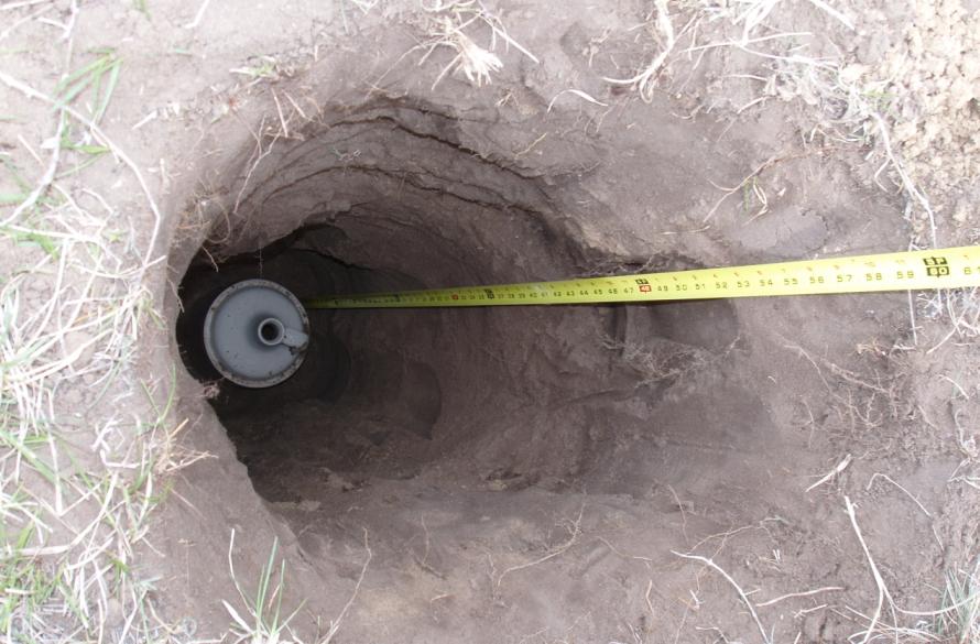
The bottom of the jug is now at a depth of 5.0'.
The old bones that were found in the hole. One has to wonder if one of the surveyors on the crew in 1900 threw them in there?
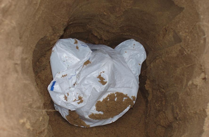
A bag now covers the top of the jug after it had been precisely set back at the horizontal position where we found it. This was to prevent sand and water from entering the jug. Then sand was backfilled to 12" above the top of the jug.
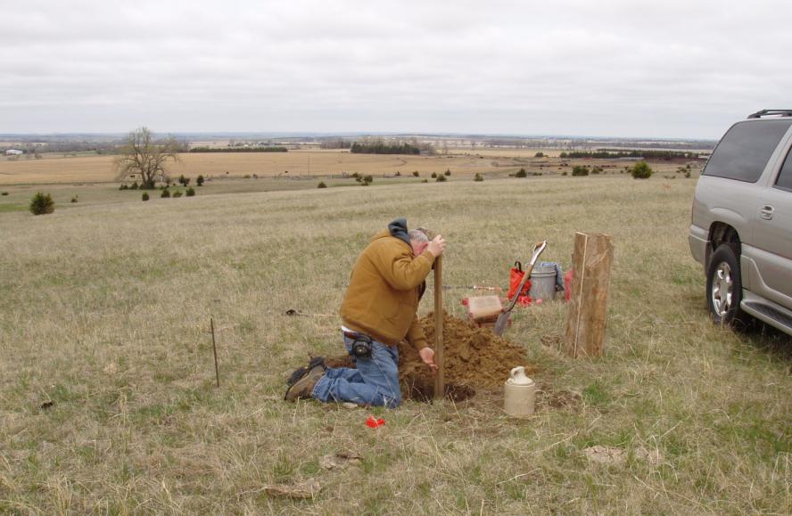
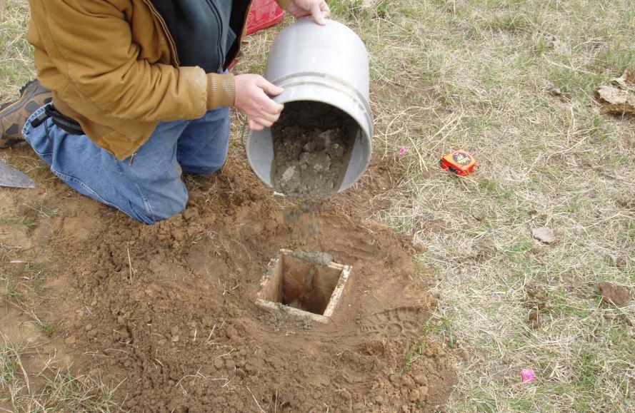
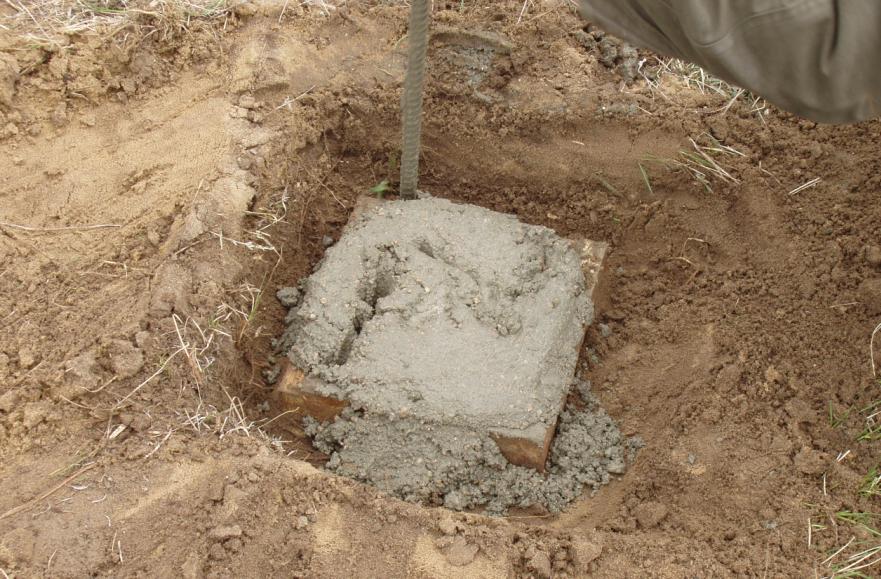
A form was made (36" long) for concrete that would be poured for the new surface monument.
Concrete being poured into the form. The bottom of the concrete and the top of the jug are separated by 12" of sand.
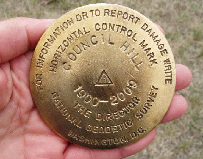
The new brass disk that will mark the location for the triangulation station.
Rodding the concrete in the form.
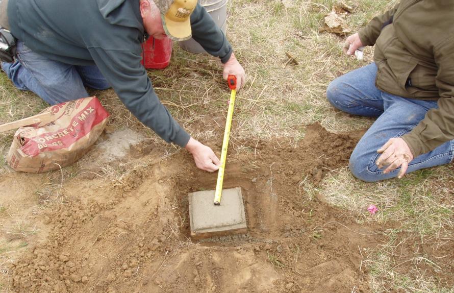
Marking the location for the disk from the reference nails.
The finished monument.
One last look at the completed monument.
Back to 98th Meridian Survey Monuments

© Jerry Penry 2009