USC&GS
Triangulation Station
"DAILY"1900
Jerry Penry
June 2, 2012
Triangulation station "DAILY" is located approximately 6 miles west and 3 miles north of Greeley, Nebraska. It is one of the original monuments established by U. S. Coast & Geodetic Survey along the 98th Meridian Survey during the year 1900. The origin of the name comes from an early landowner named Wellington E. Daily (1854-1921). We had attempted to go to this monument during the previous two years, but bad weather turned us back both times. Finally, during our third attempt it turned out to be sunny and hot, so it was a perfect day to do the monument recovery.
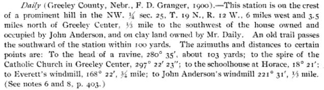
The original description and location of the monument from 1900.
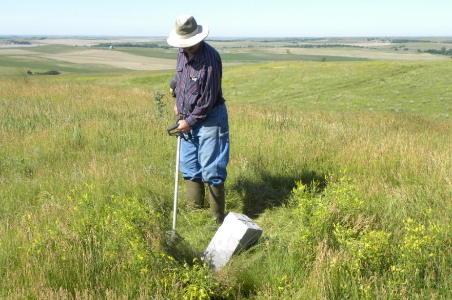
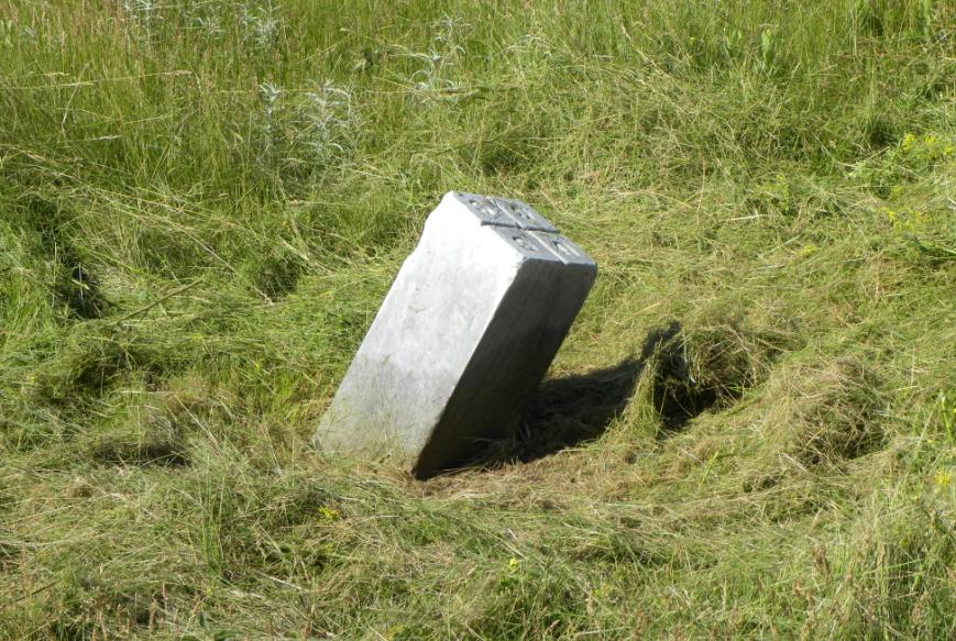
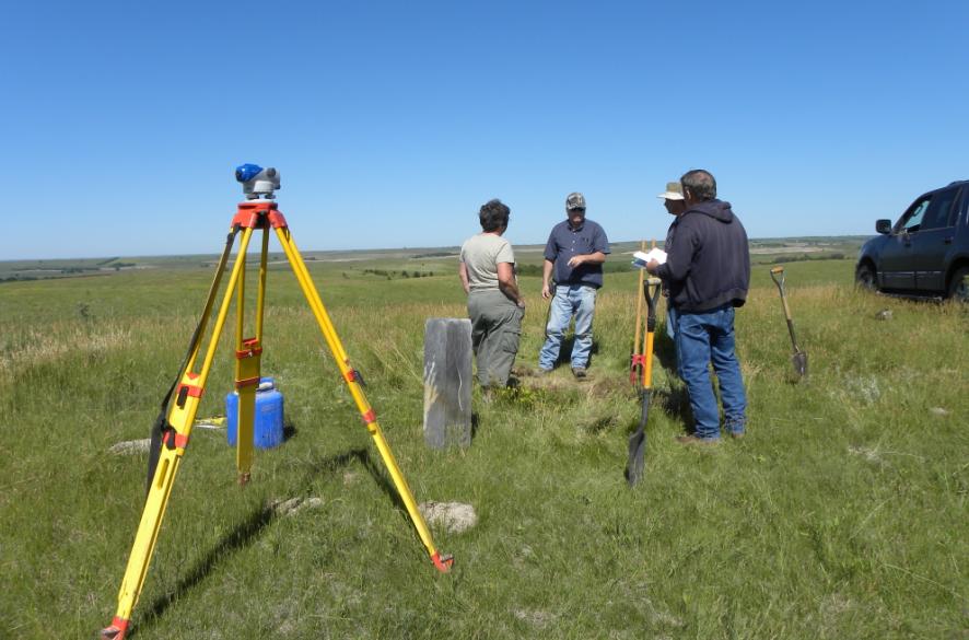
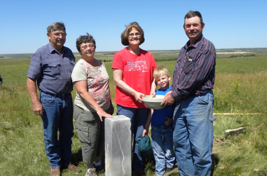
We met the landowner, Arnold Moody, at his farm, who then took us to the site along with his sister, Donita, and her husband John. In previous years, cattle had congregated around the monument and probably used it as a rubbing post. This exposed more than half of the 8-inch square marble post which was found leaning. Vehicles have also accidentally struck the monument when hunters sought the high hill for a vantage point to view the surrounding countryside.Upon arriving at the location, the hill was covered with tall brome grass, sweet clover, and other pasture grasses. Arnold used a weed trimmer to first take down the vegetation around the monument so we would have a nice area to work. The first task involved uprighting and plumbing the monument to where we thought it should be in its correct horizontal position. With level and rod, we then obtained the height of the monument. Tie nails were set in two directions 5 feet away in case there was no lower monument. Arnold remembered hearing a story that when some of his ancestors who were young boys, they once brought home a survey monument to show their father who promptly made them take it back. Was this the same monument as the one we were seeking? No one knew for sure, but if it wasn't in the same location as set by USC&GS in 1900, we would have a problem and probably not be able to find the lower monument without later having to do some precision GPS work to pinpoint the exact location.
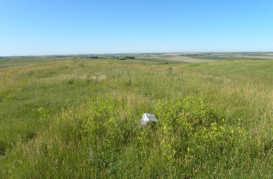
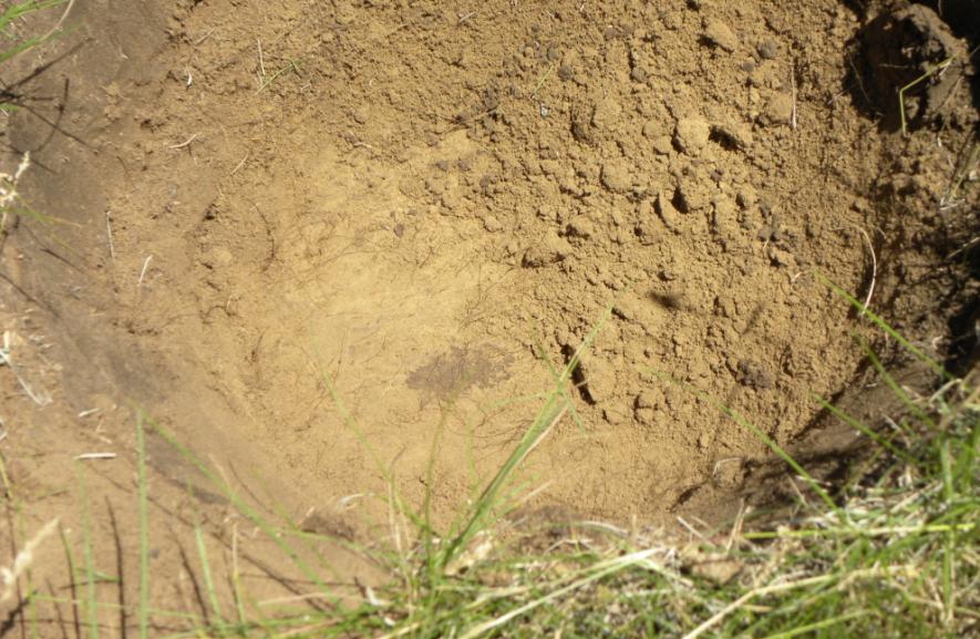
The first view of Station "DAILY" when we arrived at the site.
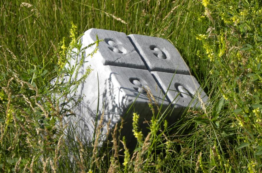
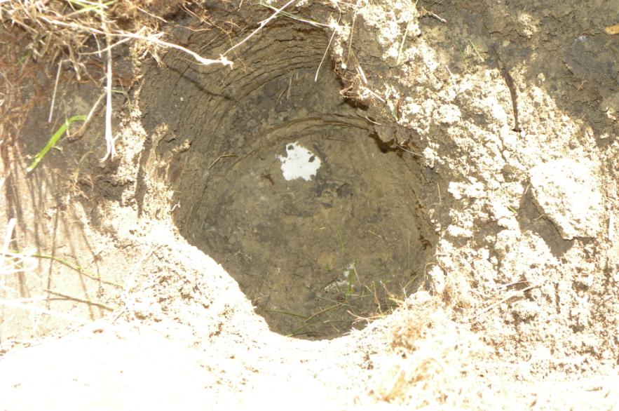
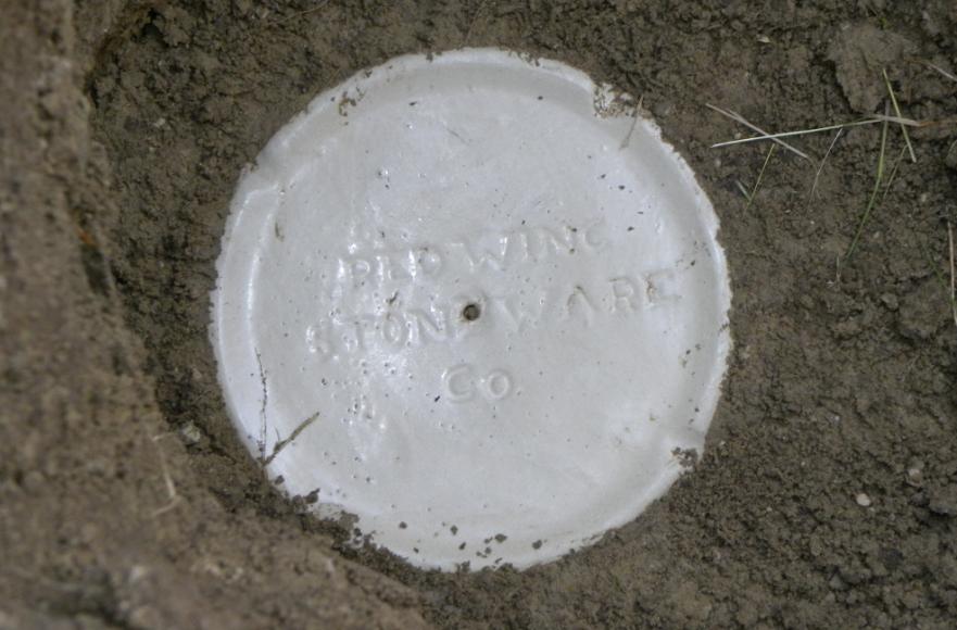
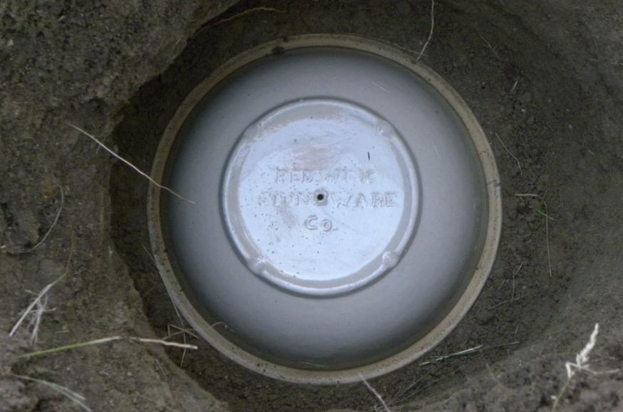
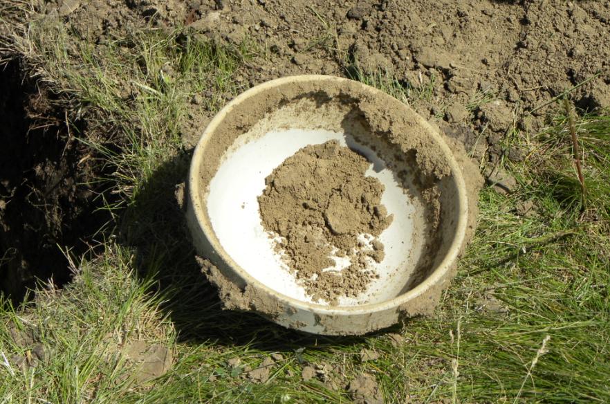
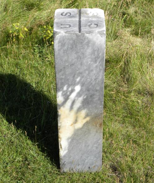
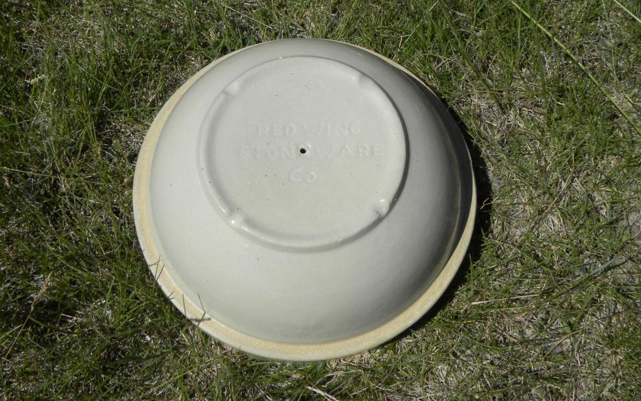
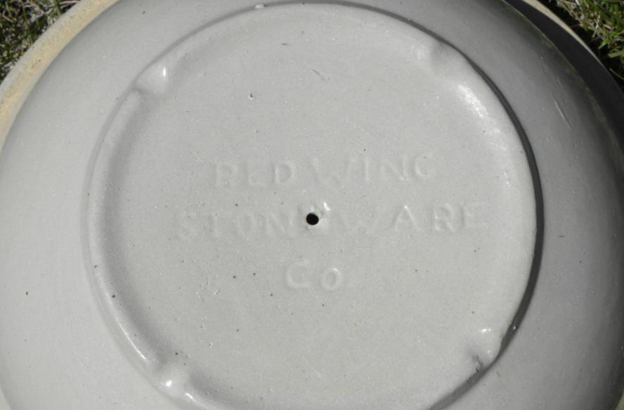
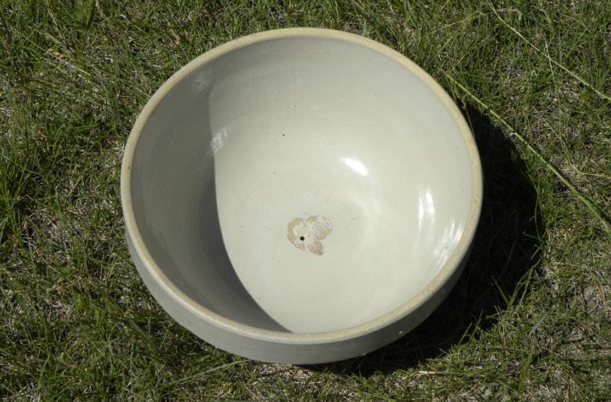
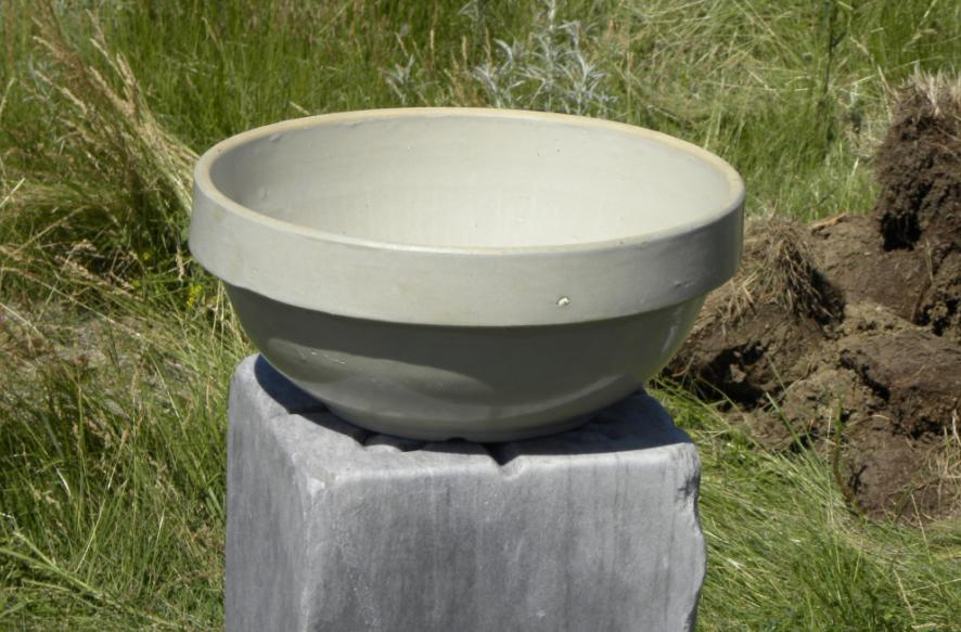
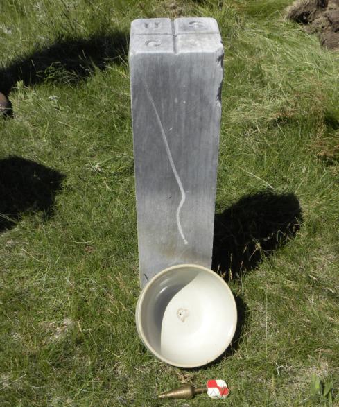
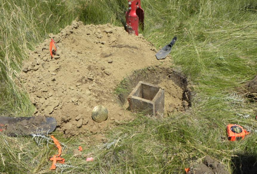
The marble post measured 30 3/4" in length and was 8 inches square. Luck was on our side as we soon uncovered the top of the lower monument just 1.8' below the ground surface which was described by C&GS as an earthenware crock. Uncovering the lower monument revealed it was made by the "REDWING STONEWARE CO.". At first is appeared to be a smaller diameter crock, but more excavation revealed it was actually a large stoneware bowl. The drill hole was found in the center as noted by C&GS.We then tied out the drill hole before removing the bowl. It was 0.32' north and 0.12' west of where we had previously tied out the top of the marble post. The inside of the bowl was chipped out where the drill bit had come through from the other side. The bowl measured 10 1/2" outside diameter and 9 3/4" inside diameter. It was 4 1/2" tall.
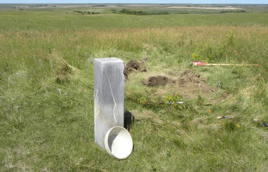
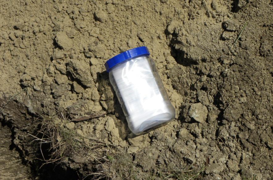
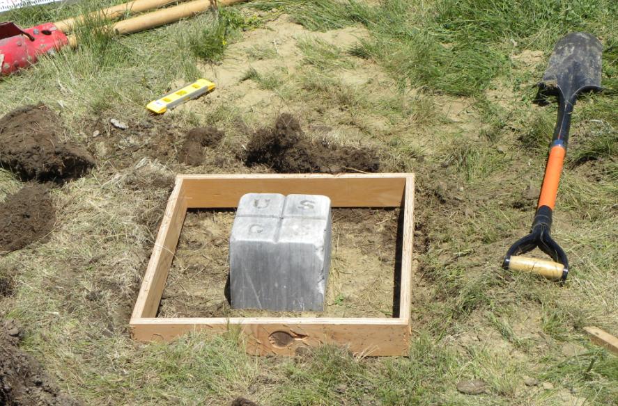
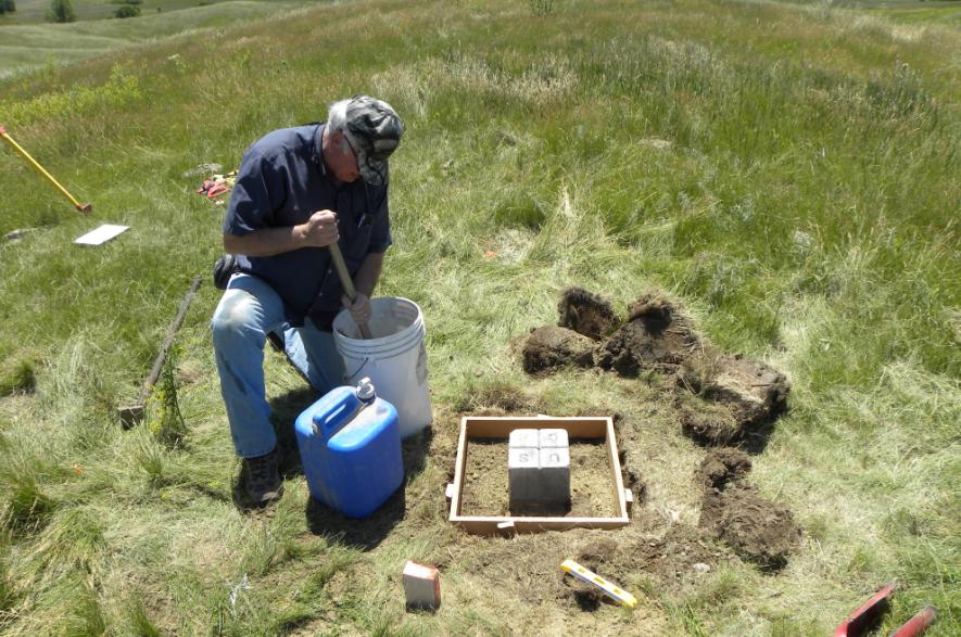
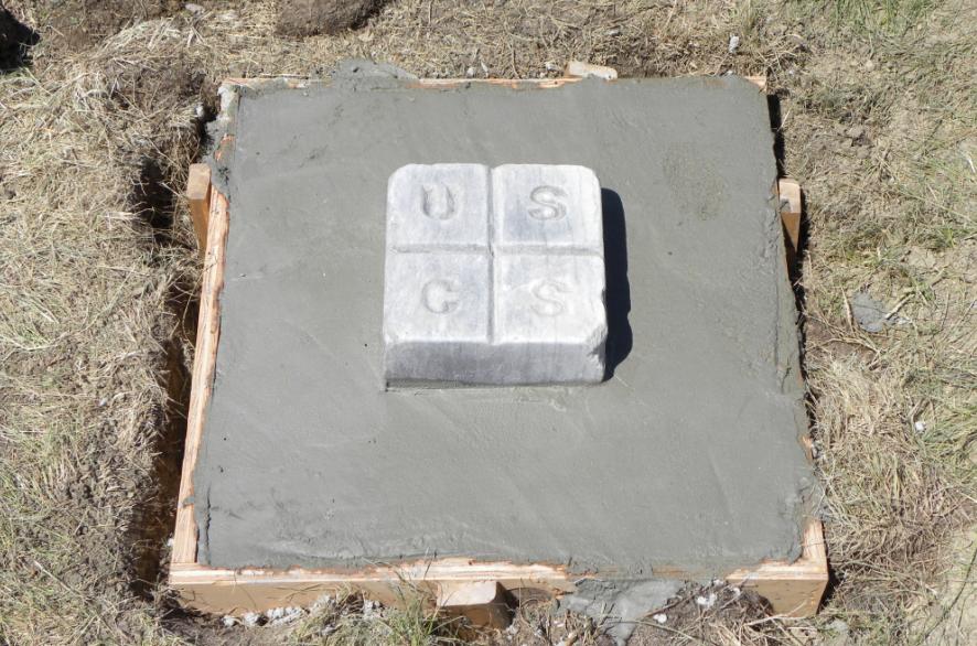
After cleaning off both monuments and photographing them, we dug the hole deeper. A time capsule was made by writing on a piece of paper what we had found and adding our names. This paper was placed in a plastic bag which was then placed in a sealed plastic jar. This jar went below the bowl which was then replaced exactly as found. A layer of sand was added, and then the marble post was reset directly over the position of the drill hole. The top of the bowl was now 1.17 feet lower and the top of the marble post was 1.24 feet lower than where we had found them. A 2-foot square concrete pad was placed around the marble post to secure the position.
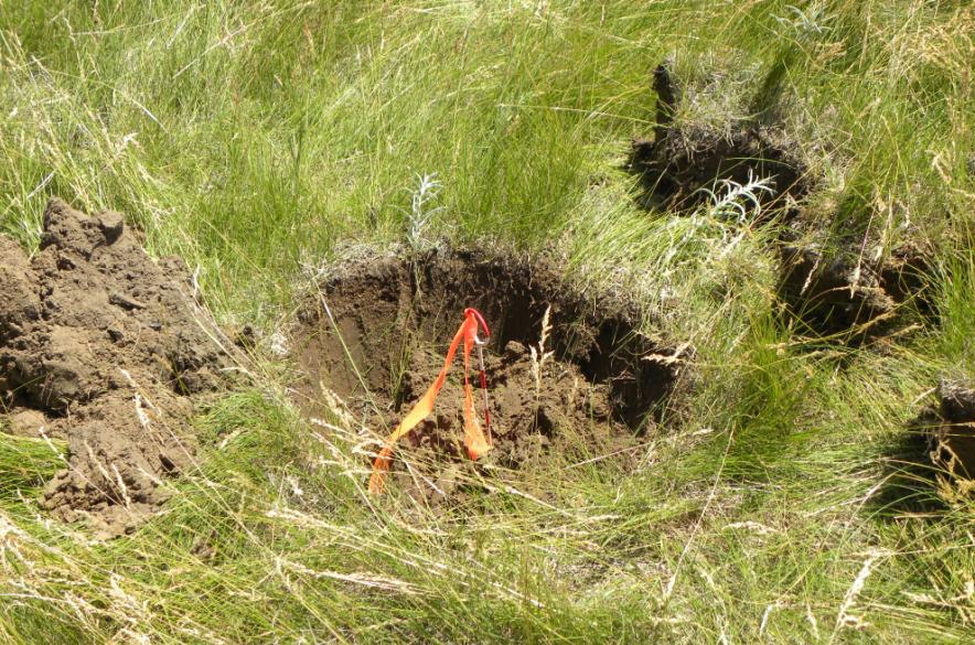
We next directed our attention to a location 109.4 feet south of the marble post where a magnetic station had been placed in 1906. Why C&GS did not use the marble post for their magnetic station is not clear, but it was possible they did not yet understand the properties of marble and did not what any interference with the magnetometer. The marble post may have also acted as a meridian since the magnetic station was noted to be south of the marble post. The magnetic station monument was noted as being a copper nail in a wooden stub and observations were done between September 13-15, 1906 by C. Methven. The declination at that time was determined to be N 11�42.7' E.
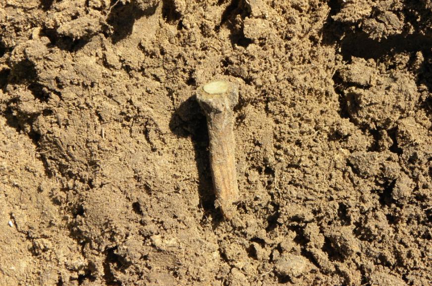
Again, luck was on our side when the metal detector found the copper nail which was still encased in a small piece of wood. A slight discoloration in the soil showed us where the remaining portion of the pine stub had been. A measurement with the EDM then showed the distance between the marble post triangulation station and the copper nail magnetic station to be 109.38', or just 0.02' from where it was stated to be.
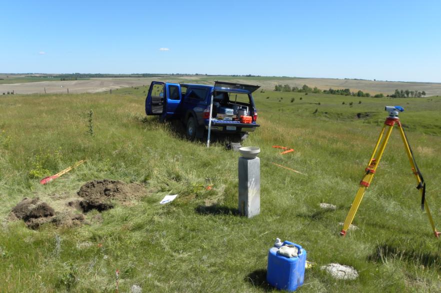
At the location of the copper nail, we set a 6" square x 36" tall box into the ground, filled it with concrete, and set a 3" brass disk in the top to mark the location. The entire remonumentation project took around 6 hours to complete.
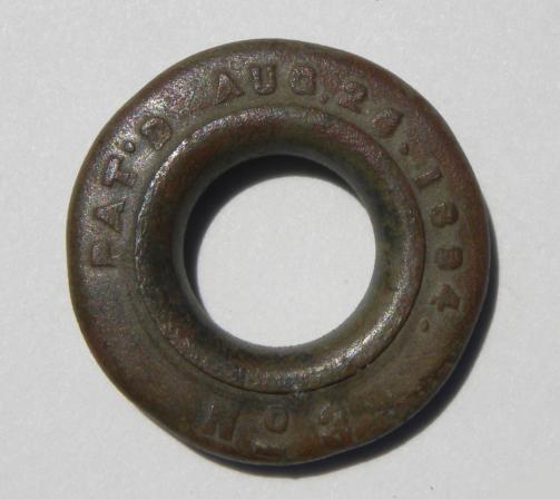
Another nice find with the metal detector was a brass grommet with a patent date of Aug. 26, 1884. This was found near the magnetic station location and was probably from a canvas tarp or tent used by the survey crew at that location. We were also able to discern the old ruts where the trail road used to be located as noted in the 1900 description.
Close-up view of the top of the marble post.
Arnold Moody using a weed trimmer to cut down the grass around the monument.
The leaning position of the marble post is very obvious.
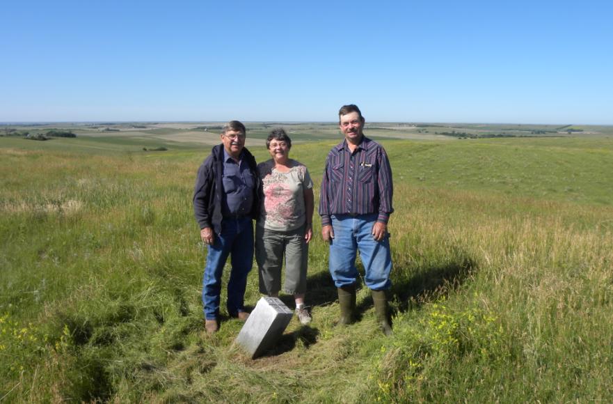
John & Donita Springer, and her brother Arnold Moody.
Excavating the marble post. The bottom was just below the surface.
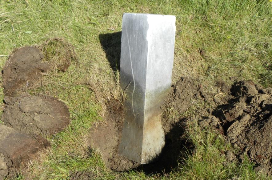
The marble post set upright in its approximate true position.
The post out of the ground after obtaining an elevation on the top and tying out the center.
The first view of the stoneware bowl indicating we were at the right location.
The bottom of the bowl with the drill hole in the center.
The inverted bowl fully exposed just prior to removal and after tying out the position.
The bowl just after removing it from the hole.
The marble post showing some of the white marbling in the gray.
The post and bowl. The white streak is where a vehicle had once hit the stone.
The stoneware bowl on top of the marble post.
The drill hole on the inside of the bowl where the bit came through.
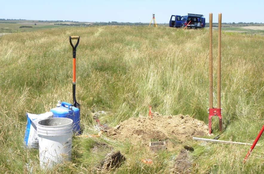
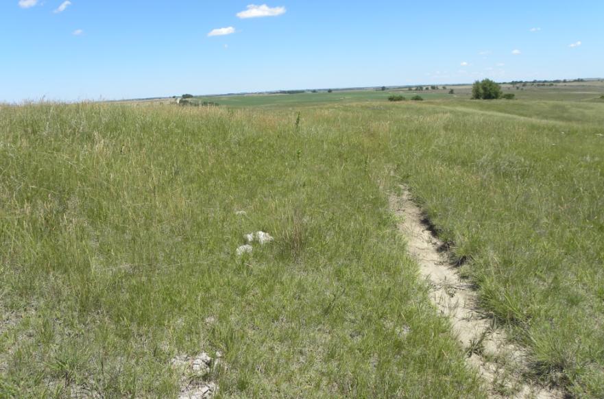
The set-up at the site and view of the countryside.
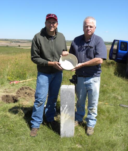
Jerry Penry and Gene Thomsen with another recovered monument.
The bowl after cleaning.
Close-up of the writing on the underside of the bowl.
The inside of the bowl.
Bowl sitting on top of the post.
John & Donita Springer, Gayle Moody, Jonathan Moody (grandson), & Arnold Moody.
Plumb bob by the monuments to show the scale.
The plastic jar time capsule that contains the note.
The reset marble post which is over the center of the bowl.
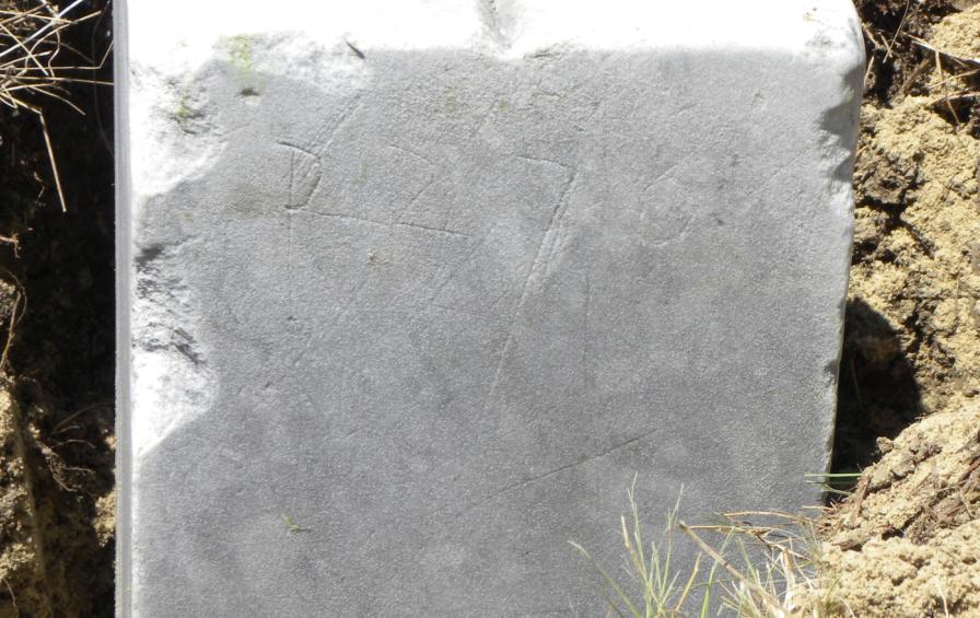
Wondering if these are random scratches or letter/numbers?
Setting the form around the top of the marble post.
Mixing the concrete.
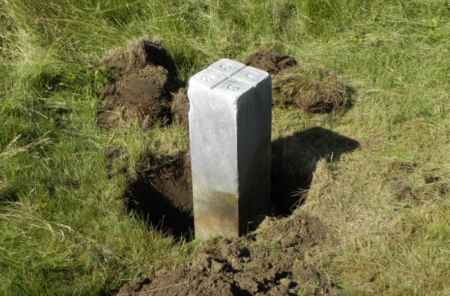
The finished monument.
-------------------------------
MAGNETIC STATION
"DAILY"
Description for magnetic station "Daily".
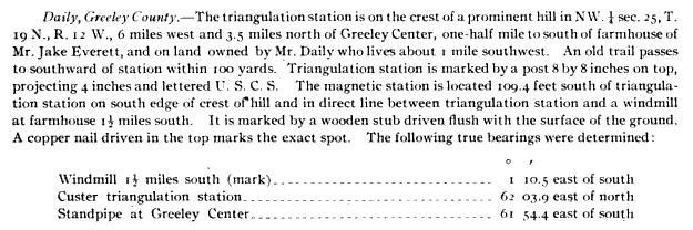
Chaining pin marks the location where the copper nail was found.
The 106-year-old copper nail with remains of wood stub around it.
Another view of the copper nail.
The spot in the hole where the rotted wood stub once was located.
Setting the box form for the concrete pier.
View looking north over the Mag Station toward Tri Station "Daily".
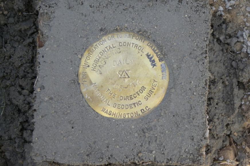
The brass disk that replaced the copper nail. Stamped "DAILY 1906-2012".
The remains of the old trail road that was noted in the 1900 description.
The brass grommet that was found in the ground near the location of the magnetic station.
Back to 98th Meridian Survey Monuments

© Jerry Penry 2012