USC&GS
Triangulation Stations

"PAGE NE & SW BASE"
1900

Jerry Penry
May 24, 2015

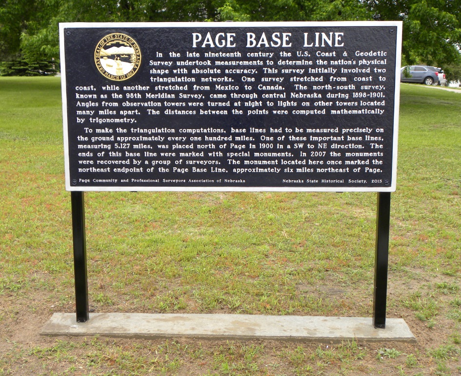
In the year 1897, the USC&GS triangulation network known as the "98th Meridian Survey" was started and progressed both southward and northward from a central point in Kansas. This network, upon completion, determined the precise distance between Canada and Mexico. It also tied together the triangulation network that extended from coast to coast across the United States. The nation was then measured in all four directions and subsequent triangulation networks originated off these main surveys. Approximately every 100 miles, when ground conditions were favorable, a baseline was established to determine a measured line in the network.

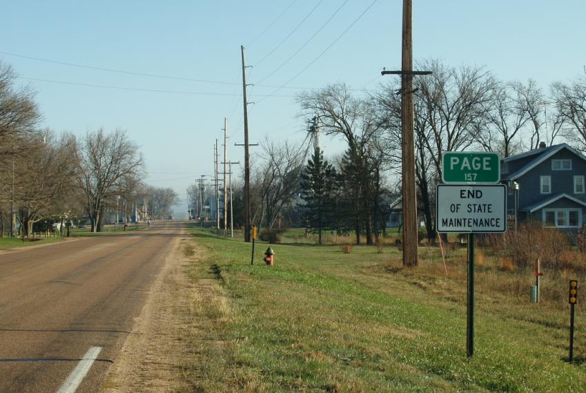
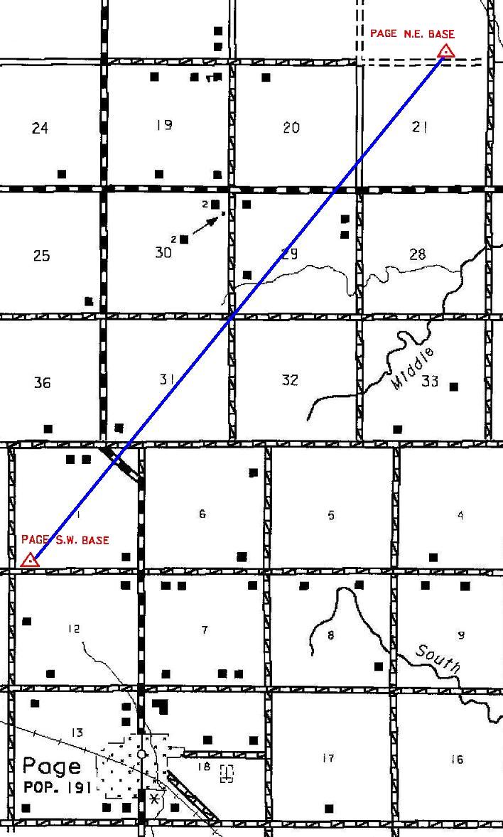
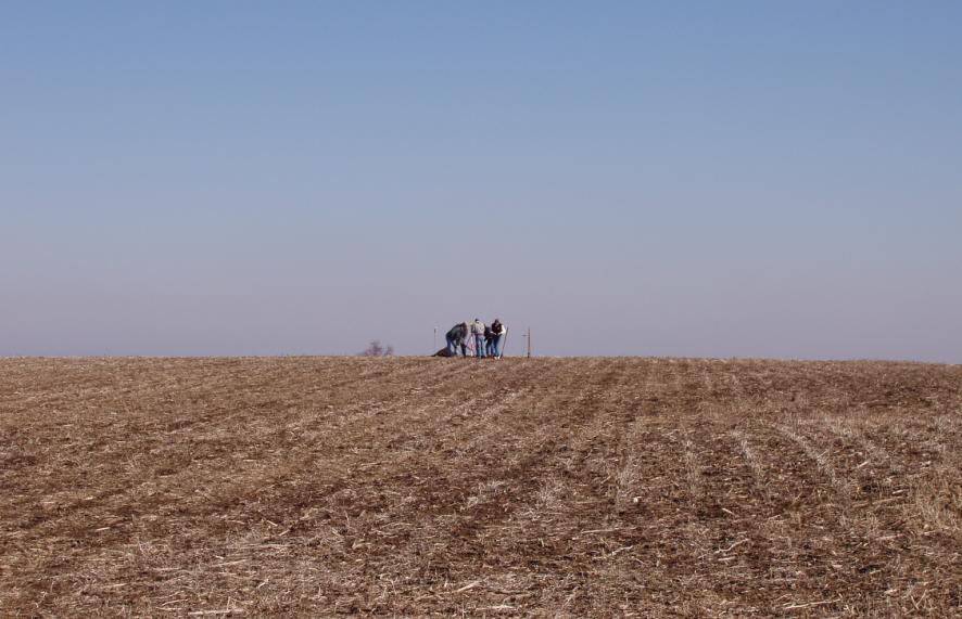
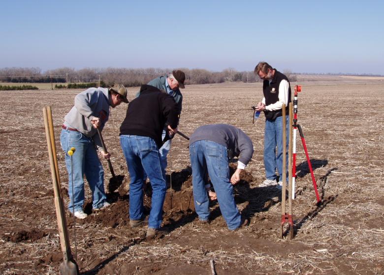
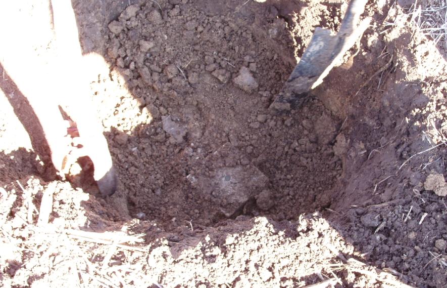
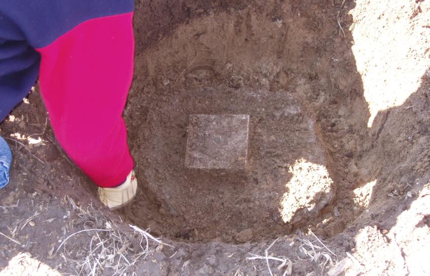
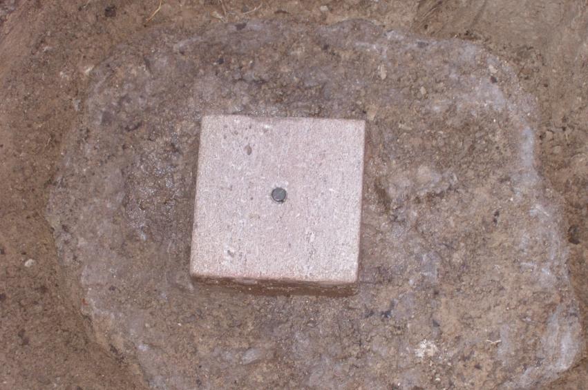
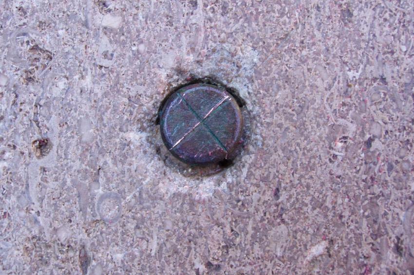
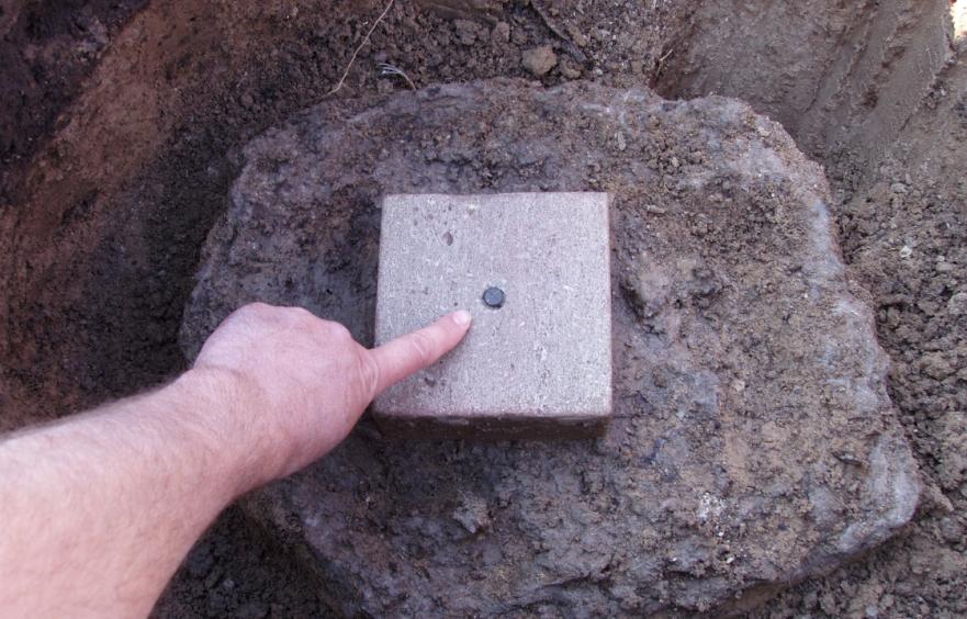
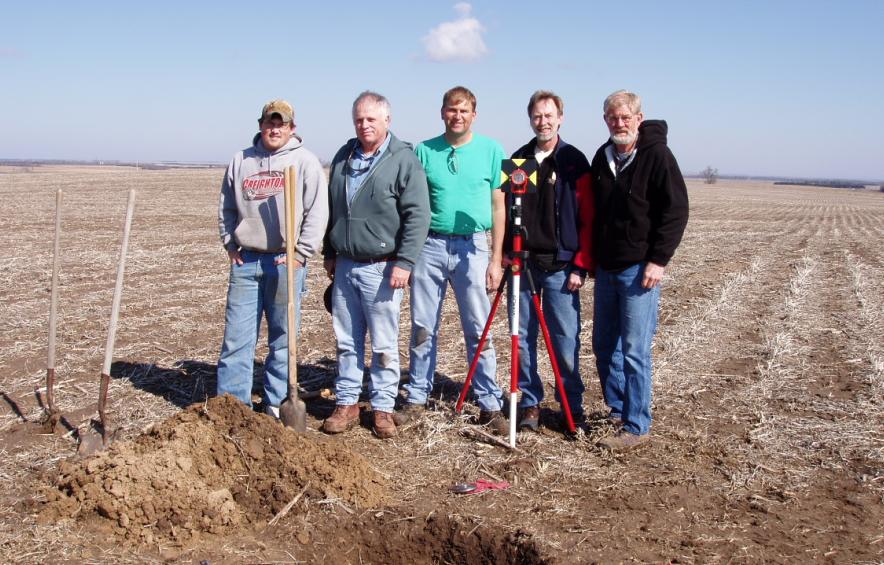
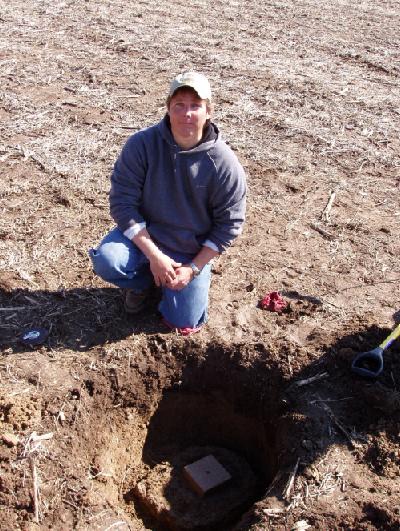
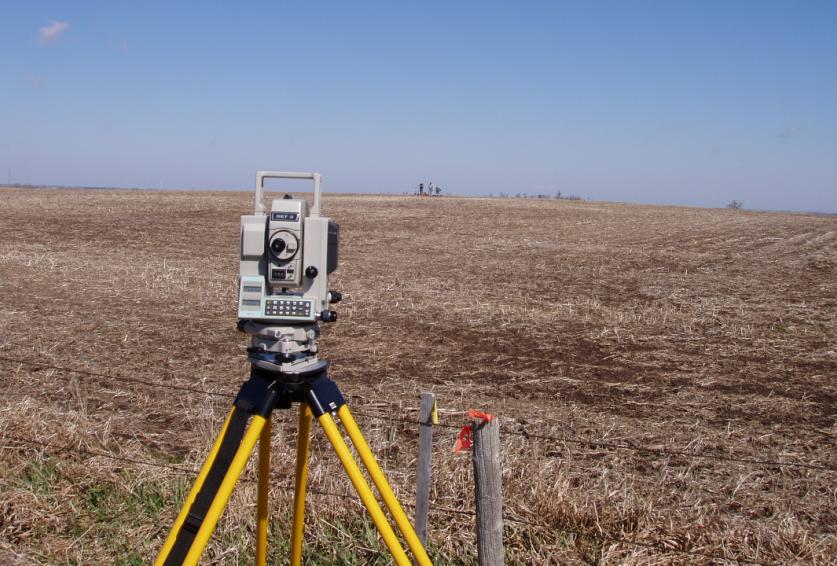
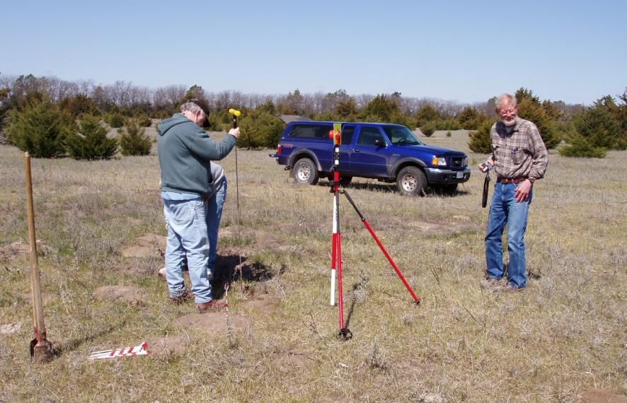
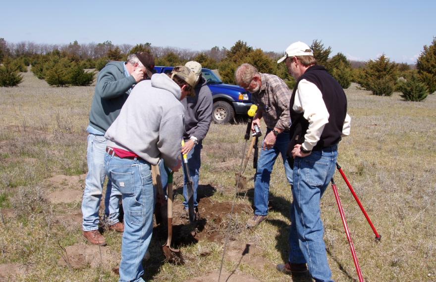
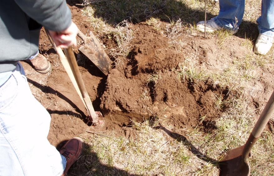
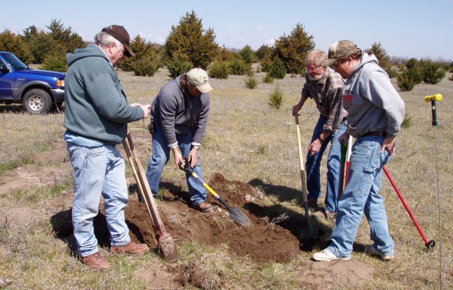
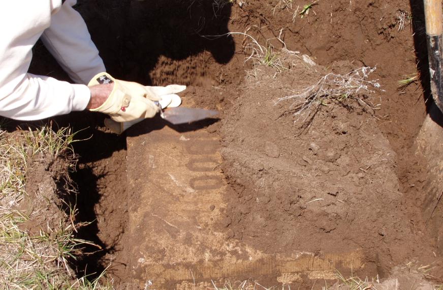
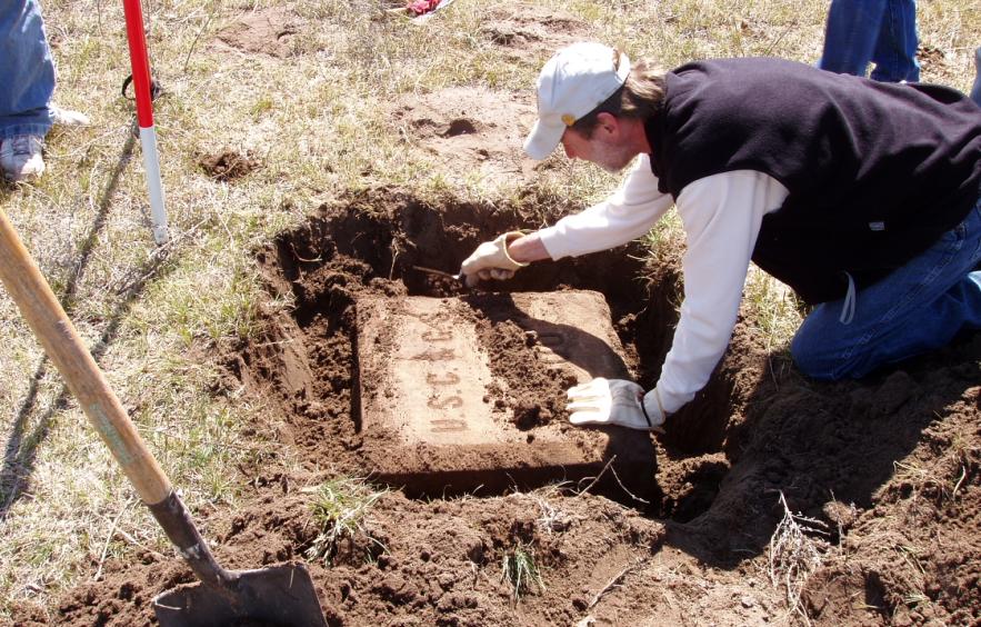
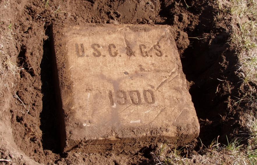
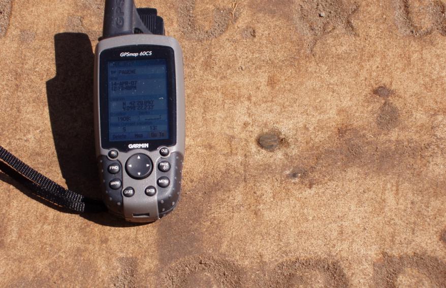
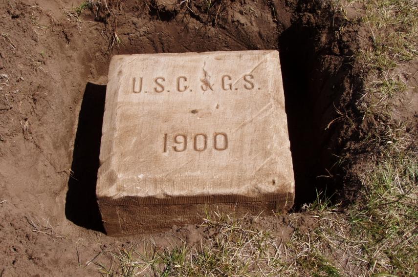
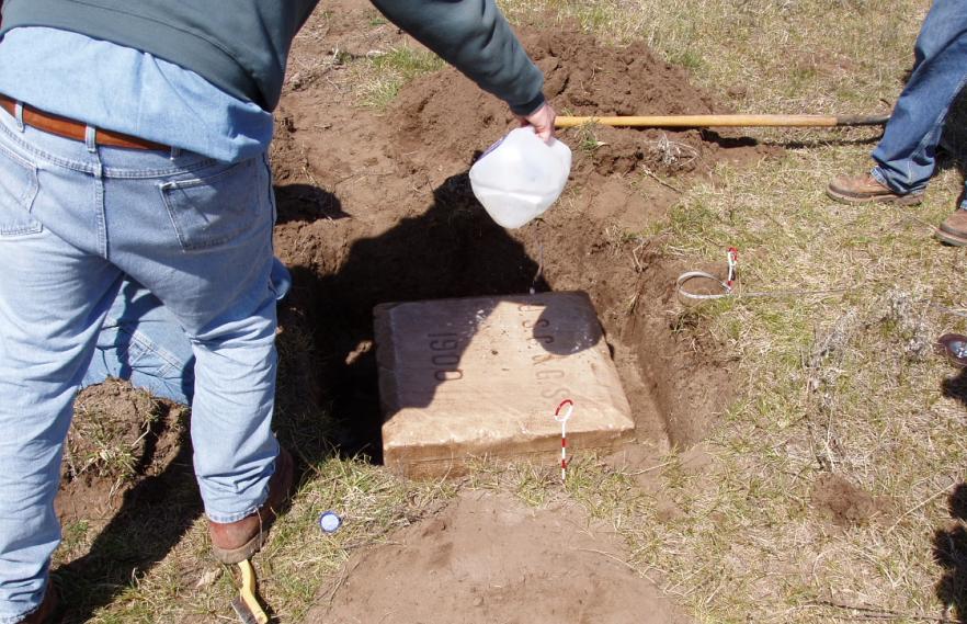
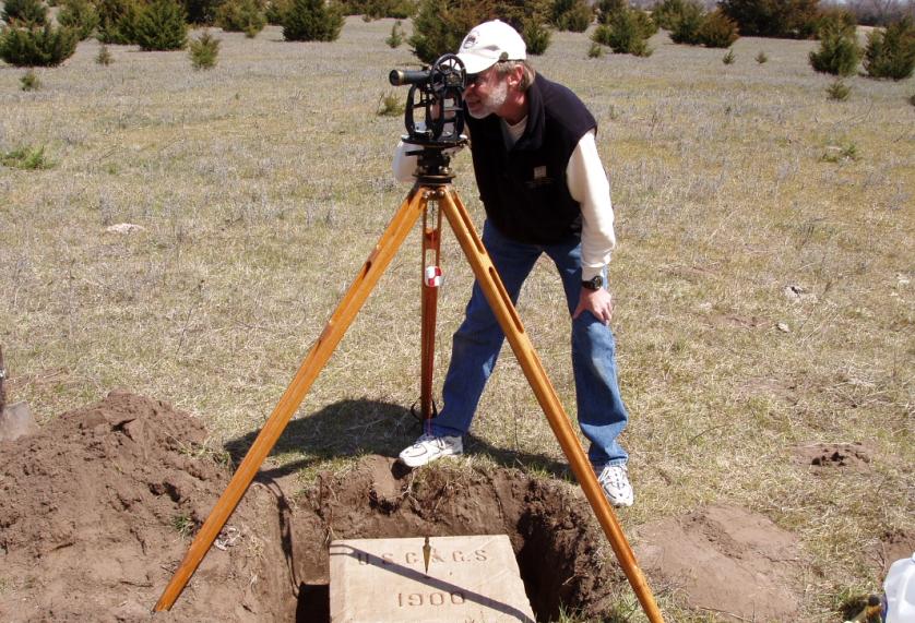
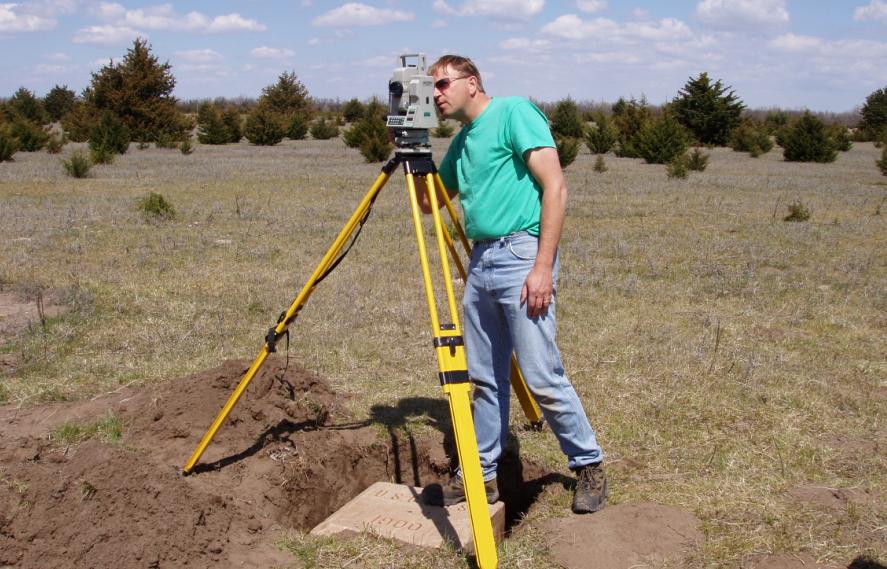
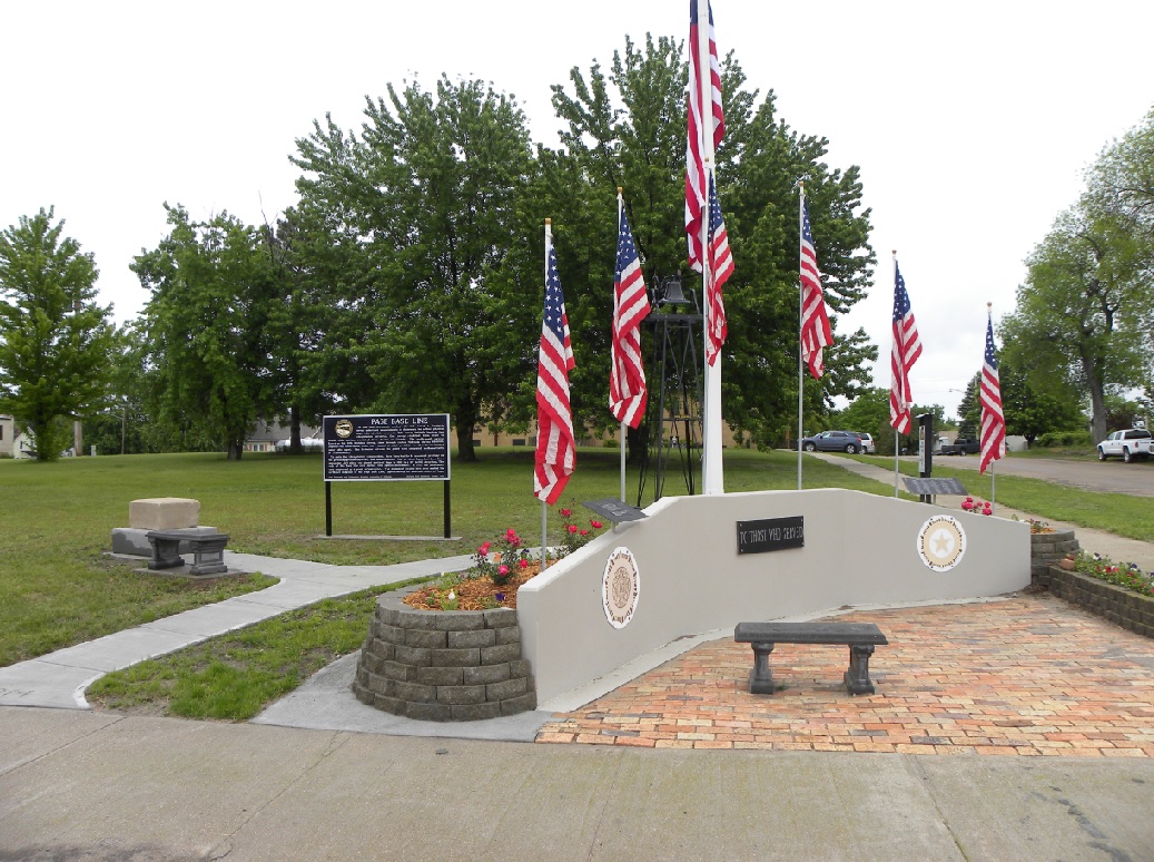
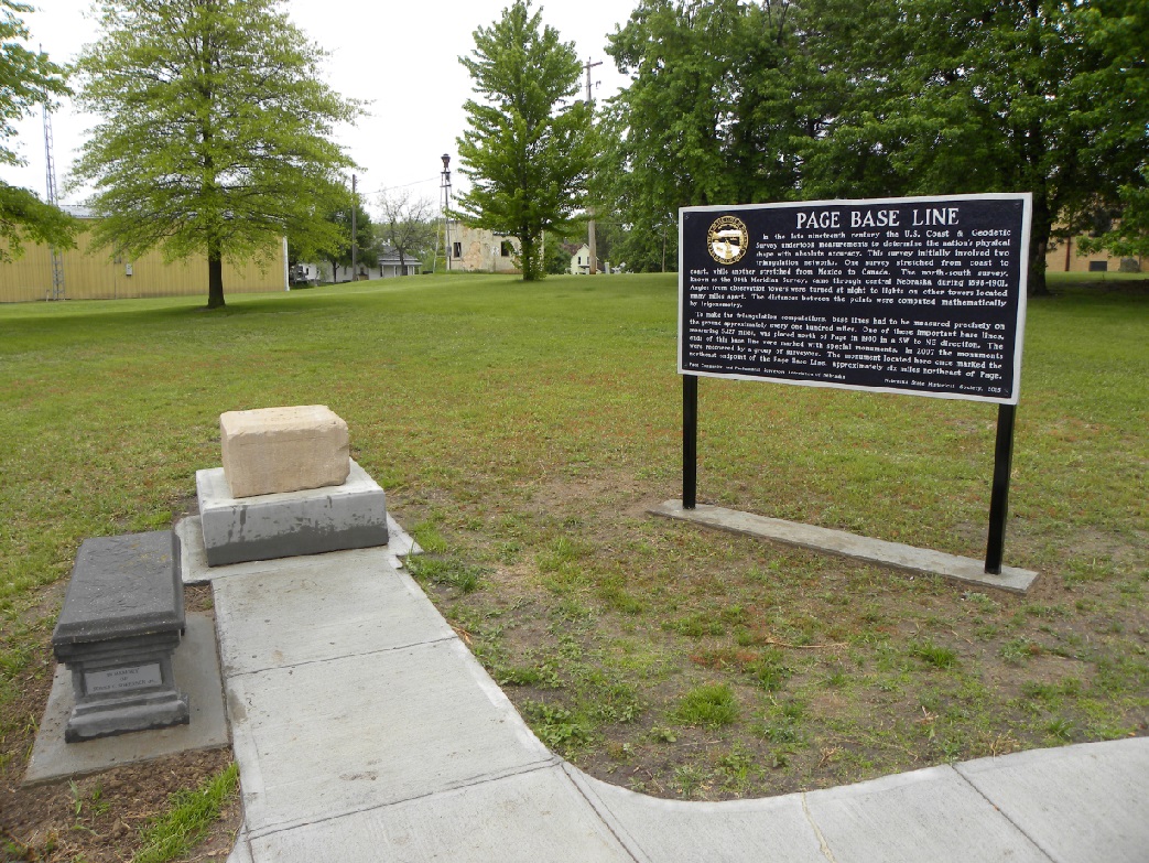
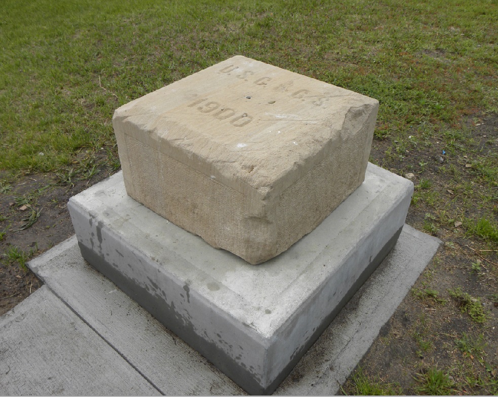
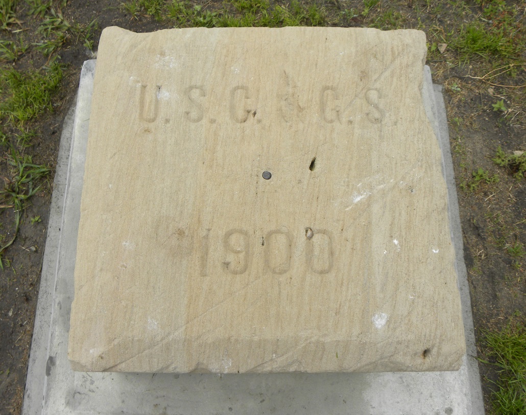
By the summer of 1900 the northern extension of the 98th Meridian Survey had reached northern Nebraska where a baseline was established near Page, Nebraska. The end points of this important baseline had been lost for many years. By using GPS technology, a group of surveyors were able to recover the lower monument at the SW Base location and the original surface monument at the NE Base location on April 14, 2007. A short time later, the land where the NE Base monument was located was plowed for cropland, so the surface monument was removed and preserved for historical purposes. On May 24, 2015, a sign was dedicated in the town of Page that provides the details about the Page Base Line and the importance of the Page NE Base monument that has been relocated from the field.

Full Story
(Click Here)


Page is a small farming community located in northeast Nebraska. Current population is 157.


Scene in the local park.


Location of the Page Base Line.


PAGE SW BASE
April 14, 2007


With the location established, the digging begins for the SW Base location. We expected that the original surface monument would be gone due to farming operations which it was.


Waiting for the first glimpse of the lower monument.


The lower monument is found intact. We were the first to see this monument since 1900. The surface monument was inadvertantly bulldozed out in the 1970's when a farmstead was removed.


Even the lower monument was set into a mass of concrete.


The lower monument is a 6" square Limestone post with a 1/2" copper pin in the center.


The fine "X" marked on the copper bolt of the lower monument.


Thankfully enough foresight was taken in 1900 to set double permanent monuments.


Seth Kauffman, Gene Thomsen, Jerry Penry, Erik Hubl, Lyle Davis. (Photo taken by Steve Rasmussen).


Holt County, Nebraska County Surveyor Steve Rasmussen.


SET-3 total station upon one of the static GPS points previously set nearby for stakeout locations.

*************************************************************


PAGE NE BASE
April 14, 2007


Probing begins for the NE Base station location.


Eagerness is apparent as everyone wants to see what will be uncovered.


Quite possibly the first view of the monument in over 70 years!


This monument was extensively searched for by C&GS in the 1930's, but there were no reference locations nearby. Triangulating and measuring from other stations in the network would have involved a large effort so they gave up. We immediately located the monument, just below the surface, with modern GPS technology.


Erik carefully reveals "1900" on the surface of the stone.


Further removal of the sandy soil reveals "USC&GS".


Plow marks were made across the top of the stone when the land was attempted at cultivation in the 1930's. The farmer at that time was questioned by C&GS personnel, but he had never seen the monument.


A handheld GPS receiver takes a reading on the NE Base monument.


The surface is wire brushed. The monument is a 24" square Limestone set in concrete. A lower monument, like what was found at the SW Base location, should be under this monument.


Water is added for further cleaning to reveal the true surface color.


The copper bolt used for the center point.


Erik couldn't resist setting up his older transit for photo opportunities.


Jerry uses his SET-3 to obtain distances to reference ties. It is the first electronic instrument ever set upon the monument.


Seth, a current surveying student at Southeast Community College in Milford, Nebraska, poses with the 107-year-old monument.


*************************************************************


PAGE SIGN DEDICATION
May 24, 2015


The historical sign and monument located on Main Street in the town of Page, Nebraska.


The Page NE Base monument and historical sign.


The Page Base Line historical sign.


Side view of the Page NE Base monument.


Top view of the relocated Page NE Base monument.


Back to 98th Meridian Survey Monuments


© Jerry Penry 2015