U. S. Coast & Geodetic Survey "PROSSER" Jerry Penry
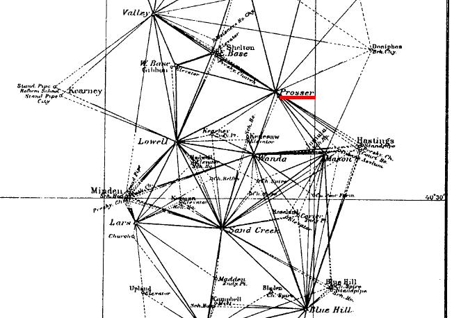
Triangulation station PROSSER is a primary horizontal control point on the 98th Meridian Survey that passed through Nebraska between 1898 and 1901. The original description by USC&GS said it was located on the summit of a prominent hill locally known as "Bean Hill". Other maps describe it as being called "Topeka Hill" and the local residents know it as "Topee Hill". According to older residents in the area, it was a popular hill for Indians to watch the wagons cross the plains on the Oregon Trail. Soldiers also used the hill to shoot buffalo. The triangulation station is approximately one mile north of the town of Prosser and derives it name from that town.
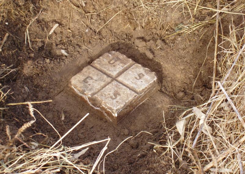
The hill was for many years used only as a pasture for gazing cattle. The surface monument is an 8-inch square marble post which is set over the top of of an earthenware crock with a drill hole in the bottom. The crock is set over a stone jug with a tack in the cork. C&GS did a fine job of triple monumenting this station.
In 1934 a C&GS recovery team found the marble post laying flat in a sand blowout in the center of three 4x4-inch posts that formed a triangle for the original observation tower. Just below the surface the brown crock was found undisturbed and the brown jug was also found. The station was completely rebuilt by placing concrete around each lower monument. The marble post was set upright with concrete placed around the top.
Today the hill has been turned by the plow and is used for a cornfield. From 1972 - 2004 a TV tower stood on top of the hill, but has since been completely dismantled although some concrete pads still exist.
Triangulation Station
1898
November 18, 2006
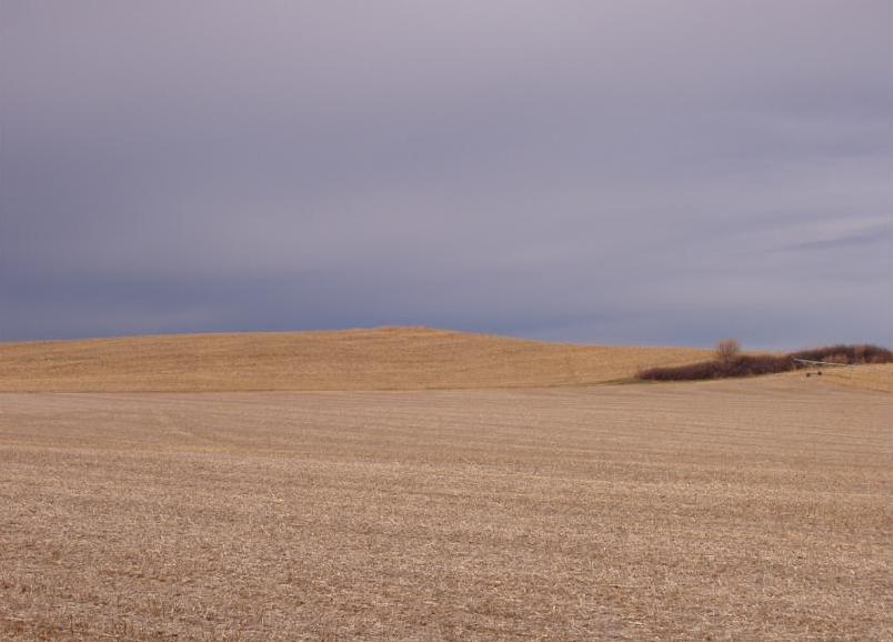
The top of the hill looking northwest from the southeast.
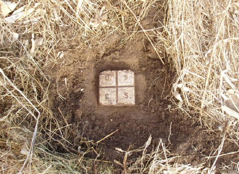
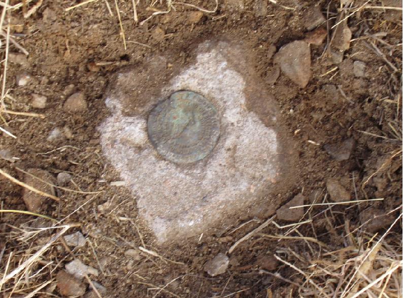
The recovered monument was located after probing.
Evidence that the hill was once a popular location by the many initials carved in the top of the stone.
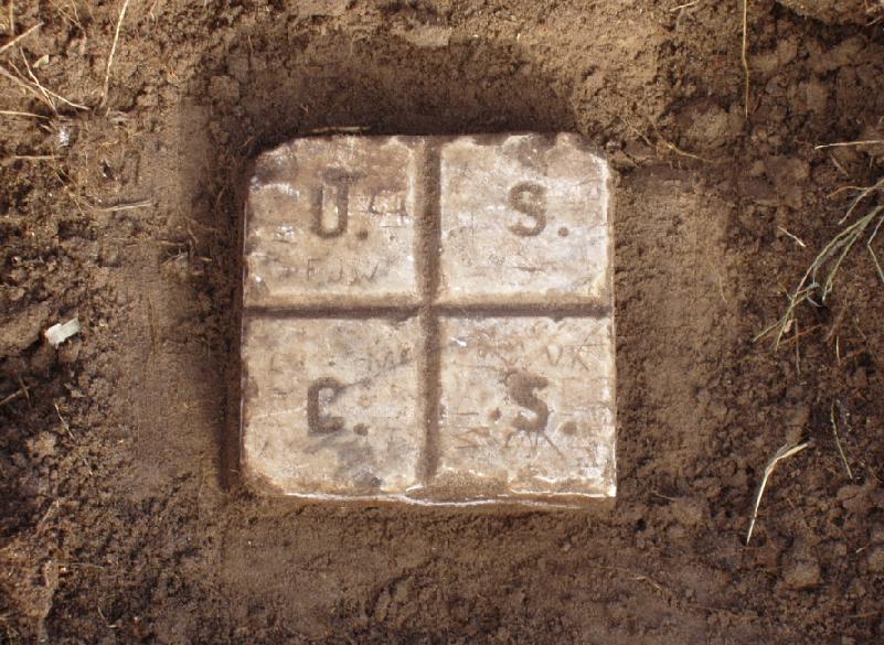
The stone is set in concrete 2" below the top. This was done in 1934 during a recovery by USC&GS.
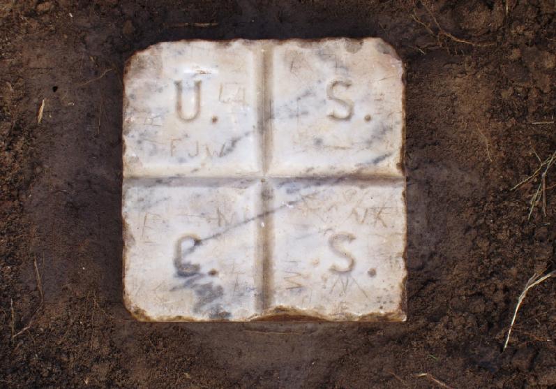
The cleaned white marble post reveals some gray streaks.
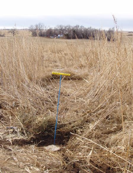
The farmhouse in the background has remained in the same family even before the monument was first placed.
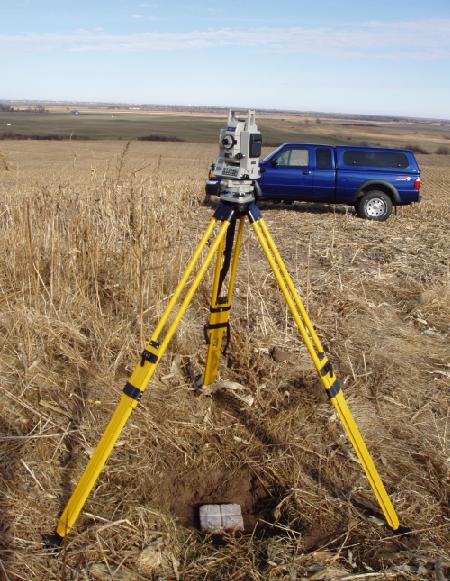
View to the north looking across the Platte River Valley with the SET-3 set upon the stone.
Recovered Reference Mark No. 2 that was placed in 1950
Back to 98th Meridian Survey Monuments


© Jerry Penry 2009