U. S. Coast & Geodetic Survey SPARTA Jerry Penry
In the year 1898 the United States Coast & Geodetic Survey started a precise north-south triangulation network that began in Kansas. The east-west transcontinental triangulation network was already established in central Kansas, so the north-south network began at existing stations "Meades Ranch" and "Waldo".
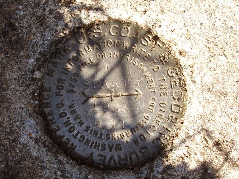
The north-south survey became known as the "98th Meridian Survey" since it was closely situated near the 98th Meridian for much of its route between Mexico and Canada. In Nebraska the survey continued through the year 1901 before entering South Dakota and Minnesota. Most triangulation monuments were 8" square marble posts. Triangulation station "Sparta" was visted on October 17, 2008, by Nebraska surveyors, Rex Heiden, Dave Hoffart, Jerry Penry, and Gene Thomsen. In 1940 the surveyors from C&GS placed a brass disk in the original 1901 marble stone. Luckily, station "Sparta" remains in an area that has changed very little since it was first placed 107 years ago.
One of the stations that "Sparta" connected with was "Page SW Base". This station was recovered in the spring of 2007. See story for "Page" below.
PAGE BASELINE
Triangulation Station
1901
October 17, 2008
(Click Here)
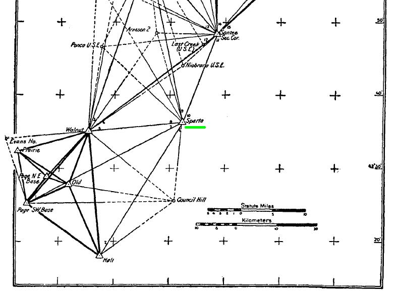
Sparta as shown in the USC&GS triangulation network.
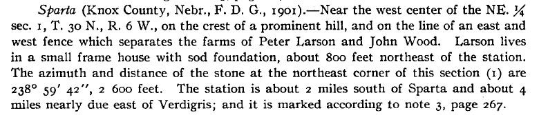
The original description for "Sparta" as recorded in 1901 by C&GS surveyors.

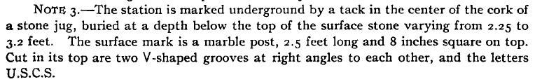
The 1901 marble post with the 1940 brass disk cemented into the top.

A splendid view of the northern Nebraska countryside.
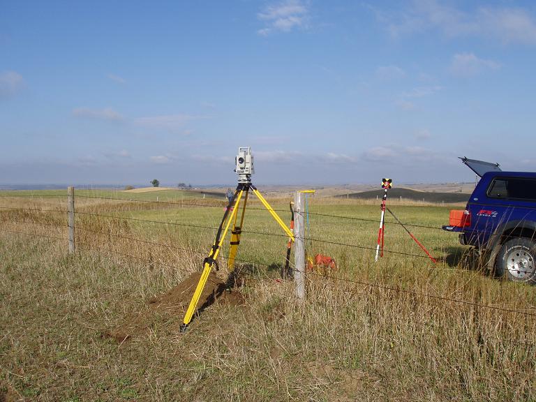
Getting distances to the 1940 reference marks.
Reference Mark No. 1.

Reference Mark No. 2.
Back to 98th Meridian Survey Monuments


© Jerry Penry 2008