USGS & USC&GS
Triangulation Stations
"HARNEY"1893 & 1950
Jerry Penry
September 3, 2010
Harney Peak, elevation 7,244 feet, is the highest point in the Black Hills and in the state of South Dakota. It is the highest summit in the United States east of the Rocky Mountains.Valentine McGillycuddy is believed to have made the first recorded visit to the top of Harney Peak in 1875 despite claims that General George Armstrong Custer had achieved the same feat a year earlier. McGillycuddy was a surveyor for the Newton-Jenney Party, a scientific expedition that confirmed the presence of gold in the Black Hills.
The military expedition led by General Custer reported finding gold in the Hills, a finding that prompted a gold rush and the U.S. government’s eventual breaking of the 1868 treaty promising the Black Hills to the Lakota Sioux Indians. Custer and some of his men apparently climbed near the summit of Harney Peak but didn’t scramble up the last rise and, therefore, cannot get the credit for being the first white men to reach the absolute top of the mountain.
The peak was named for General William S. Harney by Lt. Gouverneur Kemble Warren in the 1850s. Warren fought under Harney in the 1855 Battle of Ash Hollow, in which U.S. forces defeated a group of Brule Sioux Indians in present-day western Nebraska, south of the Black Hills.
Harney Peak is located within the Black Elk Wilderness, named for an Oglala Lakota Sioux Indian said to have survived the Battle of the Little Bighorn and the Wounded Knee Massacre. Black Elk also claimed to have received his “great vision” while he was atop Harney Peak.
In 1893, USGS established an iron bolt in a drill hole on top of Harney Peak for one of their primary triangulation points. In 1950, USC&GS placed their own bronze disk for their triangulation point on Harney Peak. The iron bolt placed by USGS in 1893 is believed to be under a metal grate walkway at the fire lookout tower based upon a determination made by adjusting the original latitude/longitude position to a modern position. There are several pieces of iron rod in drill holes on Harney Peak which are believed to be the remains of anchor tie downs and not survey points.
The original 1893 description for the point on Harney Peak.
(Results of Primary Triangulation - USGS Bulletin No. 122).
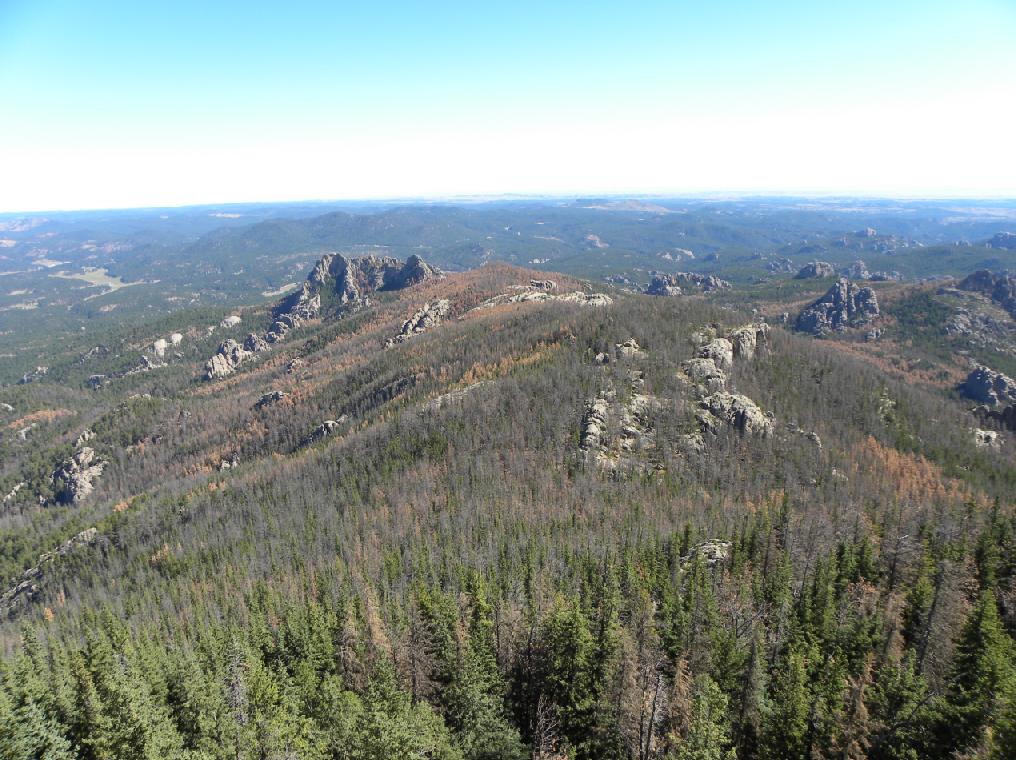
View of the Black Hills looking north from the fire lookout tower.
Bronze plaque on the wall of the Harney Peak tower.
The upper portion of the fire lookout tower.
Jerry Penry and Kurt Luebke on top of Harney Peak.
The probable location of the USGS 1893 point as determined from our modern calculations.
Kurt Luebke is at right.
Inside the Harney Peak fire lookout tower.
View from the fire lookout tower toward the west.
Do not be fooled! There are several of these old pieces of iron embedded into the rock which are
most likely from anchor tie-downs for various towers or structures that have been placed upon Harney Peak.
Commerical interests abound during the summer months with several companies offering helicopter rides for tourists to view Harney Peak.
The hiker assumes his own risk. Areas like this are not off limits if you want to get a closer look over the edge!
Kurt Luebke on top of one portion of Harney Peak.
The small dam and pumphouse that were built to supply water to the occupants of the tower.
Triangulation Station "Harney" established by USC&GS in 1950 with the Harney Peak tower in the background. (Looking east).
Closeup of USC&GS triangulation station "Harney".
USC&GS Reference Mark No. 1.
Closeup of USC&GS Reference Mark No. 1.
USC&GS Reference Mark No. 2.
Closeup view of Reference Mark No. 2.
During WWII, two men marked their names in history.
AIR CORPS
LT. VERNER BULDT(?)
CIVIL AERONAUTICS ADM
EUGENE W. DAVID.This location was once known as the "Harney Peak Airway Beacon". (USC&GS PID OT0813).
It is located approx. 13' southeast of USC&GS triangulation station "Harney". Only the stubs of the tower legs remain today..
U.S.
ARMY
C.A.A.
JULY 1943
U. S. Department of Agriculture Camera Point No. 7 with the Harney Peak tower in the background. (Looking east).
Closeup of U. S. Department of Agriculture Camera Point No. 7.
Kurt Luebke on the western end of the top of Harney Peak.
This photo of three USGS personnel was taken atop Harney Peak on August 12, 1897.
Left to right: Joseph A. Holmes, Charles D. Walcott, Henry Gannett.
Back to USGS Black Hills Triangulation

© Jerry Penry 2010